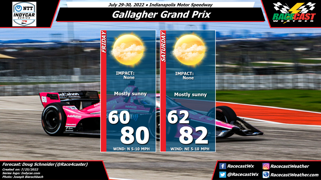
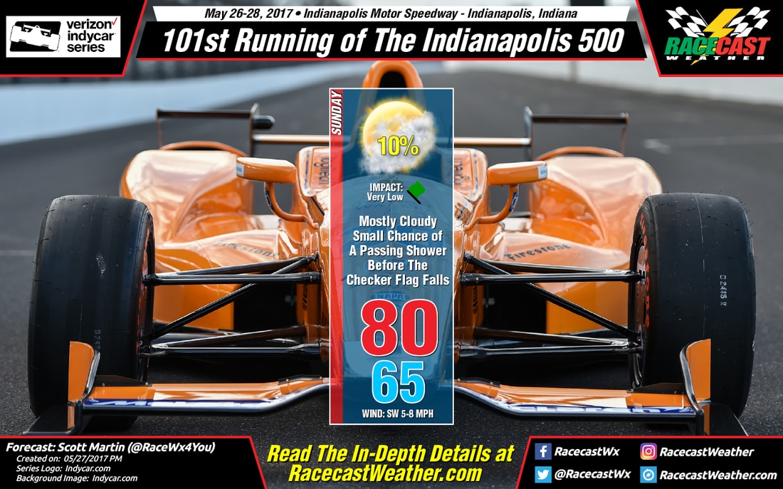
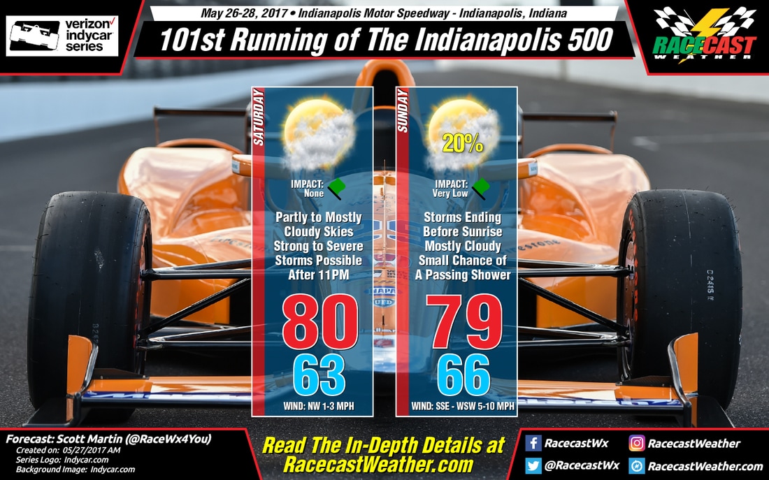
By Doug Schneider - @Race4caster
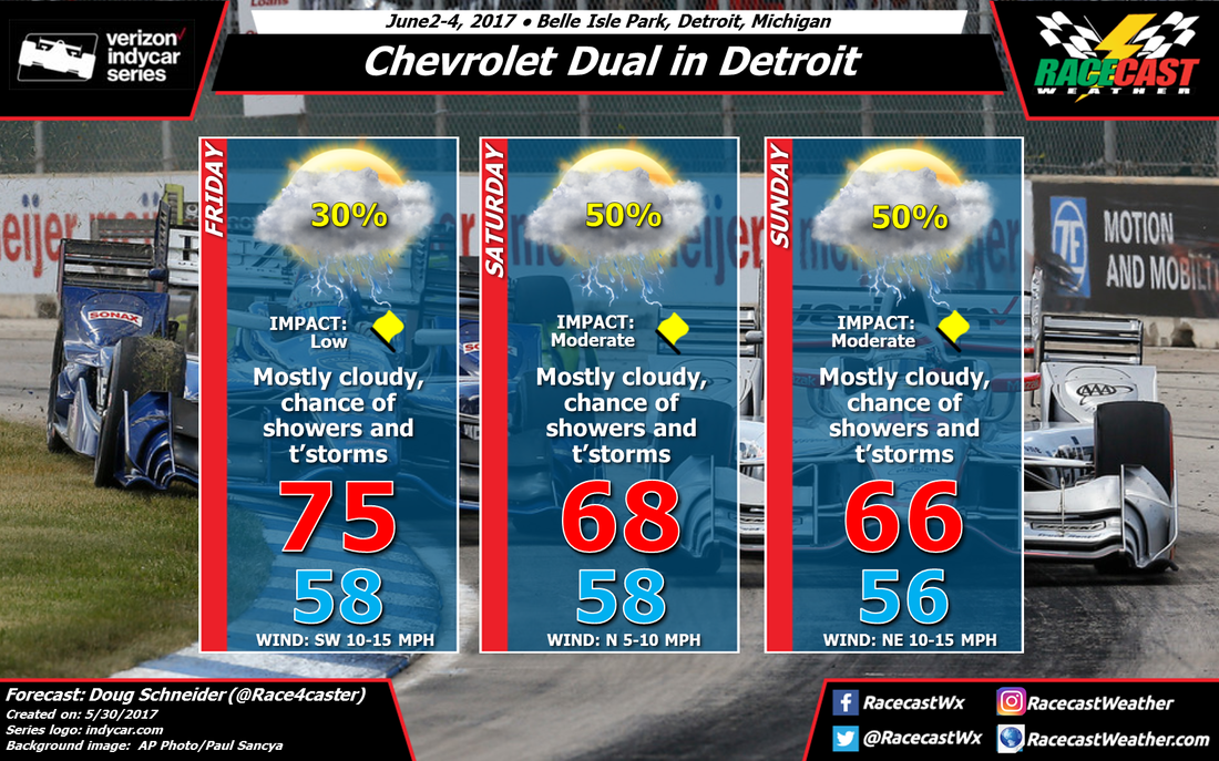
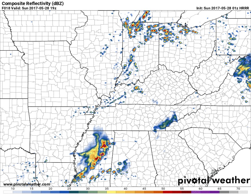
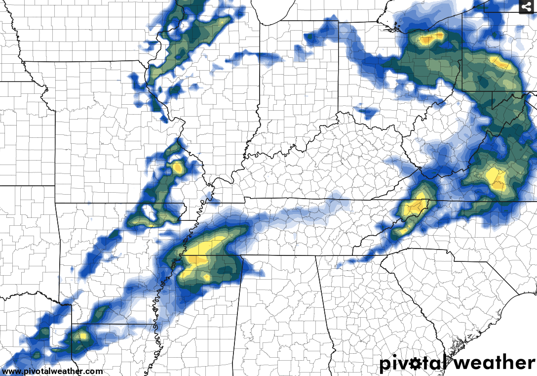
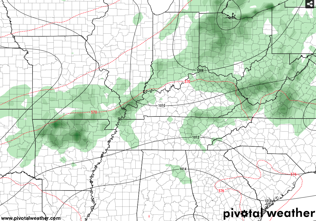
There have been some big shifts in how the models depict the weather pattern evolving over Detroit this weekend. I have very low confidence in this forecast, due to the models changing their tune back and forth between dry and wet. With so much uncertainty, I cannot make the forecast very detailed or specific in regard to timing of rain. But based on the latest model runs, it looks like there will be at least a chance of rain at the track each day. I wish I could make a forecast with greater confidence one way or the other, but sometimes we just have to admit that we don't know what will happen.