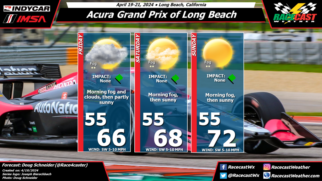
By Doug Schneider

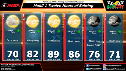
Not much has changed in the expected weather for IMSA's visit to Watkins Glen International. Sunday continues to have high chances of showers and thunderstorms that are likely to impact the race.
This morning, the radar is quiet, but as daytime heating increases, showers and thunderstorms are expected to develop in the Finger Lakes region. Coverage is expected to be scattered, so there's about a 40% chance of one of the storms hitting the track. There may be a brief downpour and lightning, which may cause a delay for a short time and require wet tires. Saturday looks similar to today, with scattered afternoon showers and thunderstorms. It will be hot and muggy both days, and the National Weather Service has issued at Heat Advisory for today and Saturday. Drink plenty of water and take breaks in the shade if you're at the track.
Sunday will have a higher chance of rain as a cold front approaches from the west. Showers and thunderstorms will be numerous ahead of this front. Showers are possible any time of the day, but the bulk of the thunderstorms are expected to come in the afternoon, mainly from 2 PM and later. It is likely that there will be heavy rain and frequent lightning in the closing half of the race, so I would not be surprised if there is a period when the race is red flagged. If you are at the track, stay weather aware and have a place to seek shelter from lightning, either in a vehicle or a building. The Storm Prediction Center has the area in a Marginal Risk of severe thunderstorms, so some strong wind gusts and hail cannot be ruled out.