|
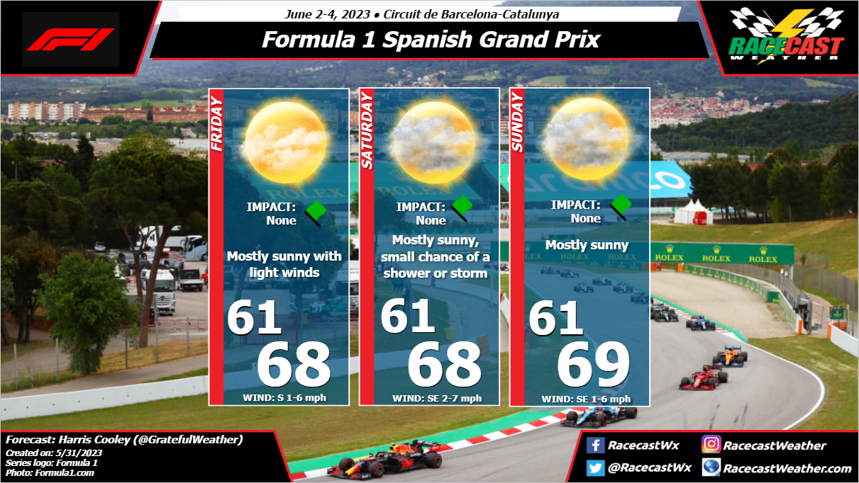
By: Harris Cooley Mostly quiet weather is expected for this weekend in Barcelona with partly cloudy skies and mild, consistent temps all weekend. Rain chances stay low but possible for Saturday as moisture and low pressure lingers over the region. A relaxed pressure gradient lays over the area keeping wind speeds low and moisture content high. The main threat for the weekend would be any pop-up showers affecting the track as well as increased track temps if cloud coverage does not increase. A metric graphic is pasted below...
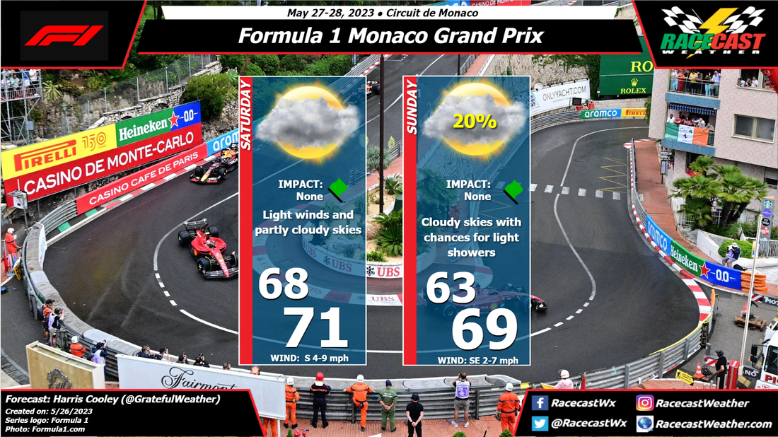
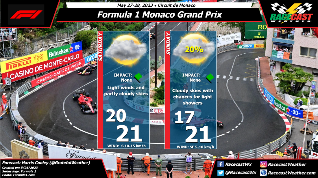
By: Harris Cooley A relaxed pressure gradient will be laying over the area through the weekend keeping wind speeds low and southerly. Low pressure will keep moisture high as well with increased rain chances Sunday in the afternoon as the surface heats. Chances are low and showers would be light, but this track becomes a much different beast with even a light round of rain. Temps will be cool with intermittent cloud coverage as well which will keep track temps low for the weekend. An update on rain chances will come as necessary with a metric graphic posted below...
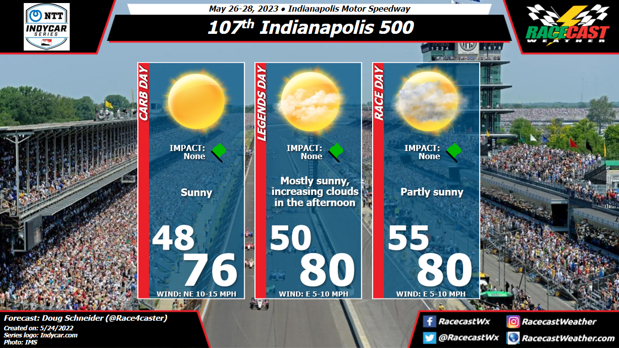
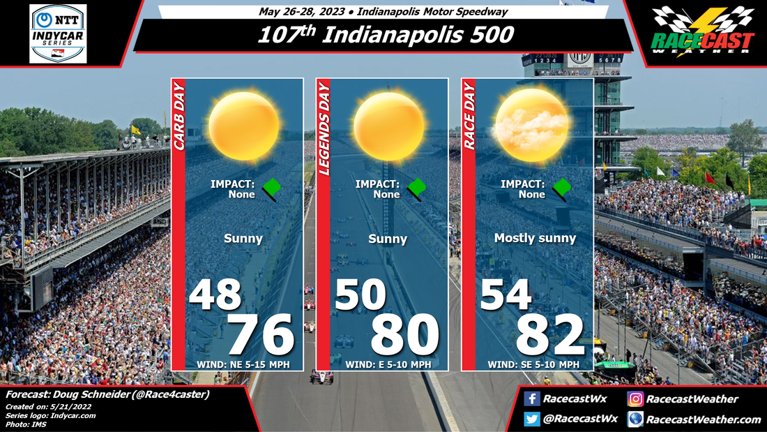
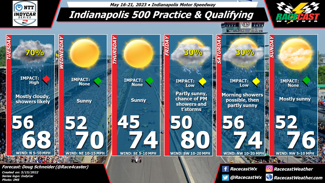
By Doug Schneider The weather continues to look great for the 107th Indianapolis 500. The main changes from the previous forecast are a slight increase in cloud cover Saturday and Sunday, and a slightly lower high temperature forecast for Sunday.
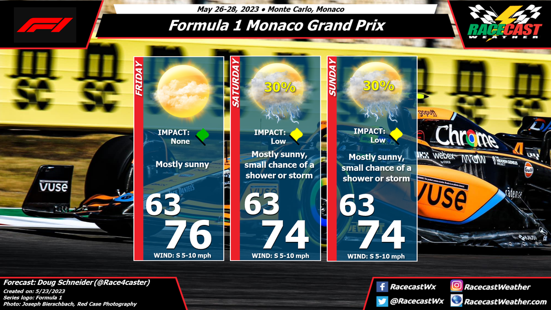
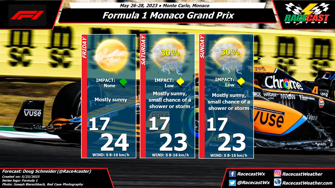
The pattern across the Great Lakes and Ohio Valley region will be a large high pressure area over the Great Lakes, with a low pressure system over the Southeast states. Through the weekend, the low over the Southeast will drift toward the northwest, but the strength of the high will keep it far enough away from Indiana that rain will not be a concern at the Speedway. However, it will bring some increasing cloud cover, starting Saturday afternoon. This will be mainly midlevel and high level clouds, which will produce a milky sunshine - maybe just enough to take the edge off of full sunshine. Carb Day will be a little breezy, with a northeast wind between 10 and 15 mph, but Legends Day and Race Day will have lighter winds, between 5 and 10 mph. I'm glad that I picked a year with great weather to be attending the Indy 500 in person. This will be my second Indy 500; my first was in 2014 when Hunter-Reay and Helio had an amazing duel in the closing laps. I expect that this year's edition will be just as thrilling! By Doug Schneider The pattern across western Europe this coming weekend will feature a large high pressure system over northern France and England. Monaco will be on the southern edge of this ridge, which means that there will be a generally southeasterly flow through the lower and midlevels of the atmosphere. This flow may spread enough moisture into the area to produce scattered showers and thunderstorms on Saturday and Sunday afternoons, as daytime heating increases instability. The question is where these showers will develop. The most likely area for shower development will be inland of Monaco, and the southeast flow should direct them toward the northeast, staying north of the race. So I think the most likely scenario is that the rain stays away. However, I will have a small chance of showers and storms mentioned on Saturday and Sunday, as they cannot be ruled out.
Below is a forecast graphic in Celsius. Check back later in the week for updates. By Doug Schneider The weather for the 107th running of the Indianapolis 500 is expected to be beautiful. The models are in agreement that there will be a large high pressure ridge over the Great Lakes region through the end of the week, which will provide dry conditions and plenty of sunshine for all the festivities leading up to the race. Carb Day will have the coolest temperatures in the 70s and a northeast wind between 5 and 15 mph. As the high pressure area shifts to the east through the weekend, winds will shift to a more southerly direction and cause temperatures on race day to rise into the lower 80s, with a slight increase in clouds.
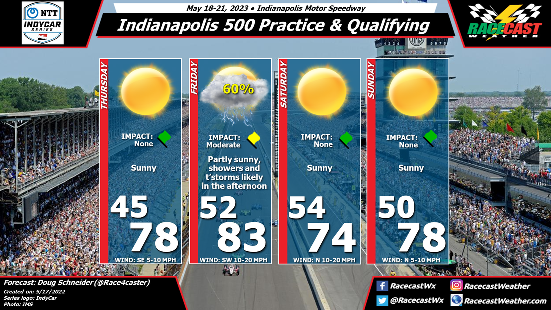
Check back through the week for updates. By Doug Schneider The timing of rain has come into better focus today. Confidence is increasing that Friday afternoon and evening will be the period when showers and thunderstorms move over the Speedway ahead of a cold front. I expect that the morning and early afternoon hours of Friday will be rain-free, partly sunny, breezy, and warm. The earliest potential timing for showers and storms to arrive will be around 2 pm, with the most likely timing being between 4 pm and 8 pm. So there should be plenty of running time in advance of the showers.
Once the cold front moves through Friday night, the weather will be ideal for qualifying on Saturday and Sunday. Temperatures will be pleasant, with highs in the 70s, and low humidity. Saturday will be a little breezy, with a north wind between 10 and 20 mph. I hope the weather for the race will be as nice as the weather for qualifying! I'll have my forecast for the race posted on Monday. By Doug Schneider After a wet start to the week, the weather should be quite nice for most of practice and qualifying at IMS.
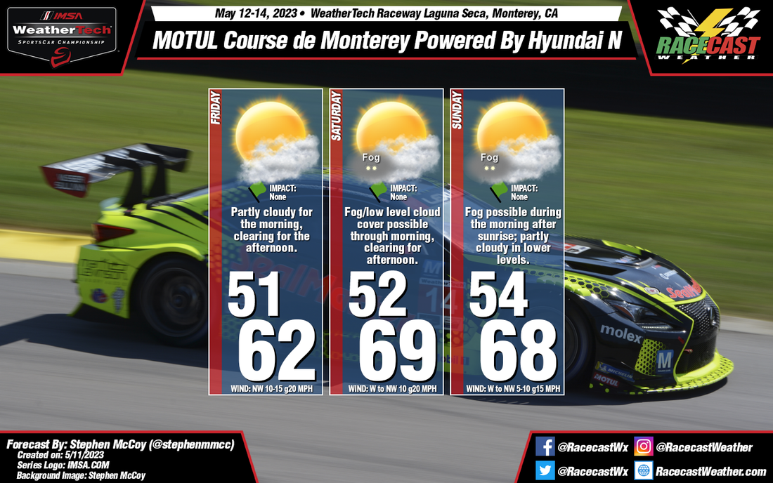
A low pressure system is expected to track across Kentucky on Tuesday, spreading rain across central and southern Indiana through the day. At this time, the morning hours will have the best chance of rain, with a possibility of the rain ending during the afternoon. If it ends early enough, there may be time of dry the track and get a little practice in late in the afternoon, but I'm not optimistic that there will be any running on Tuesday. High pressure over the Great Lakes will be building over the area on Wednesday, providing sunny skies and fairly cool temperatures in the 60s to near 70 in the afternoon. Thursday will be nice as well, with a chilly start to the day followed by sunshine and highs in the 70s. Friday and Saturday are rather uncertain at this time. The models are showing a cold front moving through, but they do not agree on the timing. The chance of rain could be anytime between noon on Friday and noon on Saturday. Although the forecast has a chance of rain and a low impact both days, rain will probably affect the Speedway on only one of those days. It is possible that the front and the showers could move through Friday night, with no impact on the sessions. That is the best case scenario. As we get closer to the weekend, I'll have a forecast update with a better estimate on the timing of the front. Sunday looks great with mostly sunny skies and highs in the 70s. By: Stephen McCoy The updated forecast for Laguna Seca has temperatures a few degrees warmer than the initial forecast with clearer conditions towards the end of the weekend.
The synoptic setup for the latter portion of this week remains similar, however the surface trough mentioned in the previous forecast is now expected to be located a bit further east, approaching the region closer to Sunday. A weaker pressure gradient will result in less cold air advection to the Monterey Bay area. In addition, what was rightfully pointed out, WeatherTech Raceway Laguna Seca is actually a few miles further inland than the city of Monterey so the cooling effect from the bay winds will not be as powerful at the track as directly on the coast. However, even being a few miles away, there is still a possibility for fog during Saturday and Sunday mornings, which will clear into the afternoons; partly cloudy conditions may continue in the low levels. |
Social Feeds
Authors
Doug Schneider Partners
Categories
All
Archives
December 2023
|

