|
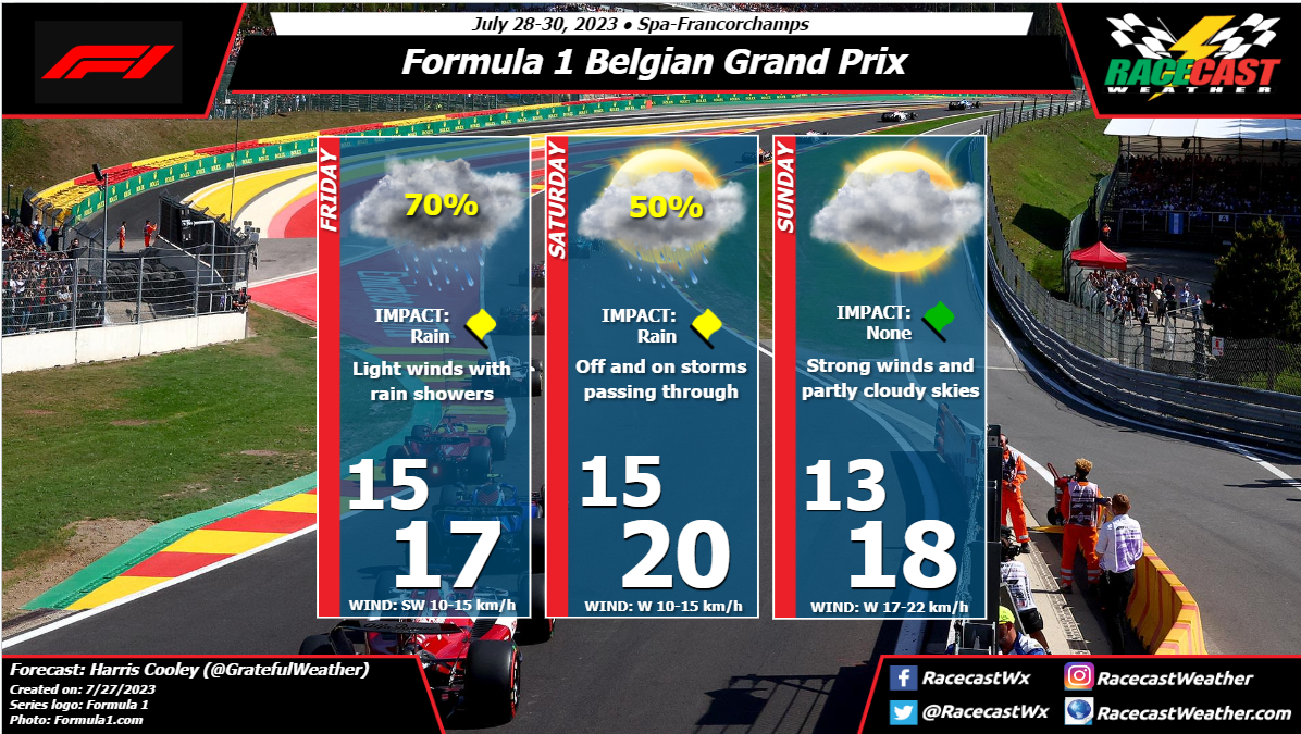
By: Harris Cooley Steady wind speeds and overcast skies will be present to begin this race weekend. Rounds of storms will be moving through the region through Saturday as a Low pressure system west of the area keeps moisture high. The rain chances should dwindle going into race day with partly cloudy skies and increased wind speeds as the Low moves north. These rain showers should be fast-moving but will likely have substantial rainfall amounts to induce problems for teams this weekend. Real-time radar surveillance will be necessary to gain a leg up on opponents this weekend. A metric graphic is posted below...
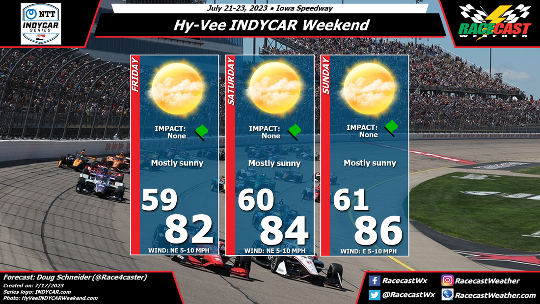
By Doug Schneider The forecast continues to look great for racing this weekend at Iowa Speedway. I don't expect any weather impacts to the on-track action. However, there could potentially be some impacts to the concert on Saturday.
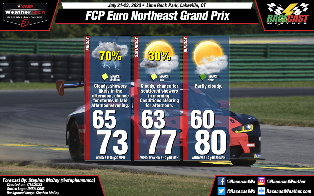
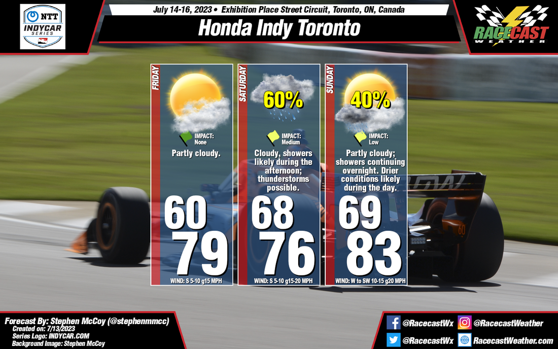
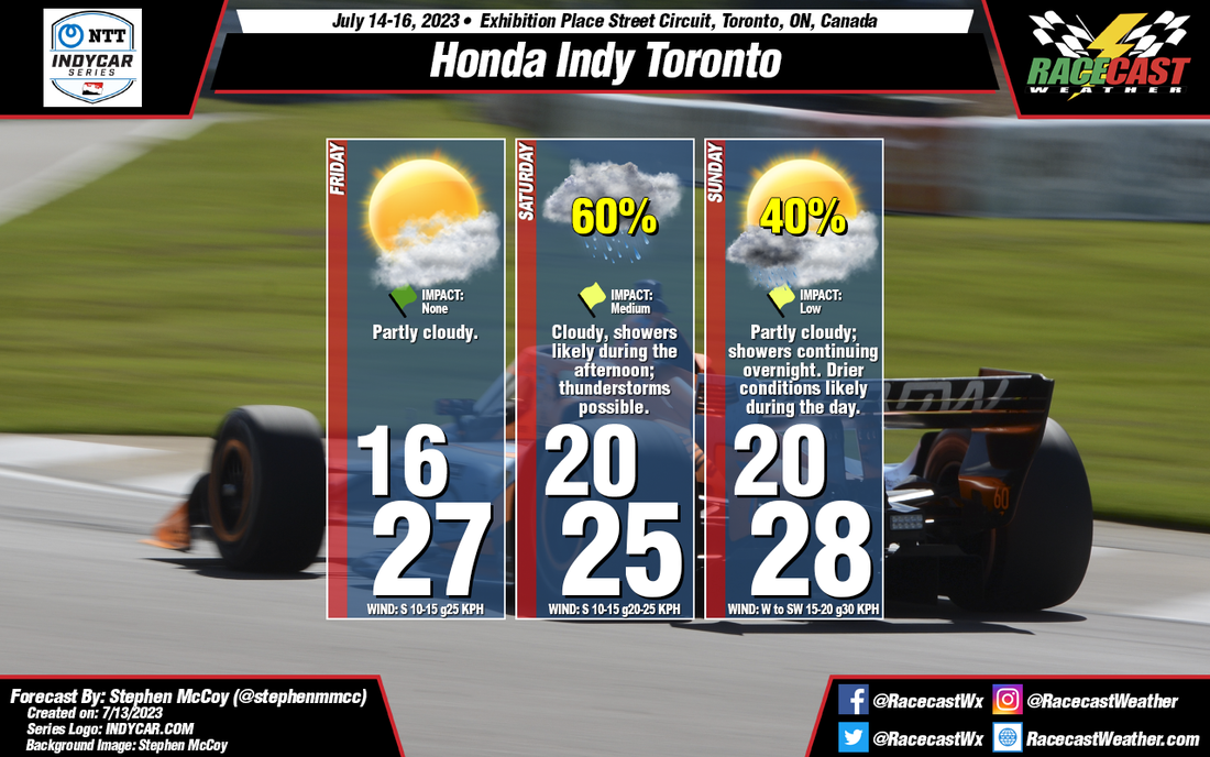
The prevailing weather pattern across Iowa will be a northwest flow through the weekend. This will provide mainly dry and comfortable temperatures and humidity. However, the models are indicating that a disturbance in this northwest flow will move across Iowa late Saturday into Saturday night. It may bring isolated to scattered thunderstorms to the area late in the afternoon and evening. While the timing won't affect the race, the Kenny Chesney concert that starts at 4:30 pm could potentially be affected, depending on the timing of storms. I don't know how long the concert will be, but right now, the most likely time period for storms is 6 pm to midnight. If that timing shifts a little earlier, then it could potentially affect the concert. By: Stephen McCoy A cold front will move through the region late on Friday as a low pressure system tracks eastward over southern Ontario. The front will bring cloudy conditions through the day with a likely chance for showers, especially in the afternoon. Some thunderstorms may also develop along the front, which may cause a halt in track activities if lightning gets too close. However, for now, it is still too uncertain where individual storms will track. Winds through the day will largely be from the South, with some stronger gusts reaching to 20 MPH.
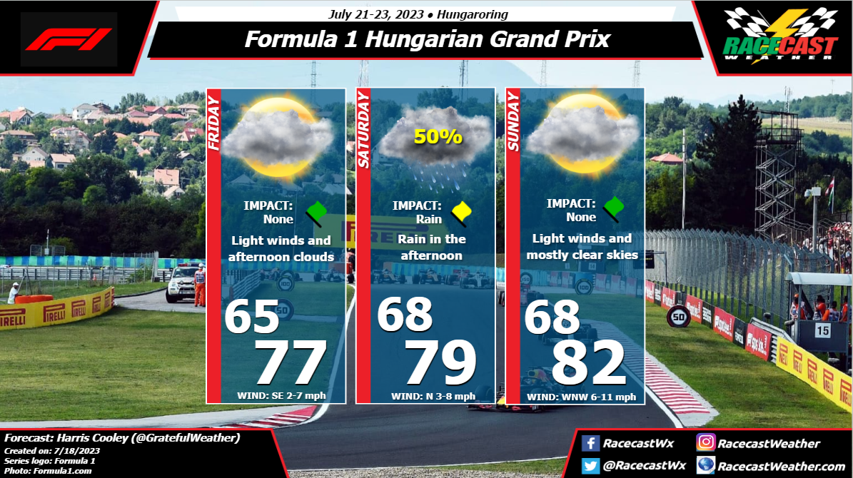
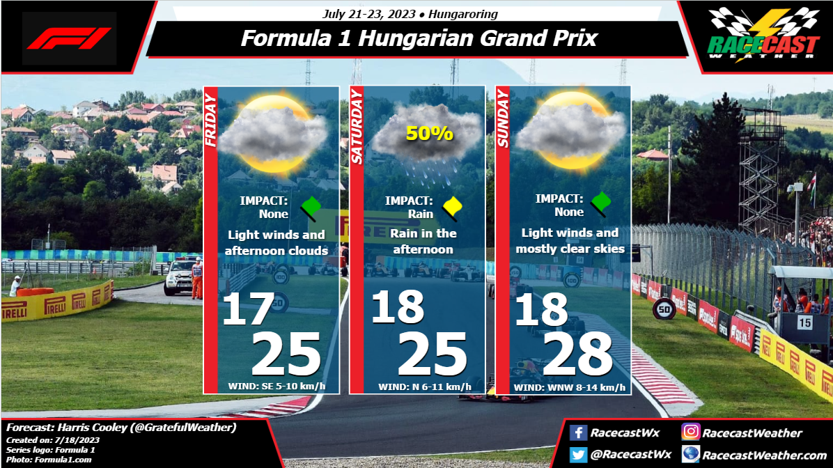
As the front moves out of the region on Saturday, high pressure will build in, bringing more stable conditions during the day. Winds from the Northwest will result in slightly cooler temperatures for the morning low, but with drier air aloft creating clearer conditions, afternoon temperatures should reach higher than on Friday. A few stray isolated showers are possible during the morning, however no significant rainfall is expected. Dry conditions will continue into Sunday, which will see the warmest highs of the weekend. By: Harris Cooley Mild temps and calm winds will be present through this weekend. Low pressure gradient is laying over the area keeping moisture around. Rain chances are high for Saturday afternoon as rain bands will be moving through the region. Sunday should present a favorable race day with low rain chances and calm winds, though temps will be a bit warmer which could impact tire degradation/strategies for the teams. A metric graphic is posted below...
By Doug Schneider The weather looks great for Hy-Vee INDYCAR Weekend at Iowa Speedway. The weather pattern will feature a broad trough over the eastern United States and Canada, putting Iowa in a dry northwesterly flow aloft and high pressure at the surface. The result will be mostly sunny skies and fairly comfortable temperatures and humidity for July in Iowa.
By: Stephen McCoy Conditions have remained mostly consistent from the initial forecast from Monday. A front moving through the region on Thursday will bring cooler temperatures on Friday morning, though partly cloudy skies will allow afternoon temperatures to somewhat normalize. A second front is expected to move through late Saturday or Sunday, bringing cloudier conditions and a chance for showers. While we would normally expect warmer conditions with southerly winds ahead of the front, the potentially widespread rainfall will likely keep afternoon temperatures cooler than Friday. A few thunderstorms may be possible in the region during the afternoon, which would certainly halt any on-track sessions should lightning get too close. Some remaining showers will possibly move through overnight into Sunday, when clearer and warmer conditions will move in.
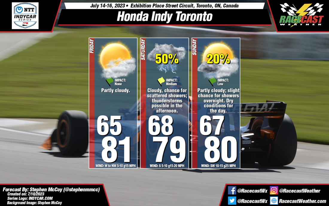
By: Stephen McCoy Before the weekend, there will be a cold front moving through the region on Thursday, associated with a low pressure system located over Northern Canada. Conditions behind the front will be as-expected for this type of synoptic setup: winds will shift to the West/Northwest, flowing around the center of the surface low. This will cause a slight dip in temperatures overnight Thursday into Friday, but afternoon temperatures should return to near 80°F (mid/upper 20's °C). With cooler, drier conditions aloft moving in from Northern Canada, expect clear to partly cloudy skies for much of Friday.
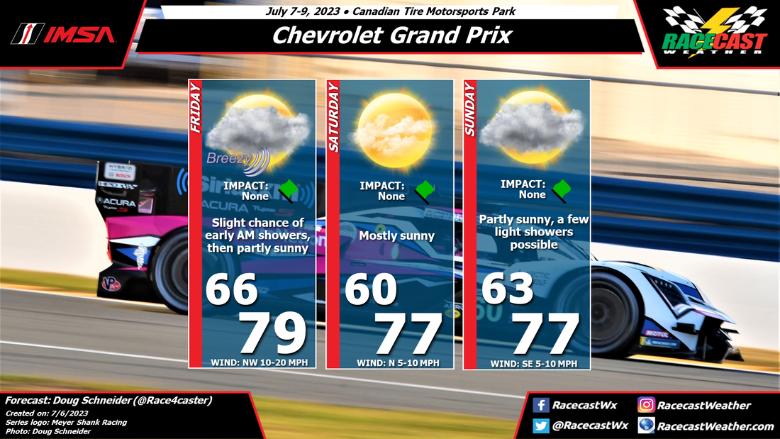
Saturday will provide differing conditions to Friday as another front is expected to make its way through the region in the evening to overnight. Surface winds will shift to the South ahead of the front, with Southwest winds aloft providing enough moisture to keep conditions mostly cloudy to overcast through the day. As fronts are generally weaker this time of year, temperatures will stay mostly constant between Friday and Saturday. There will most likely be some development along the front, creating a chance for scattered showers, especially during the afternoon, with some stronger thunderstorms possible in the region. Much like Friday, conditions for Sunday are fairly typical for this type of synoptic setup. While there is a slight chance for showers continuing overnight into Sunday morning, daytime conditions are expected to be dry. Surface winds may pick up after the front moves through as an area of high pressure begins to move in. By Doug Schneider Not much has changed in the forecast for IMSA's visit to CTMP this weekend. A few showers are possible Friday morning, and again on Sunday, but overall I expect the conditions to be good.
A cold front will move through southern Ontario Thursday night or early Friday morning. Expect a wet track as activities begin on Friday morning, but most of the rain should be gone by the time the first practice session begins at 9:15 am. The rest of the day will have clouds clearing out, with partly to mostly sunny skies. Saturday looks great, with pleasant temperatures and mostly sunny skies. Sunday is still a bit uncertain, as one model is showing some light rain through the day, but other models show dry conditions. There is an upper level trough that will be approaching from the west, which will bring moist air northward into southern Ontario. However, most of the rain should stay south of Lake Ontario. I expect that if there is any rain, there would only be a little sprinkle now and then, and it would have very little impact on the race. I don't expect that it would cause any delays or interruptions, though it may wet the track slightly. If you're going to the track, it might be a good idea to bring some rain gear, just in case. |
Social Feeds
Authors
Doug Schneider Partners
Categories
All
Archives
December 2023
|


