TODAY
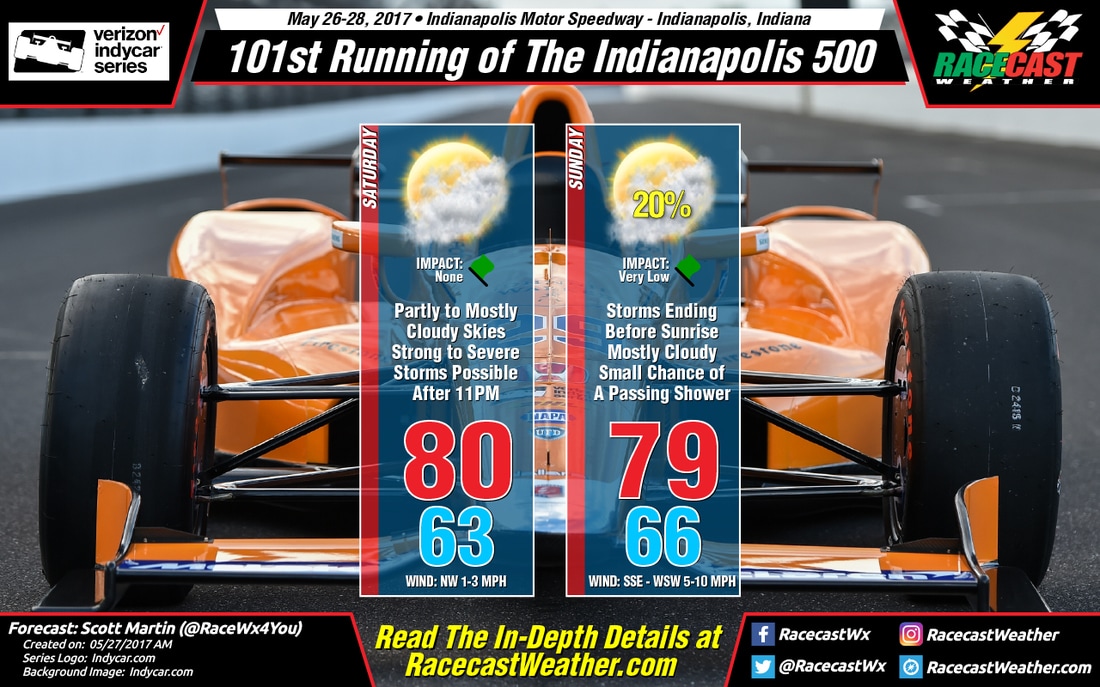
There should be no problems at all during the day at Indianapolis Motor Speedway as far as the weather is concerned. Skies will be mostly cloudy throughout the day, which will bring a little relief to those who are sensitive to the sun, and the afternoon high will be around 80 degrees. Winds will be light out of the northwest at 1-3 MPH.
As far as tonight is concerned, there is the possibility of some strong to severe storms that could move through the area after 11PM associated with a mesoscale convective system. The Storm Prediction Center has the Indianapolis area in a slight risk for severe storms throughout tonight and into the morning hours on Sunday. The good news is that the storms will be on a weakening trend as they reach Central Indiana, but the threat of damaging winds and hail are still possible. The threat of tornadoes will be rather low, but not zero. Please stay weather aware tonight, especially if you are camping at the speedway.
SUNDAY
The line of storms should diminish around sunrise, and much of the daytime hours should remain dry on Sunday at the speedway. There could be an isolated shower or two pop up during the afternoon hours, but a relatively strong cap will be in place keeping any storms from developing. So I'm thinking optimistically and going with the race starting on time and racing to full distance. Skies will be mostly cloudy throughout the day, and the afternoon high will top out around 79 degrees. Winds will be out of the south-southwest to the west-southwest at 5-10 MPH. If a shower pops up and moves over the track, it should not last long and the rain amount will be light. The chance for rain at the track is 20%.
Most of the models are agreeing and keeping Indianapolis dry throughout the day, but the GFS is keeping moisture around. Normally the GFS model is not the best at guessing convective activity, so I'm sticking with the NAM-3k mainly for the forecast. I'm crossing my fingers that I am right.


