|
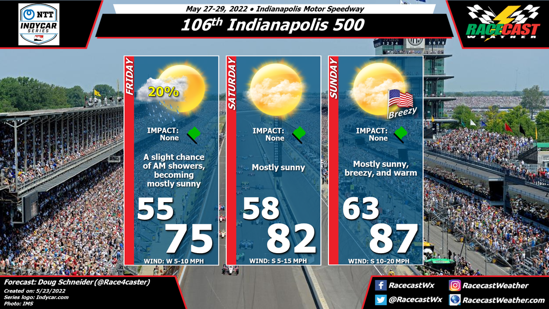
By Doug Schneider High pressure will be firmly in control of the weather across Indiana, making for great weather conditions for the 106th Indianapolis 500. The only slight weather impact will be winds, which will be from the south at 10 to 20 mph ,gusting to around 25 mph at times. While the drivers may not like it very much, it will be nice for the fans in the stands, as temperatures will be warm, reaching the mid 80s. There won't be any clouds to filter the sunshine, so sunscreen will be a must-have item, and be sure to drink plenty of water.
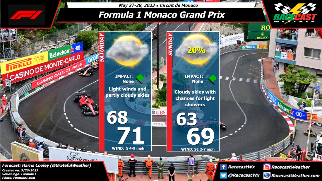
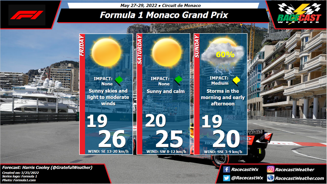
By: Harris Cooley As we head to the historic Monaco GP, Friday and Saturday are offering perfect conditions with sunny skies and mostly calm winds. We could see some gusty winds blow Friday afternoon, but the pressure gradient relaxes a bit through Saturday keeping wind speeds low. A bit more moisture and cloud coverage will set in as we get closer to Sunday due to a large Low pressure system south of the site over the Mediterranean.
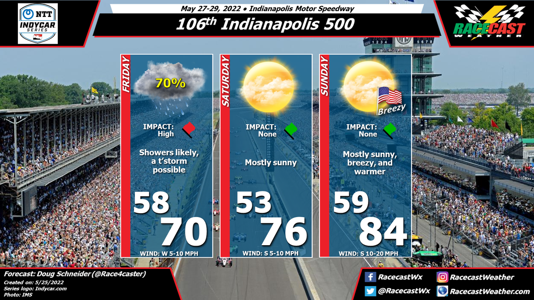
By Sunday, the pressure gradient over the site will be tightened increasing the wind speeds a bit but also bringing scattered storms to the area. These storms could linger a bit longer than usual due to the instability of the atmosphere across the whole region. They are expected to last intermittently through the afternoon which could cause some strategy issues for the teams. I will continue to monitor the timing of these storms and keep you all updated. A metric graphic is posted below... By Doug Schneider The main changes to the forecast today is to increase rain chances on Friday, and to lower temperatures. The low pressure system that will move across the Ohio Valley region has slowed down, and will still be in the area for Carb Day. This will result in numerous showers through the day, and possibly an isolated thunderstorm in the afternoon. Unfortunately, I think the showers will be frequent enough to prevent any on track activity on Friday.
The good news is that Saturday and Sunday should have excellent weather. High pressure will build over the area on Saturday, providing mostly sunny skies and pleasant temperatures in the mid 70s. The high will shift east on Sunday, resulting in warmer temperatures and stronger south winds. Winds during the race will be sustained at 10 to 15 mph, with gusts of 20 to 25 mph at times. By Doug Schneider The weather looks great for the 106th running of the Indianapolis 500.
A low pressure system will be exiting the Ohio Valley region Thursday night. On the back side of this system, there could be some showers that linger into Friday morning. Any showers during this time should be light. I think all the Carb Day activities should be completed without any interruptions. High pressure will build over the area and provide mostly sunny skies for the rest of the weekend. With a southerly wind, temperatures will trend warmer each day, peaking in the mid to upper 80s on Race Day. It could be breezy on race day, with south winds between 10 and 20 mph. Check back through the week for updates to the forecast, and be sure to follow us on Twitter, Facebook, and Instagram. By Doug Schneider A cold front has moved through Indianapolis, however there is still a trough of low pressure in the mid and upper levels over the area. Until this trough moves east of Indiana, there will still be a small chance of a light shower at the Speedway. The radar early this morning shows some isolated showers in the area. I expect that the chance of any showers at the Speedway will be gone before the practice session begins at 12:30 pm. The afternoon will start with mostly cloudy skies, then breaks in the clouds should become more frequent through the middle and late afternoon. Temperatures will remain cool, with a high only in the upper 60s. Winds will be from the north, sustained around 10 mph during qualifying but gusting between 15 and 20 mph at times.
By Doug Schneider Some good news with this forecast update - the chance of rain on Saturday looks lower, and it is possible that the rain could hold off until after the day's sessions are done.
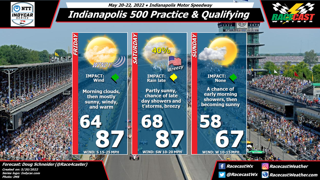
The main weather impact on Friday will be winds, which will be sustained from the south at 15 to 25 mph, gusting between 30 and 35 mph at times. This could lead to some teams choosing to have limited running time on Friday, due to the tricky conditions the winds may cause. The forecast for Saturday is looking better than it was the last few days, as the approach of a cold front has slowed down. This will put the best chance of rain on Saturday night. Still, there is a chance of some showers and thunderstorms during the day, mainly late in the afternoon. The models are not in very good agreement on timing, and some keep the daytime hours completely dry. Hopefully there will be enough time to get qualifying done before rain arrives. Showers and thunderstorms are likely Saturday night, then the front will pass through early Sunday morning. Some scattered showers are possible Sunday morning, but I expect that they will be gone by the time the Top 12 practice session starts at 12:30 pm. Temperatures will be cooler on Sunday behind the front, which could help produce some pretty high speeds for qualifying. By: Harris Cooley Conditions remain stable heading into the weekend with slight changes in temps. It's going to be a hot one on the track so tyre preservation will be the main meteorological hinderance for these drivers. There will be little cloud coverage as higher pressures lay over the site with a relaxed pressure gradient keeping wind speeds low. Winds could get gusty in the afternoons as the coastal breeze picks up.
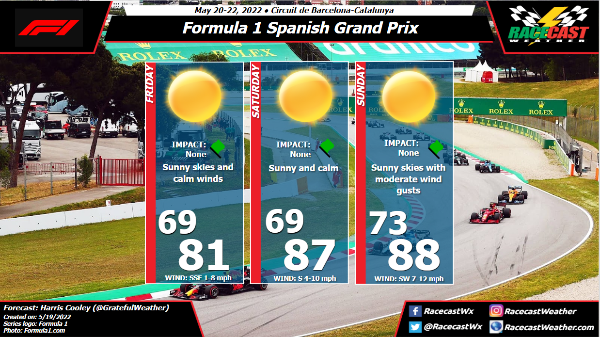
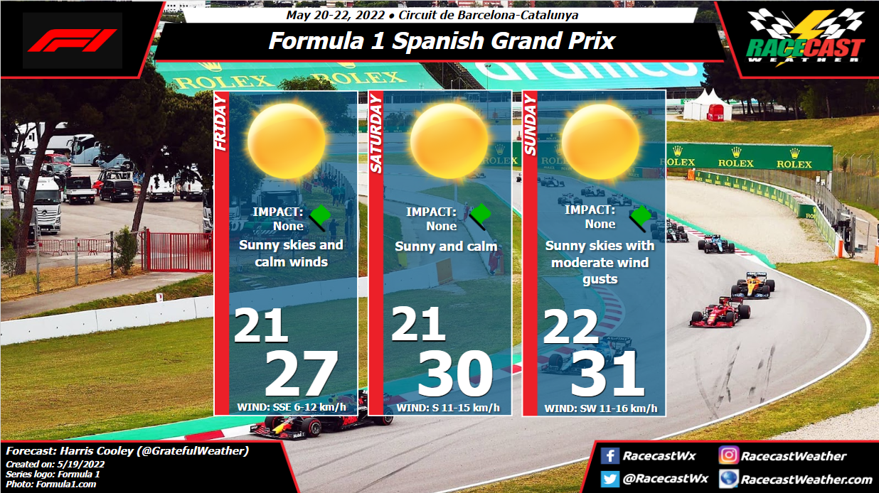
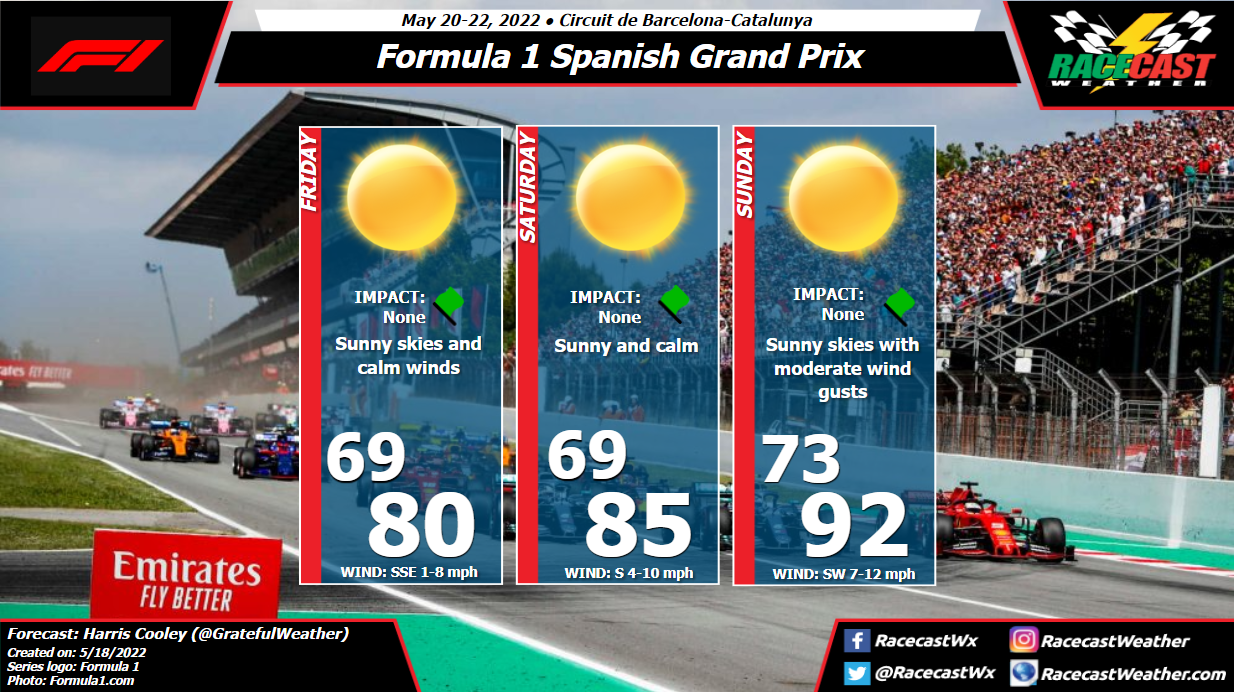
This will be a good setting for these teams to gauge where their cars stand after a few races this season racing on a historical track in crisp weather conditions. A metric graphic is posted below... By: Harris Cooley The weather is looking to be sunny and hot with light winds throughout this race weekend. Higher pressures with a relaxed gradient will be settling over the site in the next few days which will keep moisture and wind speeds low. Gusts could pick back up a bit by Sunday afternoon, but nothing to alarm the teams too much. These conditions will likely remain through the weekend but I will continue to monitor these conditions for any changes. A metric graphic is displayed below...
|
Social Feeds
Authors
Doug Schneider Partners
Categories
All
Archives
December 2023
|


