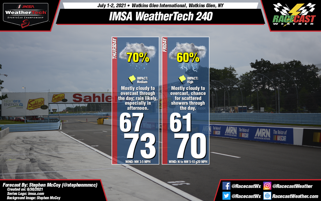
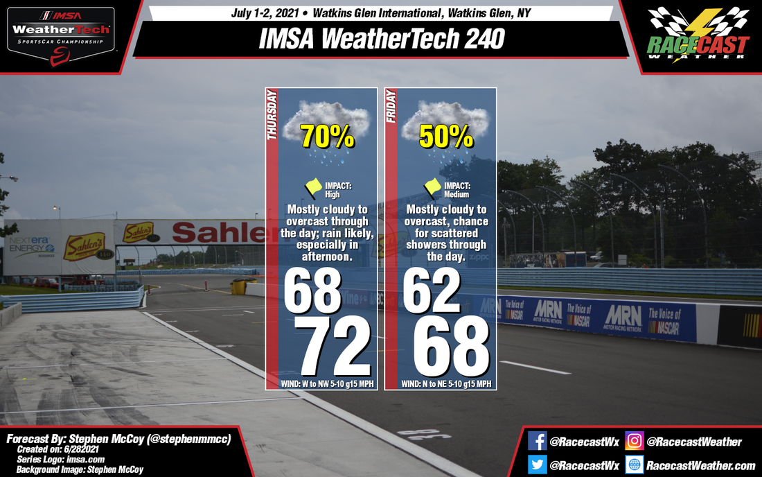
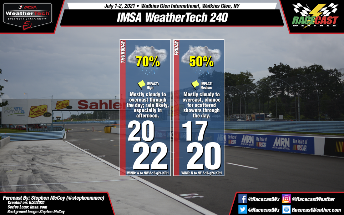
A cold front will pass through the region on Thursday as it heads eastwards to the Atlantic. Cooler air behind the front will result in lows in the low-to-mid 60's and highs in the low 70's. Winds aren't looking as strong for Thursday as they once did, however winds will pick up on Friday around the central low. The cooler low level air undercutting the present warm air will result in a fair amount of instability, causing widespread showers on Thursday along with scattered to widespread showers and/or thunderstorms on Friday. Fog may be possible Thursday morning as the result of saturated air at the surface trapped under a weak inversion, but should wane as the morning progresses.
|
By: Stephen McCoy No major changes to the forecast from Monday; continue to expect cooler than normal temperatures with chances for showers both days.
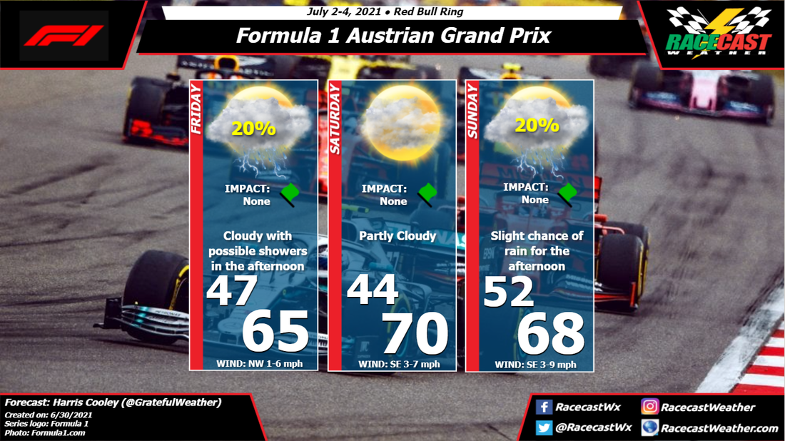
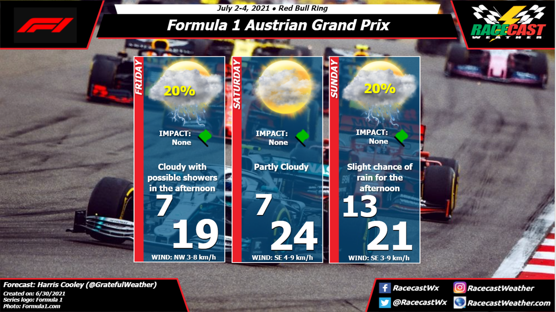
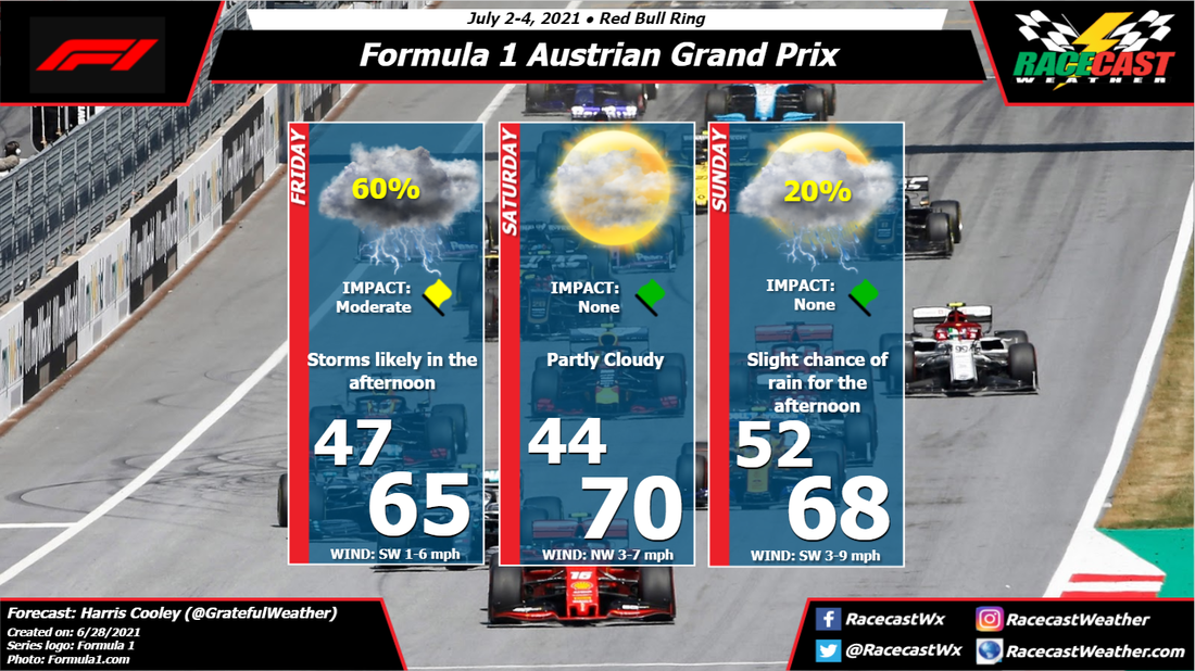
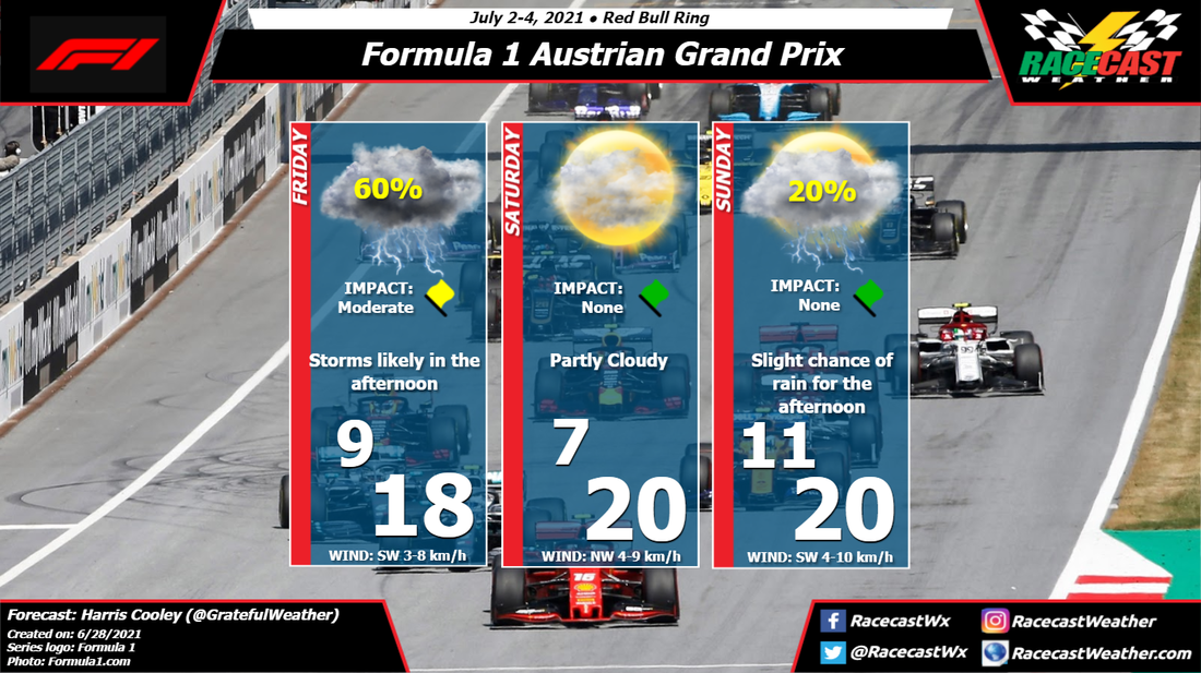
A cold front will pass through the region on Thursday as it heads eastwards to the Atlantic. Cooler air behind the front will result in lows in the low-to-mid 60's and highs in the low 70's. Winds aren't looking as strong for Thursday as they once did, however winds will pick up on Friday around the central low. The cooler low level air undercutting the present warm air will result in a fair amount of instability, causing widespread showers on Thursday along with scattered to widespread showers and/or thunderstorms on Friday. Fog may be possible Thursday morning as the result of saturated air at the surface trapped under a weak inversion, but should wane as the morning progresses. By: Harris Cooley The forecast unfortunately has backed off on the rain chances for Friday with partly cloudy skies and scattered showers in the area. We could still see some showers out on the track, but they will most likely be short-lived and fast moving. Wind speeds stay down with occasional gusts and mild temperatures; much like last weekends race. A high pressure system with a relaxed gradient is extending over Austria and is bringing in a mostly light northwestern wind which is triggering the showers in the area.
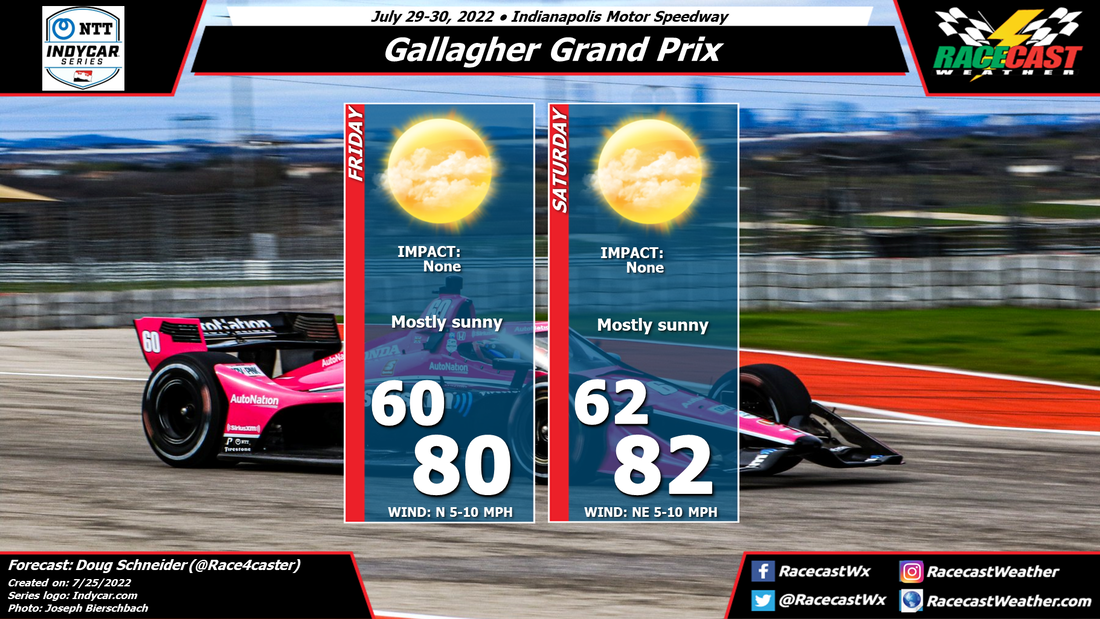
The weather is panning out to be quite identical to last weekend, so hopefully the teams take that into account and can be a little more competitive this go around. Updates will be coming as conditions change, and a metric graphic is displayed below. By Doug Schneider An unsettled weather pattern will be over Ohio during the middle of the week, but gradual improvement is expected over the weekend, which is expected to result in nice weather for race day.
A front will be stalled across Ohio on Thursday, which will bring quite a bit of rainfall. By Friday, that front will push south and east of the track as an upper level trough pushes south across the Great Lakes. So although the front will be clear of the area, the presence of the upper trough will mean a few scattered showers will remain possible on Friday. I think any showers should be light, having low impacts on the practice sessions. It will be cool as northerly winds behind the front bring cooler air to the region, with highs only in the lower 70s. Saturday is the most uncertain day of the forecast as the upper level trough will slowly push southeast. The question is how quickly it will exit Ohio, and different models have different answers to that. With the trough expected to be somewhere nearby, there could be some isolated afternoon showers that develop. However, any showers that might develop are expected to be brief and light, with little to no impact. With a little more sunshine expected than Friday, highs will reach the mid 70s. By Sunday, I expect that the upper trough will be clear of the area, although there are some models that keep it over Ohio and produce some showers. I think the most likely scenario is that Sunday is dry with partly cloudy skies. By: Stephen McCoy Quite the change in conditions from the 6 hours this past weekend at Watkins Glen. A cold front passing through the region on Thursday will bring cooler temperatures and chances for rainfall both days of the event.
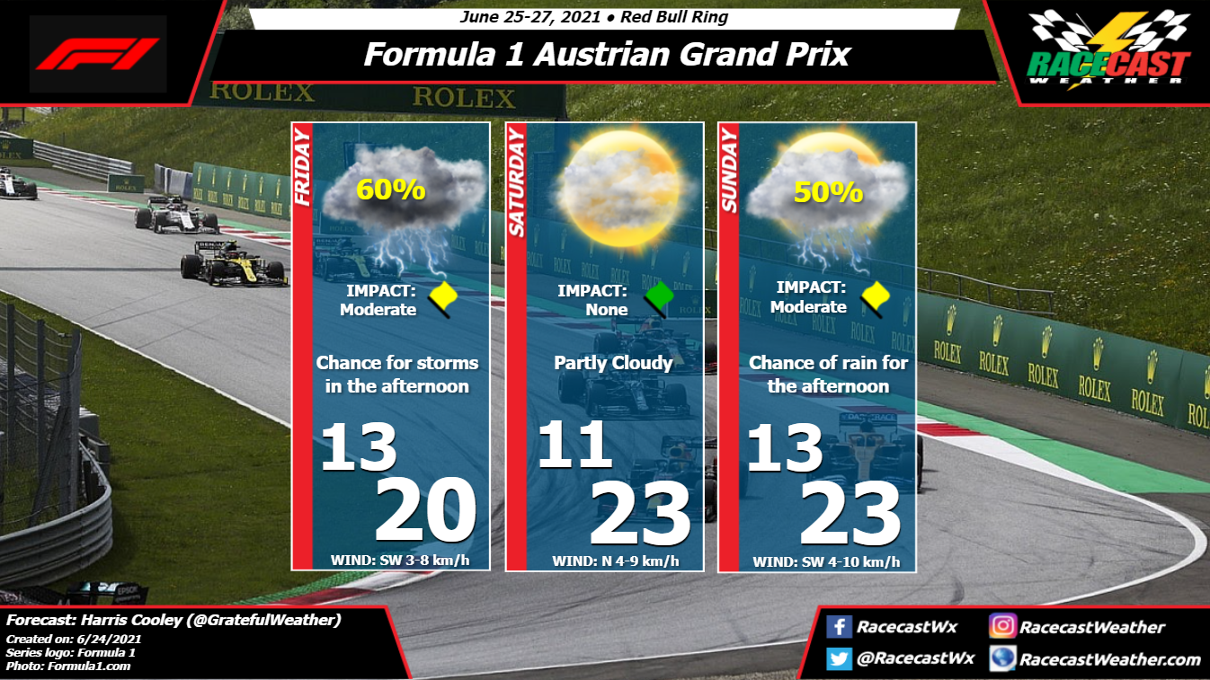
To start, on Wednesday, a surface low pressure system will develop over the upper Midwest ahead of an upper-level shortwave trough. The system will move eastwards towards the Atlantic for the remainder of the week, with the extending cold front passing through central New York on Thursday. Model guidance currently suggests a passage around the late morning to mid-day, allowing for temperatures to warm slightly during the morning. However, after the front moves through, temperatures will begin to drop as winds shift from the west/southwest to the northwest. Rainfall appears likely through much of the day ahead of the front with rainfall rates increasing ahead of the frontal passage; a few thunderstorms may be possible within the line of showers. Friday's conditions look similar to Thursday's, though a few degrees cooler due to northwesterly winds for much of the day. By: Harris Cooley As confusing as it is, we are back at the Red Bull Ring for the Austrian Grand Prix. The weather is following a similar pattern as last weekend with storms Friday afternoon and cloudy skies for Saturday and Sunday. We saw Max Verstappen crush everyone else around the track this past weekend with good weather on race day. We are likely going to see similar weather this weekend as well with a loose high pressure gradient relaxed over the site. This will keep wind speeds light with some occasional moderate wind gusts that drivers will need to be wary of. The sporadic bouts of sunlight and cool temperatures could lead to some grip issues around the track as well.
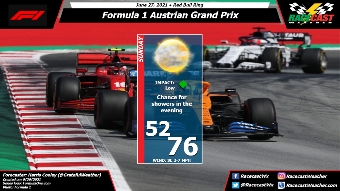
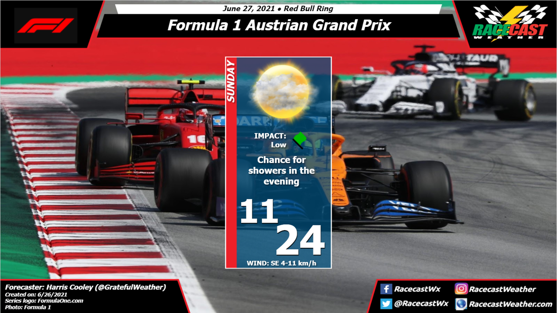
Overall, we will likely see much of the same weather we did last weekend, but hopefully we see a closer race now that these teams have spent a week out at the track. A metric graphic is displayed below... By: Harris Cooley Rain chances have backed off for the race tomorrow. Storms are still expected for the evening, but the race will likely be over by the time they set in. It will be increasingly cloudy as the race goes on with increasing wind gusts as well. This is likely because of the impeding storms in the area, but only a total of 3 mm of rain is expected for tomorrow evening. Temperatures will be mild and will cool off with the cloud coverage. It could make the race more exciting if we saw these storms set in a little bit earlier, so I will continue to monitor the timing of these storms and keep you all updated. A metric graphic is displayed below...
By Doug Schneider Saturday's forecast continues to have a chance of showers and thunderstorms, although it looks like conditions are less favorable for pop-up showers in the afternoon than before. There is a weak upper level disturbance moving over the area that may help spark some showers and storms in the Finger Lakes region, but they should be few and far between. The chance of one hitting the track is only 20%.
The forecast for Sunday at Watkins Glen have been something of a moving target. This is due to the interaction of high pressure to the east and low pressure to the west. The trend over the past few days is for the low pressure to the west to move more slowly east, and for the high pressure to the east to become stronger and more dominant. That is why I have removed the chance of rain from Sunday's forecast. With the stronger high pressure system will come more stable conditions, more sunshine, and hotter temperatures. By: Harris Cooley Not much has changed from the original forecast, except for a decrease in rain chances. Storms are likely for Friday's practice sessions with partly cloudy skies for Saturday, and back to scattered showers for Sunday. The rain will be spotty and scattered for Sunday, so the onsite forecasters are going to really have their hands full! It will be hard to predict exactly when/where these storms will pop up for Sunday, but we will keep you all updated. Teams' should be preparing for a humid, cloudy race regardless if any storms end up raining on the track.
These conditions will likely make this a very close race and will also be a good test for who the most skilled drivers are. Experience will be a key factor for a race in the rain, and we are wishing all teams have a safe race nonetheless. As always, a metric graphic is posted below... |
Social Feeds
Authors
Doug Schneider Partners
Categories
All
Archives
December 2023
|

