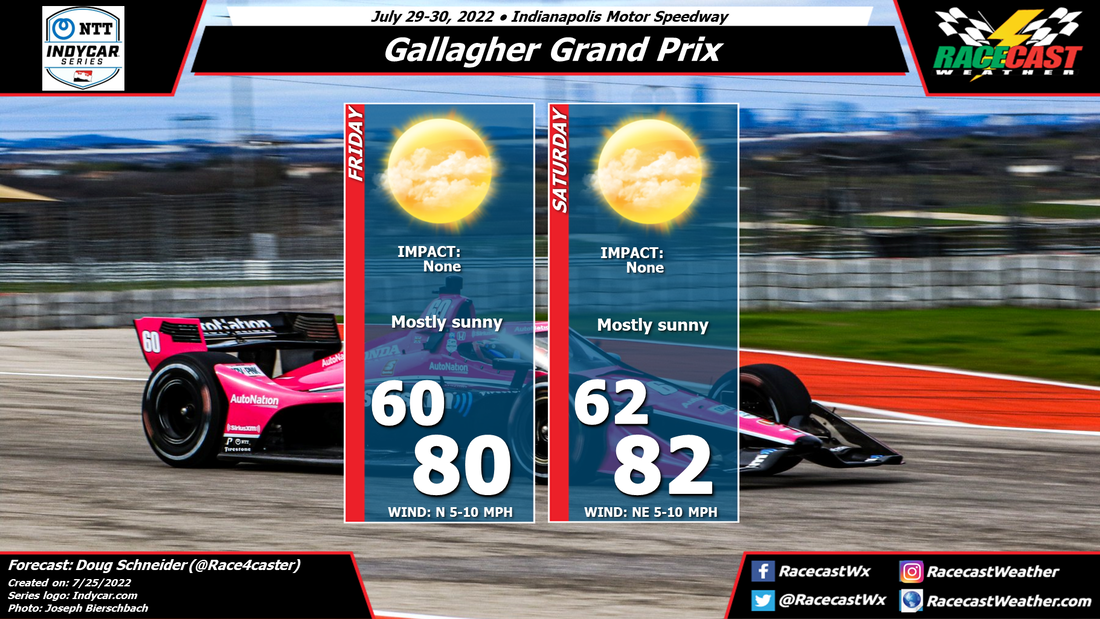
|
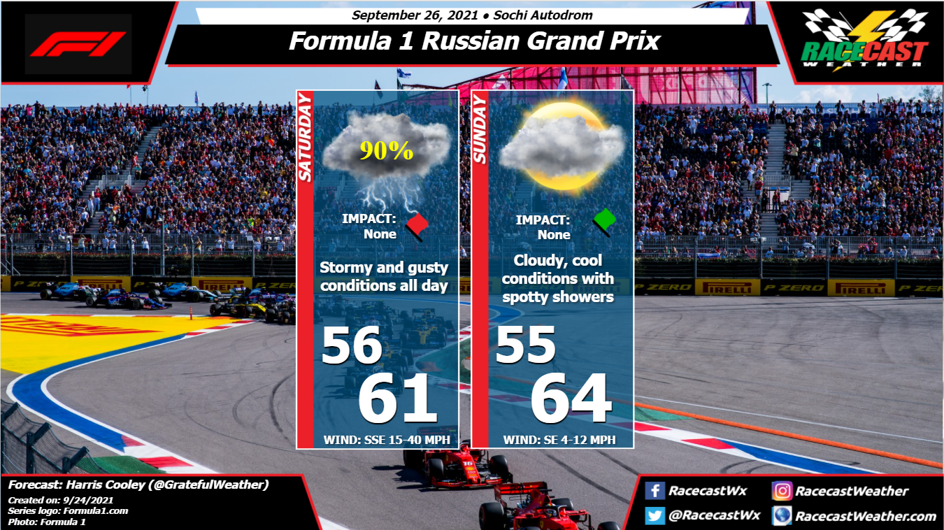
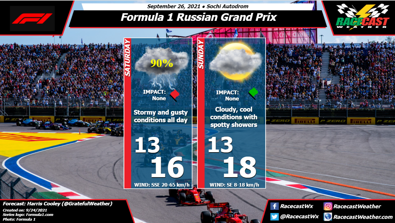
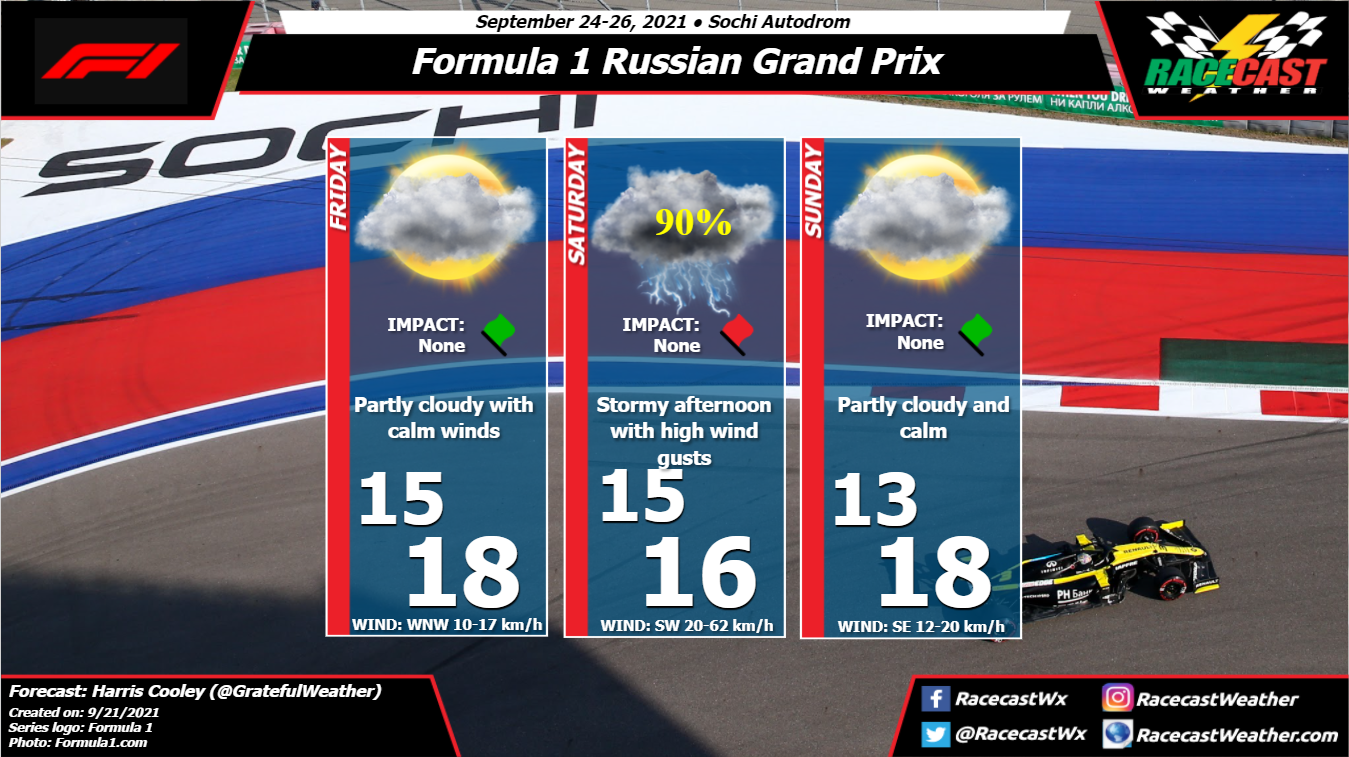
By: Harris Cooley The forecast has held up with a strong storm system moving through all day tomorrow with rain amounts up to 40 mm. We will see if the teams are able to get any time on the track tomorrow, but it is likely that this system will spoil most of the afternoon with windy conditions. Luckily the race day will be a bit clearer with mostly cloudy skies and a chance of rain. Wind speeds will be low as well as temperatures which could make for a slippery day on the track, especially if the teams cannot get a session in tomorrow. A metric graphic is displayed below...
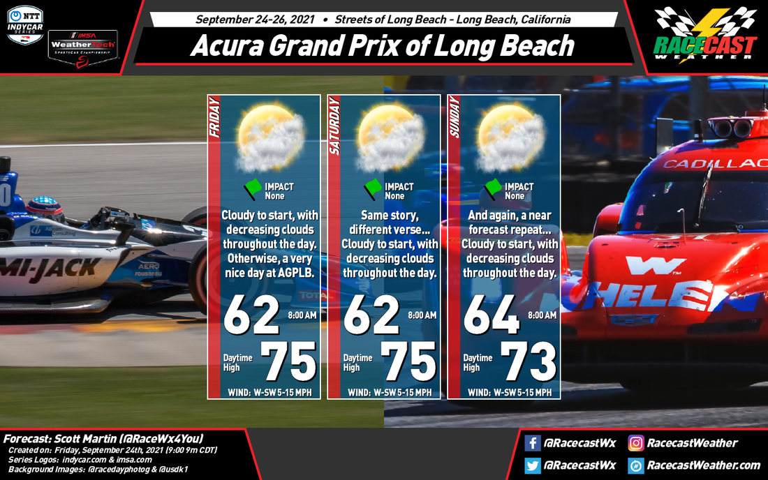
by Scott Martin. The forecast for the Grand Prix of Long Beach for IMSA and the NTT IndyCar Series really hasn't changed that much at all, with the exception of a slight nudging of the temperatures. Skies on each day will start off mainly cloudy, with some fog reducing visibilities during the morning. Eventually the fog will lift and clouds will dissipate as the noon hour approaches and skies will be partly cloudy to mostly sunny by the afternoon. Highs will top out in the lower to mid 70s. No rain is in the forecast.
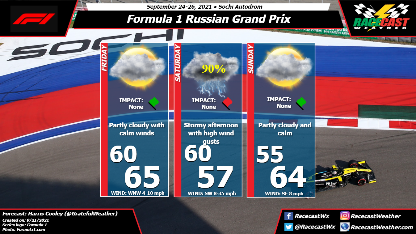
By: Harris Cooley Friday looks to be fair weather with calm winds and partly cloudy as the pressure gradient stays relaxed. A Low pressure coming off of the Black Sea is expected to bring heavy rain and winds to the area for Saturday afternoon which could cause some issues with getting time on the track. It is expected to pass by that evening though and should clear up by Sunday. Temperatures will remain mild with intermittent wind gusts, so grip will be a key factor in this weekends race. A metric graphic is posted below...
by Scott Martin This will be an easy forecast week for IMSA and IndyCar, as the weather will not be changing that much at all in Long Beach, California. Skies will start off cloudy on each day, with those clods dissipating throughout the day, becoming mostly clear by the afternoon hours. 8 am temperatures will start off in the mid 60s and reaching the mid to upper 70s by the late afternoon hours. Winds will be out of the west to southwest at 5-15 mph each day. That is really it... no rain, no snow, and no severe weather. Have a great time at the event.
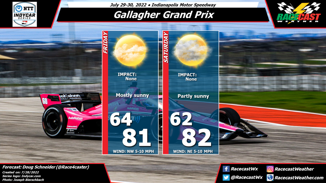
By Doug Schneider The main change to the forecast today has been to add a mention of a light sprinkle or shower on Sunday morning.
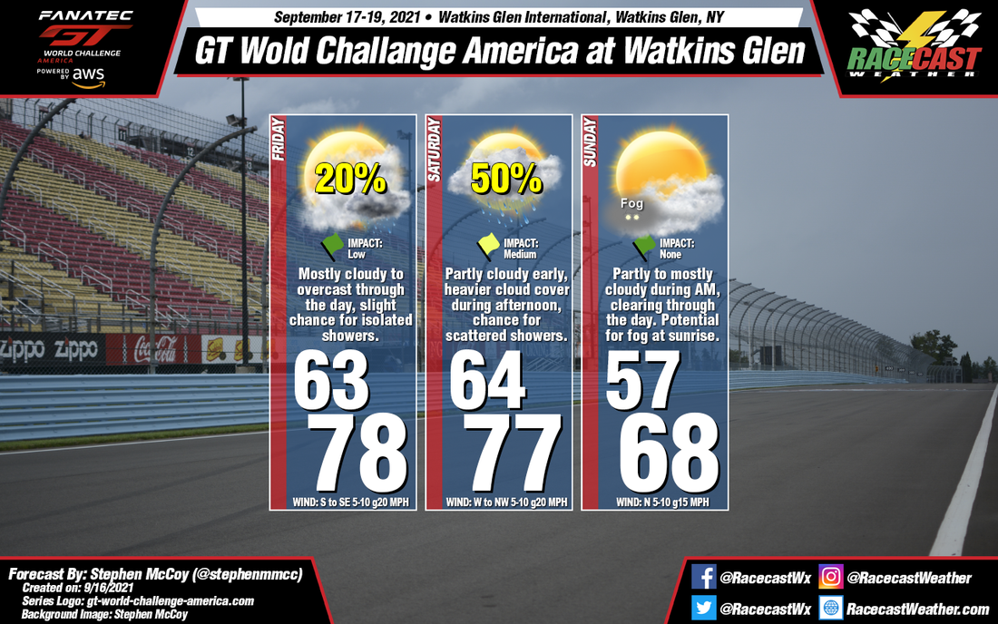
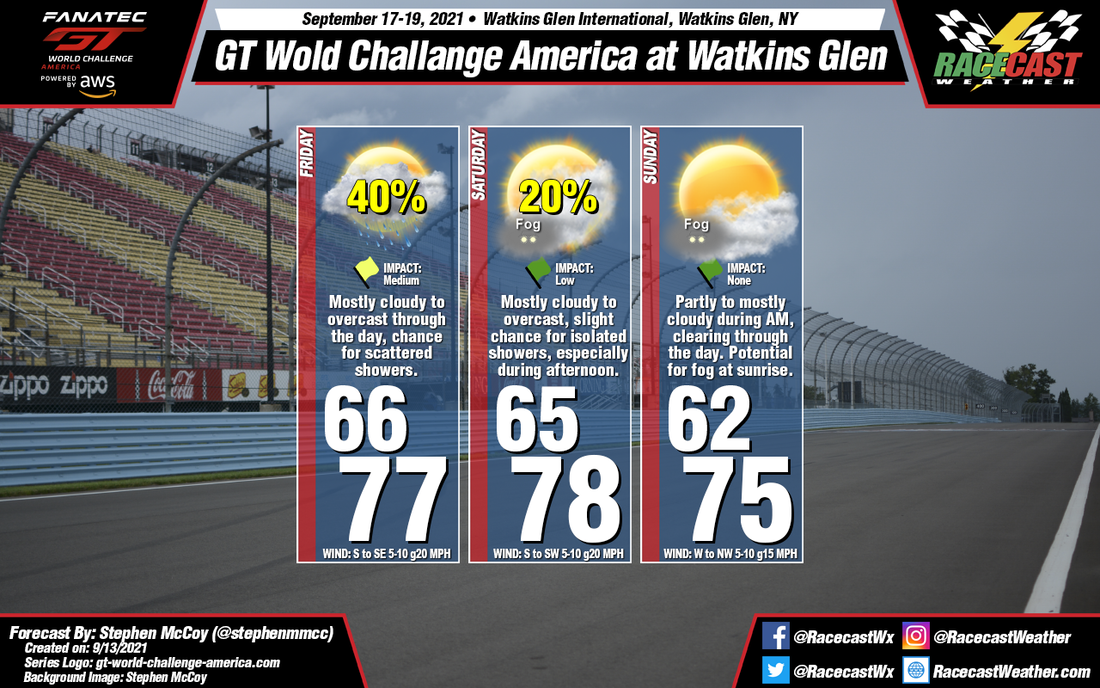
A west to northwest flow will bring the marine layer into the Monterey Peninsula each night, resulting in low clouds forming. These clouds will linger through the morning, and dissipate by noon, leaving mostly sunny skies on Friday and Saturday afternoons. On Sunday, the moisture will get a little deeper as a cold front approaches from the northwest. This could squeeze out a little rain, probably just a couple hundredths of an inch at most. Rain could fall during the Sunday morning warm-up session, but again, the light nature of the rain should not have much of an impact. For the race, it will be partly sunny with temperatures in the 60s. By: Stephen McCoy Conditions for this weekend at Watkins Glen have remained mostly as expected, with a shift of precipitation from Friday to Saturday. A surface low pressure system located off the Atlantic coast will cause winds to be largely from the south to southeast on Friday, bringing moisture off the ocean and resulting in mostly cloudy to overcast conditions. The increased moisture may also cause a slight chance for isolated showers in the region, especially in the afternoon. On Saturday, a cold front extending south from a surface low located over Canada is expected to move through the region, bringing a higher chance for precipitation during the afternoon. Winds behind the front will shift to the west to northwest, cooling temperatures into Sunday with cloud cover decreasing through the day as drier air moves in.
By: Stephen McCoy Mixed conditions will start the event off on Friday and will improve as the weekend progresses.
Around mid-week, a low pressure system will move eastwards over Canada to the north of the region. This system will bring a cold front through the area with a high percentage of rainfall and a drop in temperatures expected Wednesday into Thursday. A second low will take a similar route as the first during the early part of the weekend with its warm front moving northward through New England Thursday into Friday morning. This will allow temperatures to warm again into the upper 70's, which will remain largely consistent through the next few days. Of note: the National Hurricane Center has identified a disturbance in the Atlantic which has a 50% chance to develop into a tropical system within the next 5 days. Current model guidance suggests the system will curve along the east coast before moving out into the northern Atlantic. This has been brought up as its location at the beginning of the weekend will bring moisture from the Atlantic to the region, resulting in a chance for scattered showers through the day, especially during the afternoon. As mentioned, conditions will improve for the remainder of the weekend as the low and potential tropical system move further eastward. Winds shifting to the west/northwest on Sunday will bring slightly cooler temperatures and clearer conditions. Saturated air at the surface and a temperature inversion just above the surface will result in a potential for fog for both Saturday and Sunday morning. By Doug Schneider Aside from some clouds and fog each morning, nice weather is expected for IndyCar's visit to WeatherTech Raceway Laguna Seca.
All this week, a large area of high pressure will be located off the California coastline. This high will produce a west to northwest flow off the Pacific Ocean. In this setup, it is common for the Monterey Peninsula to experience fog and low clouds overnight due to the marine layer - moist air off the ocean spreads inland, and as temperatures cool overnight, fog can form. This past weekend at the IMSA event, fog and low clouds formed each morning, and usually cleared out between 10 am and noon. I expect a similar pattern this weekend. Some of the early morning sessions may be impacted due to low visibility. Once the clouds and fog lift, sunny skies will prevail. Thanks to the cool air off the ocean, temperatures will only reach to around 70 degrees in the afternoons. |
Social Feeds
Authors
Doug Schneider Partners
Categories
All
Archives
December 2023
|

