By Doug Schneider
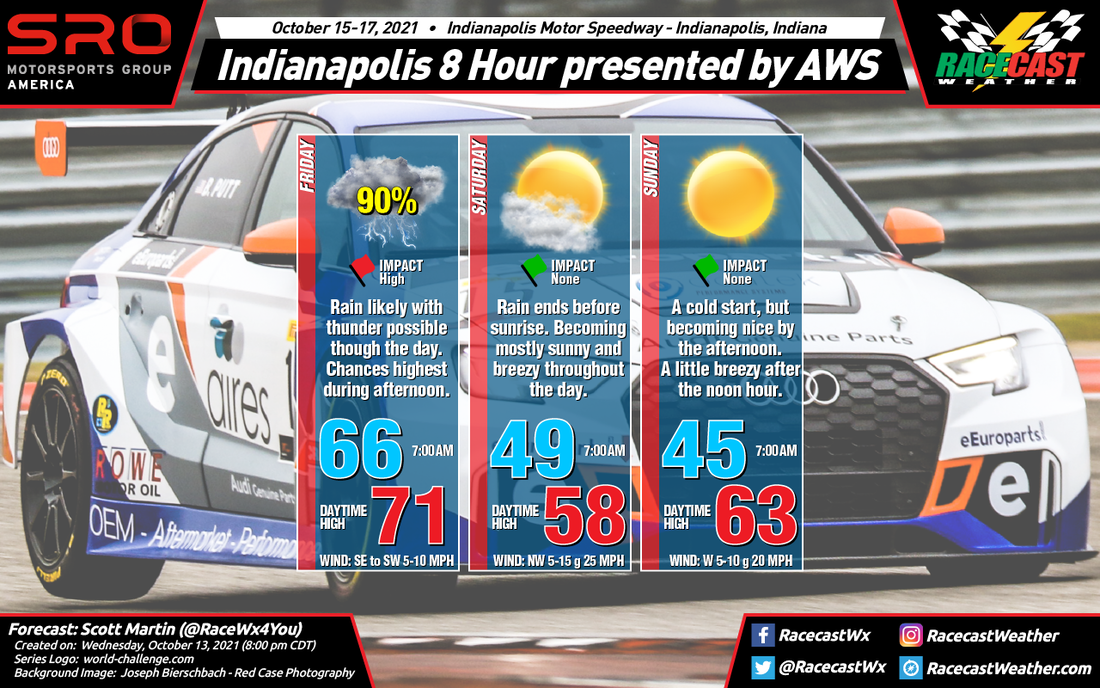
After a wet day today, the rest of the Indianapolis 8 Hour activities will likely have dry weather, but with cool and breezy conditions.
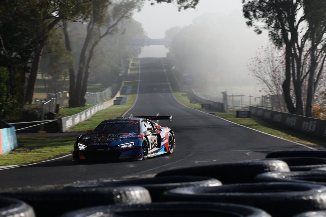
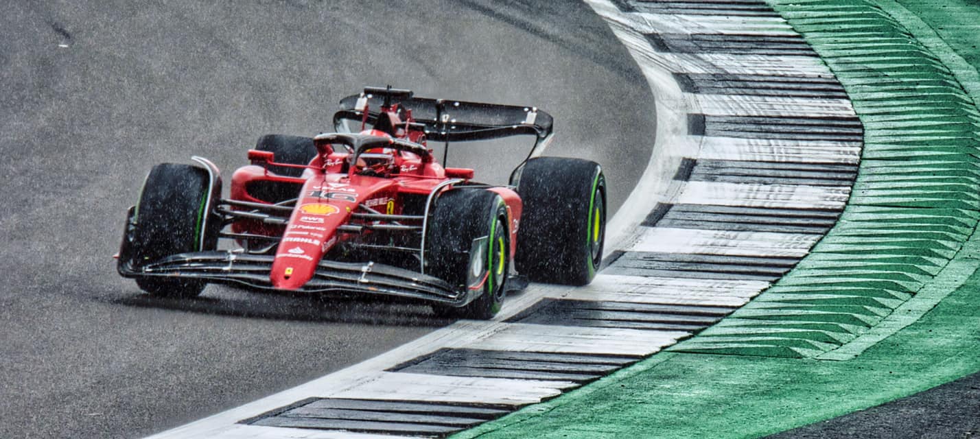
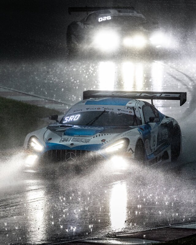
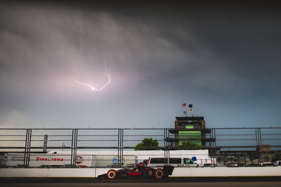
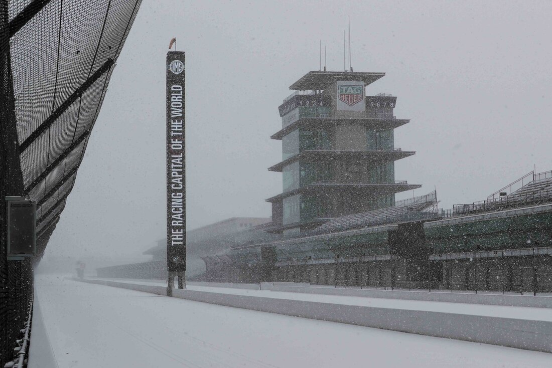
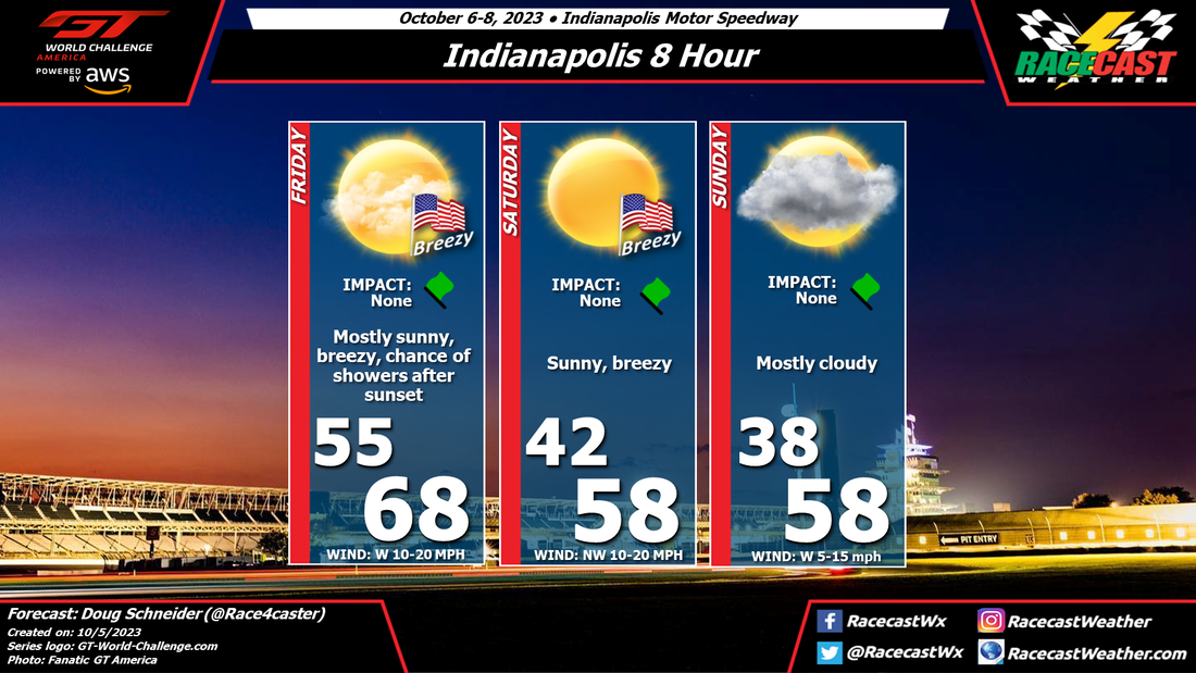
Today's practice sessions at IMS have been affected by rain, associated with an upper level trough and an approaching cold front. This front will move through the area this evening.
Behind this front on Friday, nice weather is expected, with mostly sunny skies and breezy conditions through the day. Highs will peak in the upper 60s. On Friday night, another cold front will pass through the area. It may bring some showers to the Speedway, but I expect that it will arrive after 8 pm, after the qualifying session ends at 7 pm. It is possible that some showers could arrive earlier than that, but I think the chance of rain affecting the qualifying is low.
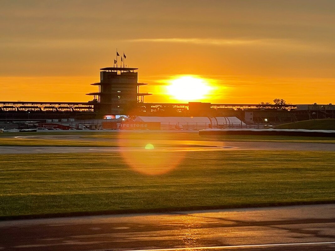
Behind the second cold front, temperatures will get much colder. Lows on Saturday morning will be in the lower 40s, with daytime highs only in the upper 50s with sunny skies. The northwest wind will continue to bring cool temperatures through Sunday, with lows in the 30s and highs in the 50s. Clouds will increase on Sunday as a weak upper level disturbance crosses the area.
Today's practice sessions at IMS have been affected by rain, associated with an upper level trough and an approaching cold front. This front will move through the area this evening.
Behind this front on Friday, nice weather is expected, with mostly sunny skies and breezy conditions through the day. Highs will peak in the upper 60s. On Friday night, another cold front will pass through the area. It may bring some showers to the Speedway, but I expect that it will arrive after 8 pm, after the qualifying session ends at 7 pm. It is possible that some showers could arrive earlier than that, but I think the chance of rain affecting the qualifying is low.
Behind the second cold front, temperatures will get much colder. Lows on Saturday morning will be in the lower 40s, with daytime highs only in the upper 50s with sunny skies. The northwest wind will continue to bring cool temperatures through Sunday, with lows in the 30s and highs in the 50s. Clouds will increase on Sunday as a weak upper level disturbance crosses the area.