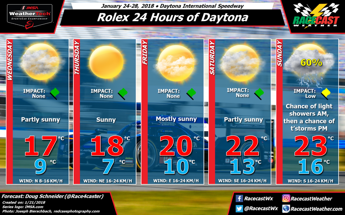
By Doug Schneider - @Race4caster
 |  |
Click images to enlarge
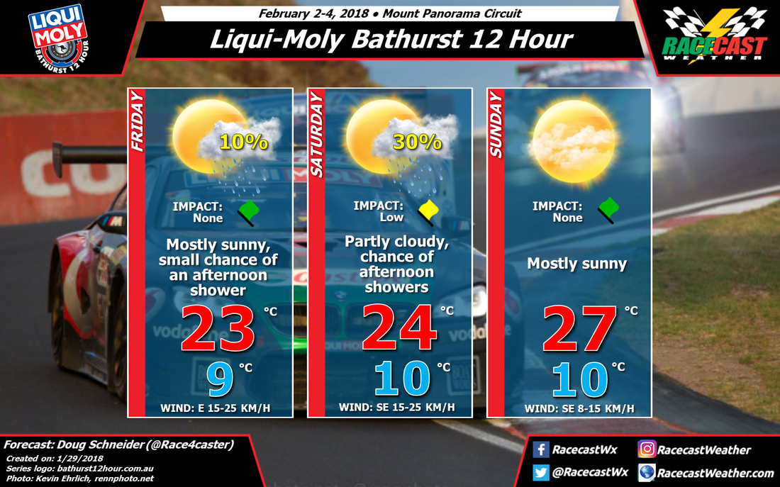
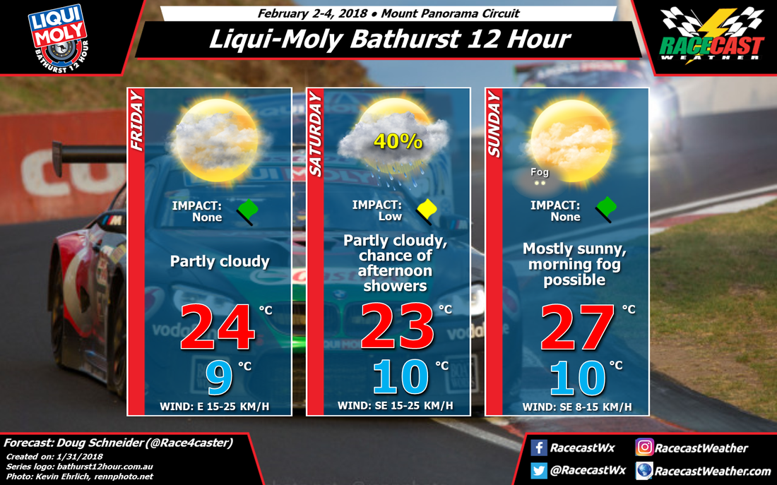
The forecast for the Bathurst 12 Hour hasn't changed much from what I posted on Monday. The weather pattern continues to feature a large high pressure system off the southern coast of Australia that will be drifting slowly toward the east through the weekend.
I took the small chance of showers out of Friday's forecast, as it appears more likely today that showers will be confined to the Blue Mountains, and stay well east of Bathurst. It will be a really nice day at the track, with highs in the mid 70s F and mid 20s C, with partly cloudy skies.
Saturday continues to have a chance of afternoon showers, and I've raised the chance of rain to 40% today. The main difference from Friday to Saturday will be a stronger southeasterly flow that will allow showers that develop over the Blue Mountains to track farther west. I think that any showers at the track will be fairly short-lived, producing rain amounts in the range of 2 to 5 mm (0.1 to 0.2 inches).
If there is rain on Saturday, then fog is likely to form on Sunday morning for the start of the race. It's hard to say how dense the fog will be at this point, and it is possible that there could be some impact on the race start, perhaps a delay until the fog lifts. It's hard to say for sure since that will depend on a shower occurring on Saturday to moisten the ground. The rest of Sunday looks very nice, with mostly sunny skies and a high near 80 F and 27 C - much cooler than last year's race.
I'll have at least one more forecast update posted before the start of the race.