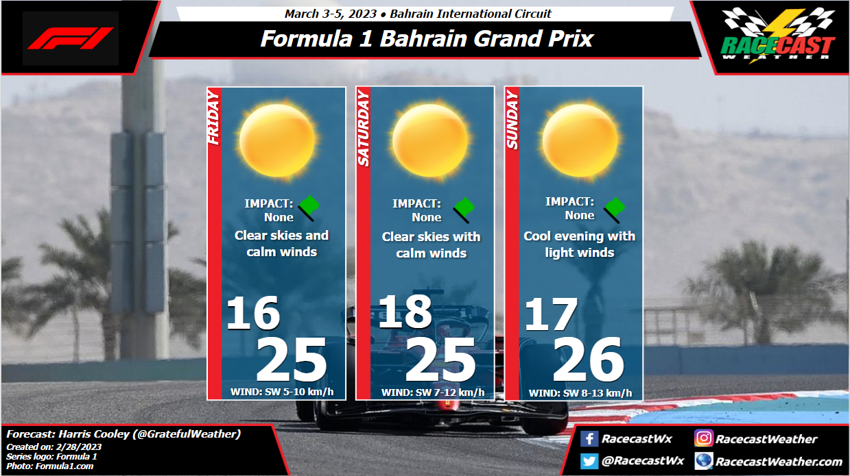
All three days will be virtually the same with cool temps being present when the sun is down and heating up as the sun shines through the day. High pressure with a weak gradient will keep moisture content low along with wind speeds/gusts through the weekend. A metric graphic is posted below...
By: Harris Cooley 
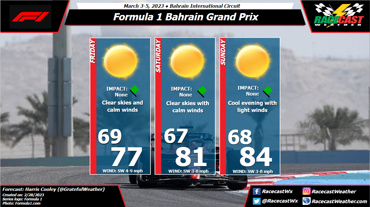
Perfect weather conditions are gracing F1 this weekend for our first race of the 2023 season. Crystal clear skies all weekend with low wind speeds will be present which is a nice change of pace from last year's windy weekend. The race being at night will certainly help the drivers with their grip as the sandy conditions already play enough of an obstacle.
All three days will be virtually the same with cool temps being present when the sun is down and heating up as the sun shines through the day. High pressure with a weak gradient will keep moisture content low along with wind speeds/gusts through the weekend. A metric graphic is posted below... By: Stephen McCoy A low pressure system is expected to form over the southern plains on Thursday, ahead of a strong upper level shortwave trough. Through the remainder of the week, the system will track northeast through the eastern portion of the country, with a strong cold front potentially bringing severe weather to much of the southeast.
For the Tampa area, conditions for the start of the race weekend will be dry, but with relatively strong sustained winds. On Friday, surface winds are expected directly from the South ahead of the aforementioned front, largely coming off the Gulf of Mexico. With little resistance until reaching land, wind speeds over the area may reach upwards of 20-30 mph with potential gusts peaking as high as 40-45 mph during the afternoon. Low level winds coming in from the southwest, also off the Gulf, will result in partly to mostly cloudy conditions through the day. Drier, warmer air just above the 850 millibar level will keep showers from developing over the region, again resulting in dry conditions through the day. As the low pressure system continues moving up the east coast through the weekend, its cold front is expected to weaken and stretch further to the southwest from the center. This will cause the front to move over the Tampa area either late Saturday or Sunday, which the forecast models are currently somewhat split on. (The included forecast graphic assumes that the front will move through the region overnight Saturday or early Sunday morning.) In either case, showers are possible ahead of the front which could have a slight impact for on-track sessions. Surface winds will shift to the southwest ahead of the front, maintaining similar, but slightly lower, wind speeds from Friday. Behind the front, conditions will clear, with northerly winds bringing slightly cooler and drier air to the region. |
Social Feeds
Authors
Doug Schneider Categories
All
Archives
February 2025
|