|
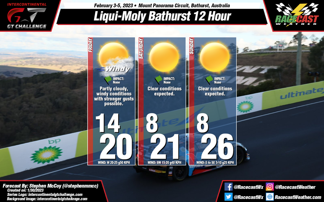
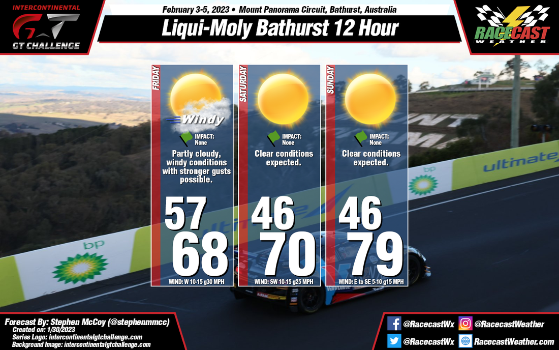
By: Stephen McCoy Conditions are looking all bright and sunny for this year's Bathurst 12 Hour with no impacts expected for any of the weekend's sessions. A cold front is likely to pass through New South Wales overnight Thursday into Friday; while low temperatures will be similar to those from earlier in the week, high temperatures may struggle to break 20°C (~70°F). Strong winds behind the front from the West/Southwest will cool temperatures overnight Friday through Saturday; morning lows for Saturday and Sunday will be below 10°C (50°F). However, winds will shift on Sunday to the East/Southeast, bringing warmer coastal temperatures to the region, resulting in highs nearer to the mid 20's C (70's F). Partly cloudy conditions will be present for much of Friday from lingering moisture in the low levels. However, drier air will move in over the region, resulting in clearing conditions for the remainder of the weekend.
By Doug Schneider
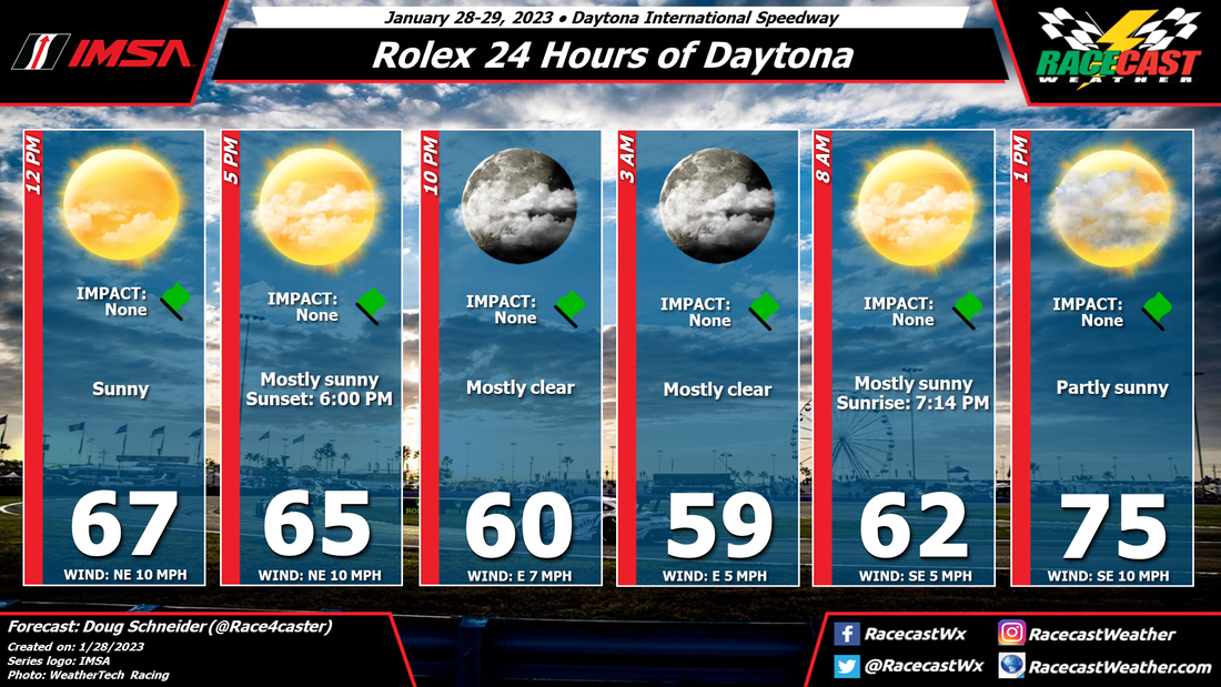
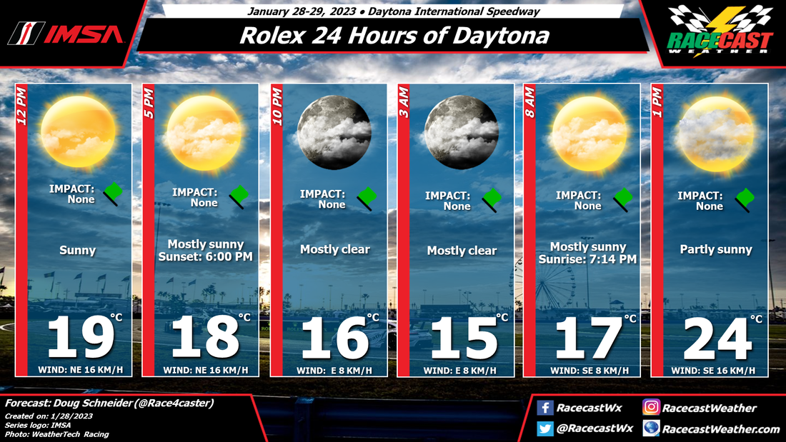
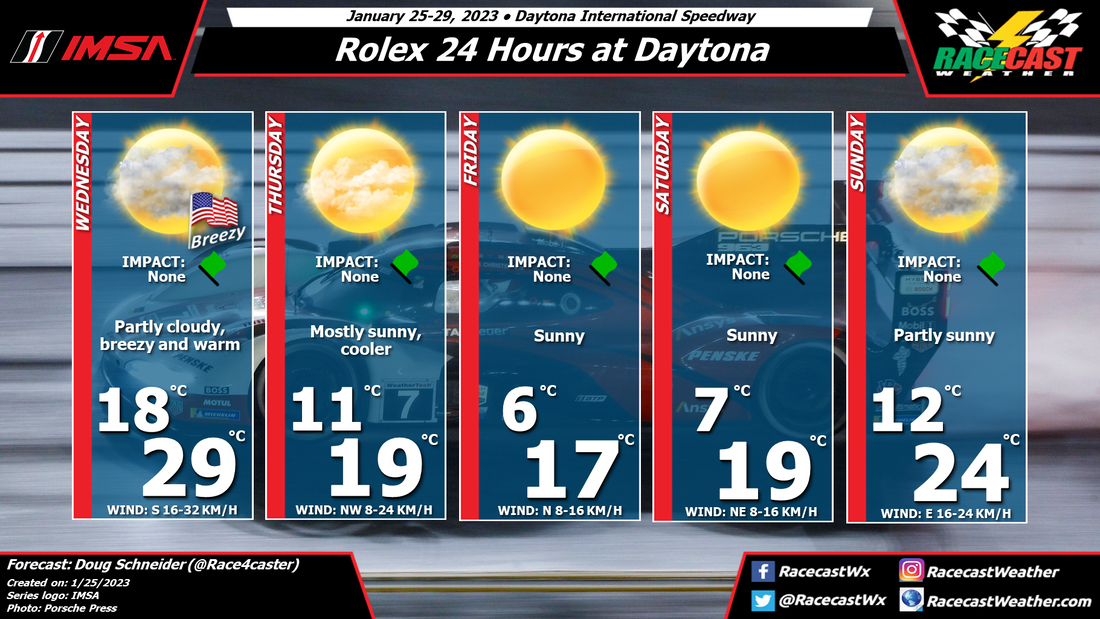
It will be beautiful weather for the Rolex 24 as high pressure moves across Florida. Enjoy the race! By Doug Schneider The weather continues to look great for this year's edition of the Rolex 24 Hours at Daytona. Only a few small changes were made from Monday's initial forecast.
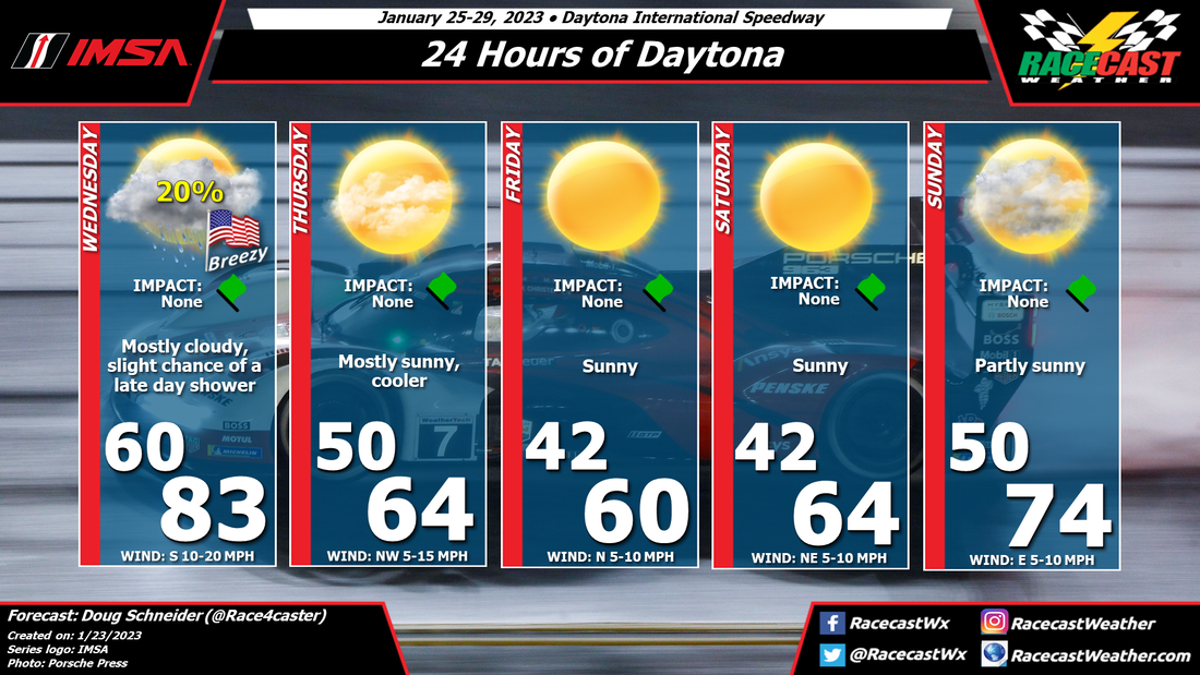
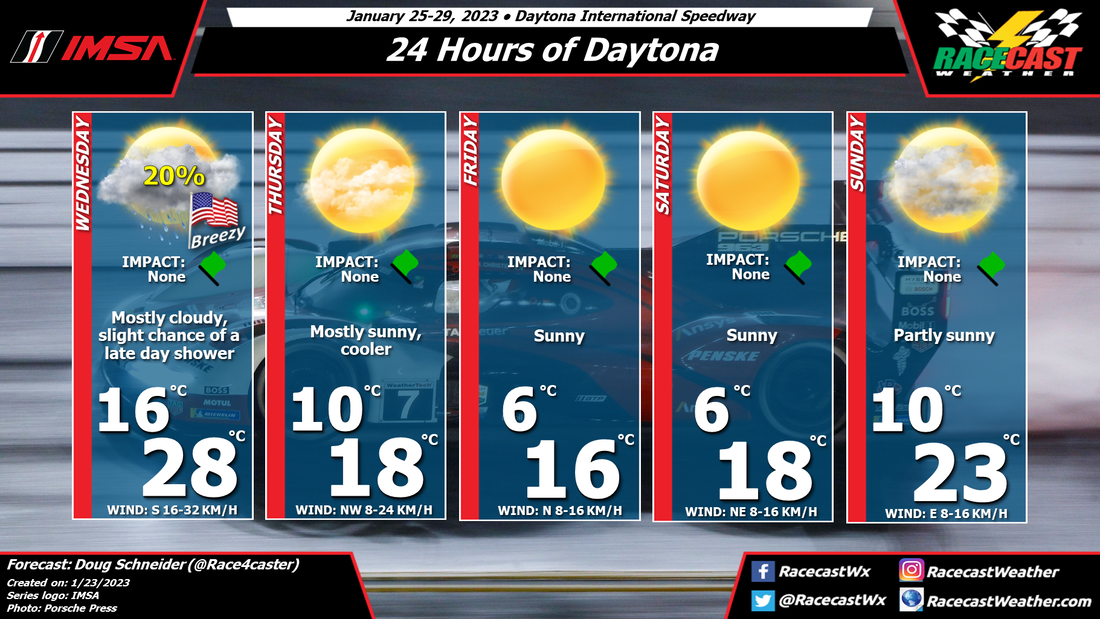
Today at Daytona will be warm and breezy. High temperatures will reach the mid 80s, and winds will be 10 to 20 mph, with gusts of 25 to 30 mph at times. A cold front will approach the area from the northwest, and bring some showers to the area tonight. Colder temperatures will follow the cold front for Thursday, with high temperatures about 15 to 20 degrees colder than Wednesday. Cool and sunny conditions will continue through Saturday as winds remain from the north. Sunday will see warming temperatures into the 70s, with increasing clouds. Some rain showers could arrive late Sunday, but it looks like they will hold off until after the race is over. By Doug Schneider This year's edition of the Rolex 24 is expected to have very nice weather. Temperatures will be on the cool side for a few days, but dry weather is expected through the event.
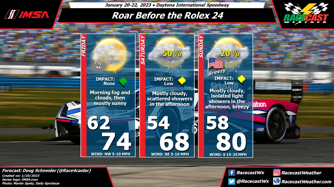
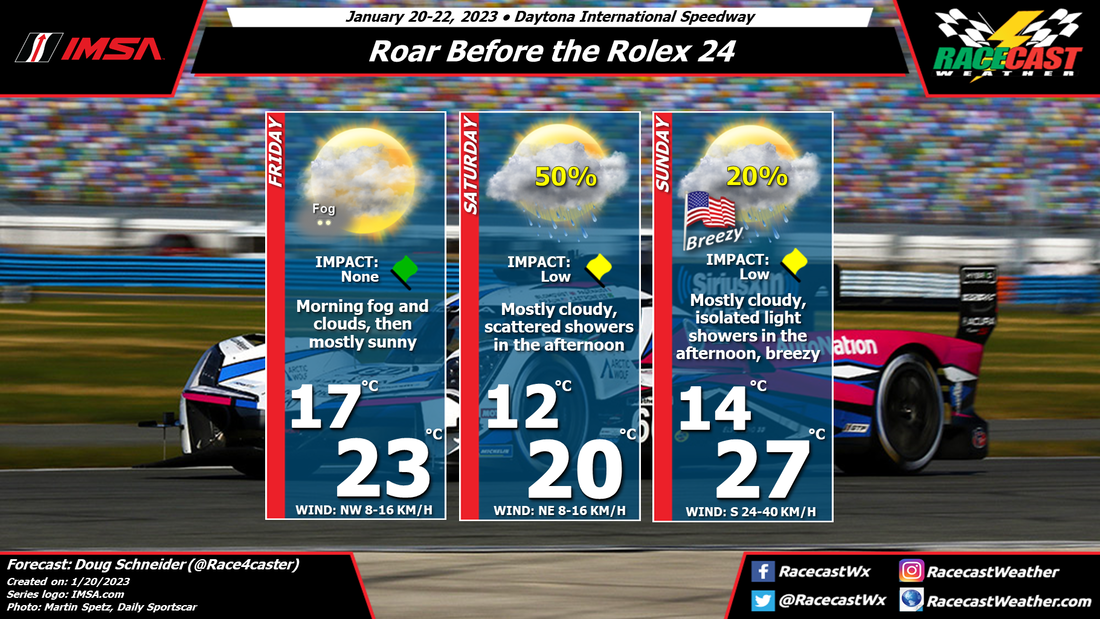
The opening day of practice for Mazda MX-5 Cup and Michelin Pilot Challenge will be the warmest day of the event, with high temperatures reaching into the lower 80s, thanks to a south wind at 10 to 20 mph. A cold front will be approaching the area from the northwest, and there is a slight chance of a late day shower. Most of the showers with the front will come after sunset, and will exit before sunrise on Thursday, so I don't expect that rain will have an impact on the practice sessions. Behind the cold front, temperatures will be quite a bit cooler as winds switch around to the northwest. For Thursday through Saturday, highs will be in the lower to mid 60s, with lows in the 40s. This is about 6-10 degrees colder than normal at Daytona, but not as cold as last year's race which had lows in the 30s. Sunday will be very nice, with temperatures warming into the mid 70s, under partly sunny skies. By Doug Schneider The chance of rain on Saturday is looking higher with today's forecast update for the Roar. A cold front is expected to move through the Daytona area today, but it will be dry. There will be some clouds and fog in the area to start the day, but it will clear out behind the front, leaving a mostly sunny afternoon. The front is expected to stall across central Florida, just south of Daytona. On Friday night, a low pressure system will take shape over the Gulf of Mexico, which will cause the front to lift back to the north. Moisture will begin spread over the warm front on Saturday afternoon, which will lead to scattered showers in the Daytona area. This could affect the late day sessions. The highest chance of rain will be Saturday night as the front moves over Daytona. Sunday will be quite mild as the warm front will be across Georgia, and a southerly wind strengthens. Winds will be gusty, up to 25 to 30 mph at times. Most of the day will be dry, but there is a slight chance of some isolated showers in the area, mainly in the afternoon. The Rolex 24 weekend is within range of some of the models, so let's take a look at the general pattern that they are pointing to, keeping in mind that the details are uncertain this far out.
There is good agreement among the models that a broad upper level trough will be over the eastern United States for the latter half of next week. At the surface, they show a cold front moving across Florida around Wednesday or Wednesday night, followed by a large surface high pressure area over the Gulf Coast region and the Southeast. From this pattern, we can expect a good chance of dry weather through the majority of the event. The possible exception to the dry weather may be on Wednesday with the cold front passage, and possibly late Sunday as a low pressure system develops over the Gulf. Temperatures below normal can be expected for Thursday through Saturday. For Daytona, the normal high temperature is near 70, with a normal low temperature in the upper 40s. I expect that highs will be mainly in the 60s, and lows in the 40s. It does not look like last year, which had very cold temperatures around freezing on Sunday morning. I'll have a forecast graphic with all the details posted on Monday morning. By Doug Schneider We're excited to bring you another season of race forecasts! The 2023 racing season kicks off with the IMSA Roar Before the Rolex 24, and this year's edition should be very interesting with the new GTP cars.
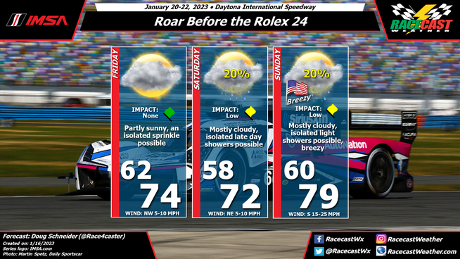
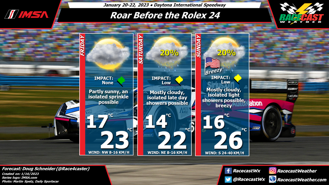
Overall, it looks like the weather will not be a significant factor during the Roar, but there could be some pesky light showers in the area, mainly on Saturday afternoon and on Sunday. A cold front is expected to pass through Daytona on Friday morning. It should be a dry frontal passage, as moisture will be very limited. However, a brief sprinkle can't be ruled out entirely, but the chance of one is very low. Behind the front, winds will shift to the northwest, but temperatures will remain pleasant, with highs in the mid 70s. On Saturday, the front is expected to stall south of Daytona, then lift back to the north Saturday night. The exact position of this front, and how quickly it lifts northward, will determine the rain chances for Saturday. This makes the forecast rather uncertain, but at this time, I expect that the late afternoon hours will have a slight chance of showers. Any showers should be light, with low impacts. On Sunday, the front will be north of the area, and a warm southerly flow will develop. This will warm temperatures up into the upper 70s, and south winds will be breezy and gusty. Gusts up to 30 mph will be possible. Like Saturday, the chance of rain will depend on the position of the front. Some models keep it near the FL/GA border, and have higher rain chances in Daytona, while others push it much farther north and have no rain in Daytona. For now, I will have a just slight chance of showers in the forecast. If shower occur, they should be light with little impact. I expect gusty winds will be the bigger impact on Sunday. |
Social Feeds
Authors
Doug Schneider Partners
Categories
All
Archives
December 2023
|

