|
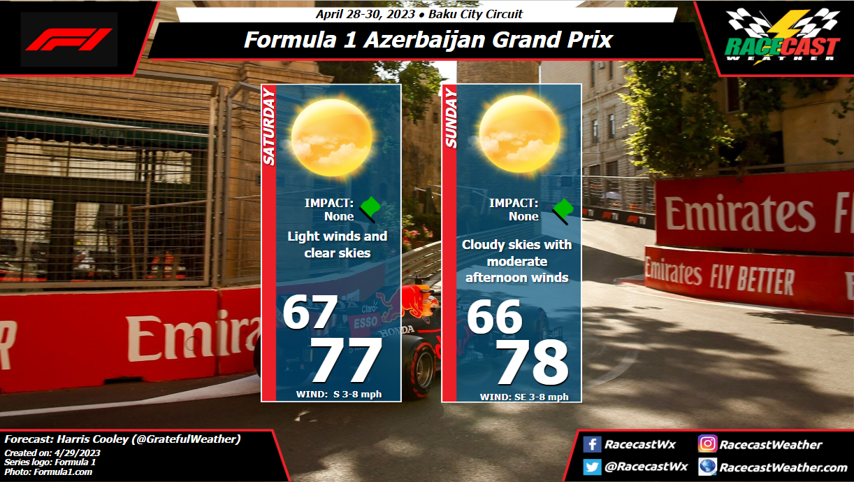
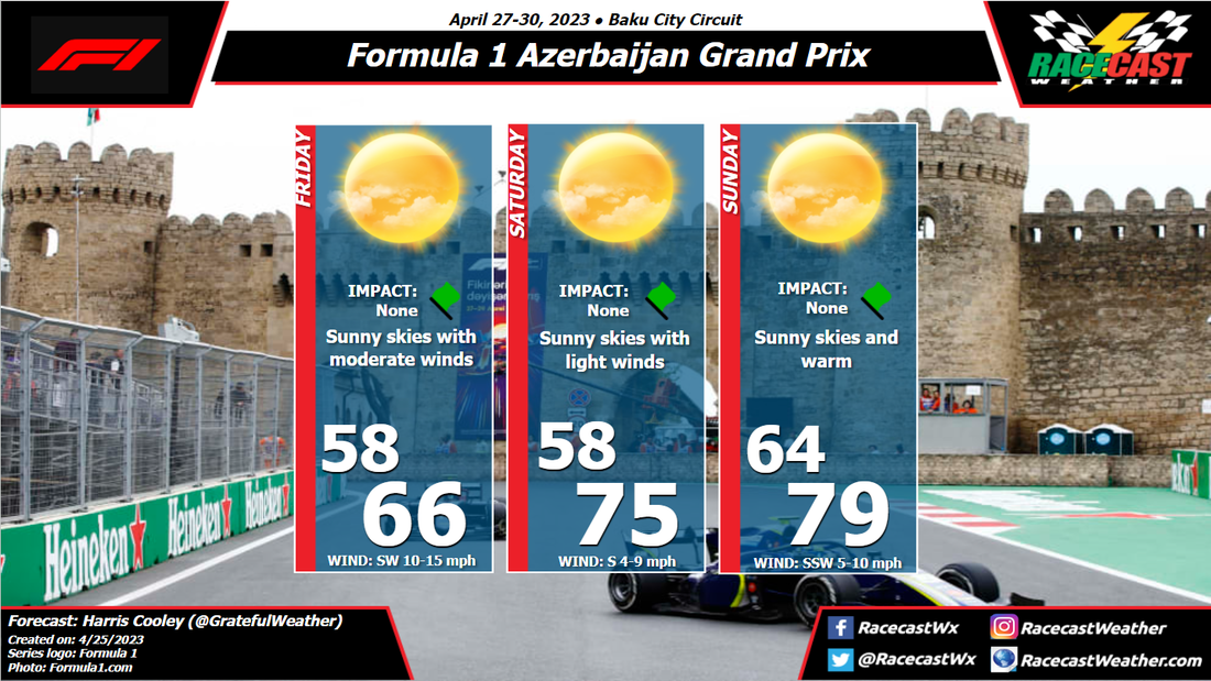
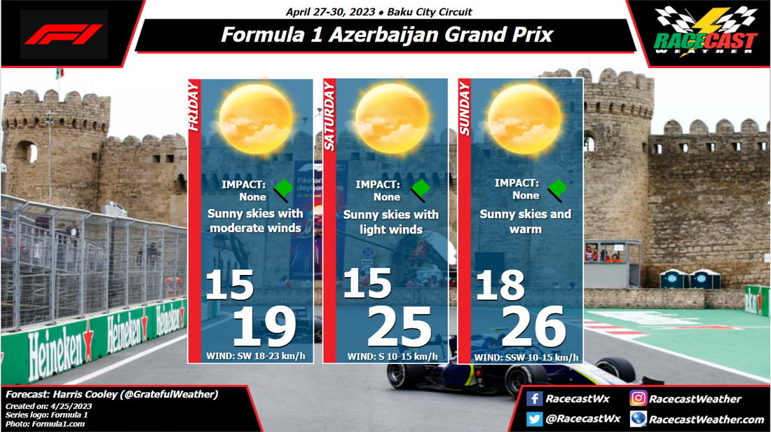
By: Harris Cooley There is not much change in this forecast from the initial forecast with clear skies and warm temps being present through race day. Winds will stay calm through the race as well as the pressure gradient remains loose prior to this frontal passage after the race. Clear skies will likely allow for track temps to heat up throughout the day leading up to the race. This will require some attention from the teams as grip is a major factor at this track. Prime racing conditions either way though, so we should be in for a good weekend.
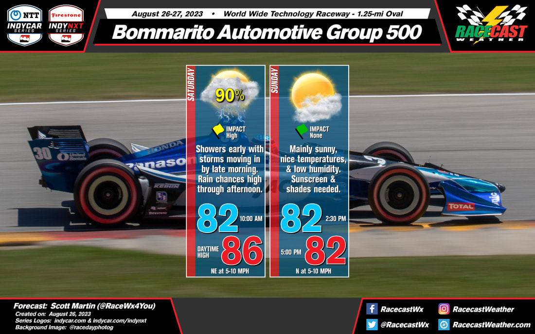
By Scott Martin. The good news... Much of Saturday will be dry, but clouds will be on the increase. The bad news... Rain and storms become possible by late afternoon, and becoming likely through the rest of the evening. A shower or two will be possible early on Sunday morning, while dry & clearing skies during the afternoon.
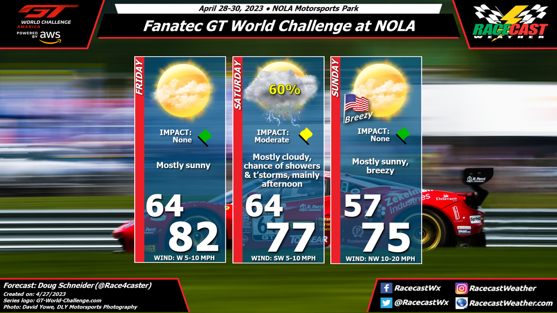
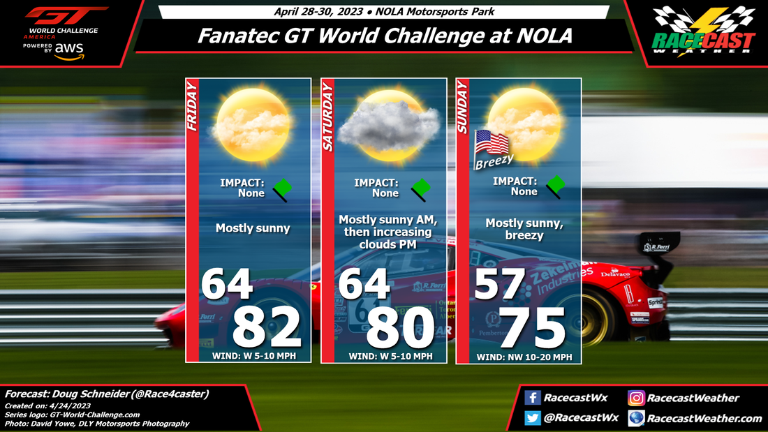
By Doug Schneider The timing of a cold front has shifted with the latest forecast update, bringing a good chance of showers and thunderstorms during the day on Saturday. In my previous forecast, I mentioned that the timing of the front and associated showers looked to be Saturday night, but the models are now showing an earlier timing. So there could be some impacts on the racing on Saturday, mainly during the afternoon. Lightning will be the main threat, but there could some some heavy downpours for a brief period.
Sunday still looks like a beautiful day for racing, with mostly sunny and breezy conditions and comfortable temperatures. By: Harris Cooley Clear skies and cool temps start the race weekend as a high pressure sits in the Caspian Sea. Moderate to gusty winds will be present Friday afternoon because of this, though Saturday's winds drop down to calm bringing an uptick in temperatures. Sunday will mimic Saturday to start, though lower pressures set in which could bring some moisture to the area earlier than expected.
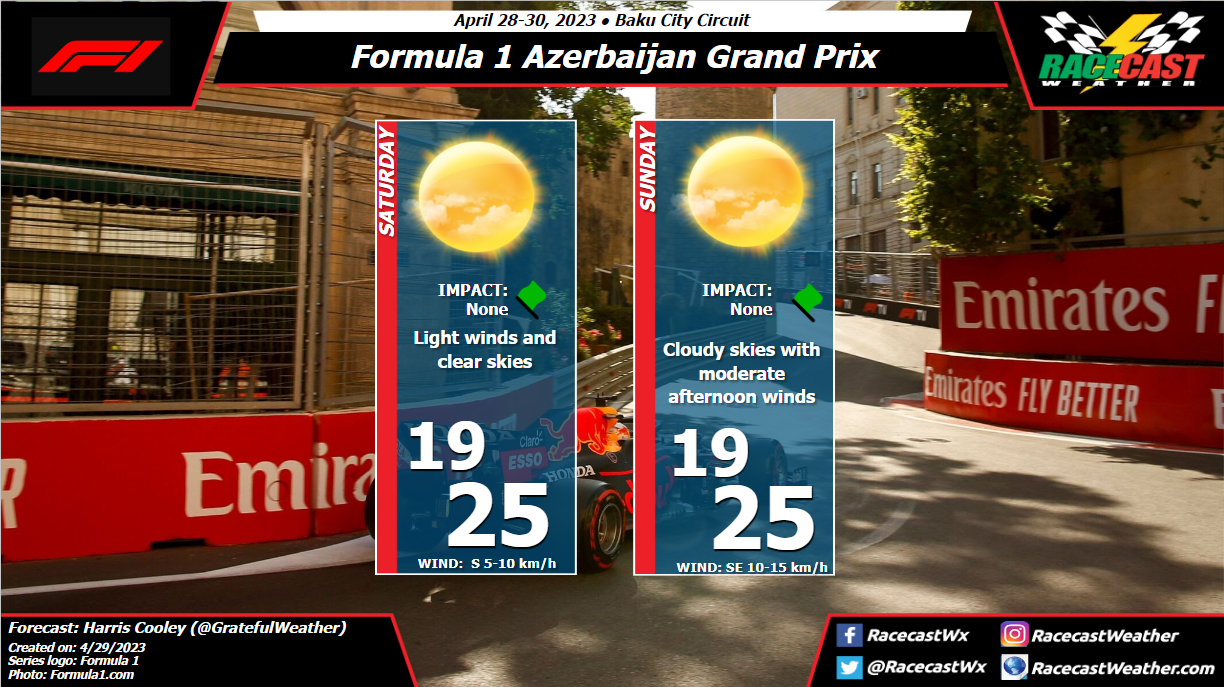
A better look at the impacts of this system will come in the next update, but the chances are low for Sunday. Conditions should be prime for some fun racing throughout the weekend. A metric graphic is posted below... By Scott Martin Race weekend falls into a slightly unsettled weather pattern for Central Alabama. There will be plenty of moisture available, but with the cool to mild temperatures, rain coverage on each day will be isolated, which will keep chances small. Friday, for now, looks to have the higher rain chances for the whole weekend as there will be a storm system exiting the area on late Thursday to early Friday. Some leftover showers will be what we may have to deal with. A trough is expected to send a disturbance into the northern portions of Alabama on Saturday that will keep a small chance of showers and maybe a thunderstorm in the forecast, but that should be out of the area by Sunday afternoon. Only keeping a very small shower chance in the forecast in case that system hangs around a little longer. The forecast will be refined through the week.
By Doug Schneider The weather looks good for Round 2 of the GT World Challenge America season at NOLA Motorsports Park. Friday will be mostly sunny and warm as teams hit the track. On Saturday, expect mostly sunny skies to star the day, with cloud increasing through the afternoon. A cold front will be approaching the area, and is expected to pass through the area Saturday night. There is a small chance of showers with the front, but at this time, it looks like a very small chance that would occur overnight, with no impacts to the action. Behind the front on Sunday, it will be cooler and breezy, with a northwest wind between 10 and 20 mph, gusting between 25 and 30 mph at times.
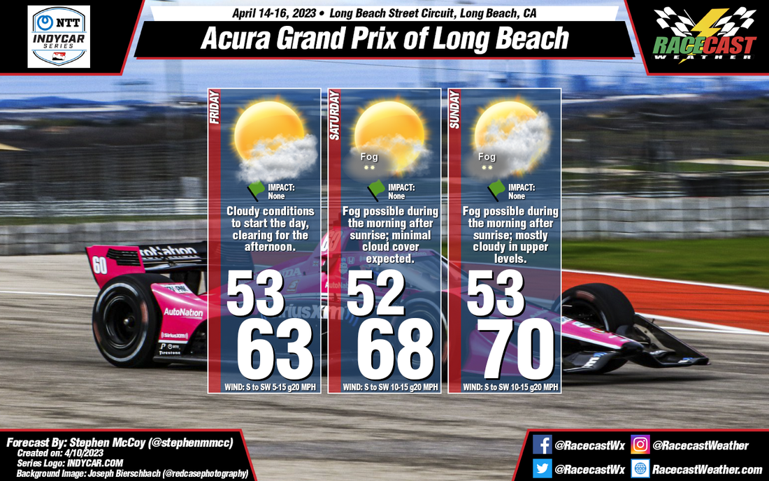
By: Stephen McCoy There will be some slightly below-average temperatures for this weekend at Long Beach, however the remaining conditions are to be expected for this time of year in SoCal. We'll see a typical sand-sea interaction each day where winds will move off the land over the Pacific overnight and through the morning before reversing, with afternoon conditions consisting of winds coming onshore. As a result of this interaction, there is a possibility for patchy to widespread fog in the morning after sunrise, but should clear fairly quickly by the late morning and should not last into the afternoon. Skies are expected to start the weekend partly to mostly cloudy in the lower levels of the atmosphere, but should clear out Friday afternoon. Clearer conditions will persist through Saturday, before upper level cloud cover moves in for Sunday.
|
Social Feeds
Authors
Doug Schneider Partners
Categories
All
Archives
December 2023
|

