There are indications that a low pressure system could develop off the Atlantic coast and move into North Carolina Sunday night and Monday. I am skeptical of this system even developing as models tend to do poorly with tropical low pressure development this far out in time, and even if it does develop, it may arrive after the racing is over. But it is something I will be keeping an eye on over the next few days. Stay tuned to my Twitter feed @Race4caster for updates through the week.
|
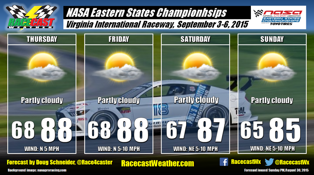
By Doug Schneider Virginia International Raceway hosts the NASA Eastern States Championships this coming weekend. The general weather pattern over the eastern states will feature high pressure over the Ohio Valley region on Thursday that will drift east to the Mid-Atlantic coast by Sunday. This high pressure ridge will likely have a stabilizing effect on the atmosphere, and so I am not mentioning a chance of rain in the forecast at this time. While afternoon showers could pop up, I think the chances of one at the track are too low to mention a chance of rain. The main weather concern will likely be the heat and humidity. It will be warm each day, with highs in the upper 80s, and it will feel humid, with afternoon dewpoints in the mid to upper 60s.
There are indications that a low pressure system could develop off the Atlantic coast and move into North Carolina Sunday night and Monday. I am skeptical of this system even developing as models tend to do poorly with tropical low pressure development this far out in time, and even if it does develop, it may arrive after the racing is over. But it is something I will be keeping an eye on over the next few days. Stay tuned to my Twitter feed @Race4caster for updates through the week. By Doug Schneider A cold front is moving across northern California early this morning, and all the rain associated with it is passing well to the north of the SF Bay area. So while Sonoma Raceway will see quite a bit of cloud cover this morning, no rain is expected. The clouds should start to break up in the late morning hours, between 9 am and noon. Mostly sunny skies should prevail through the afternoon. Temperatures will be cooler, with highs in the upper 70s. It may be breezy at times as well, with winds approaching 15 mph and gusting to 20 mph.
Behind the front, a westerly flow will transport moisture off the Pacific Ocean, and this will cause low clouds to develop tonight, and linger into Sunday morning. Again, these clouds will dissipate in the late morning, and leave sunny skies for Sunday afternoon, with highs in the upper 70s. The IndyCar championship festivities will have nice weather on Monday as well, with mostly sunny skies and highs in the upper 70s. By Scott Martin FRIDAY
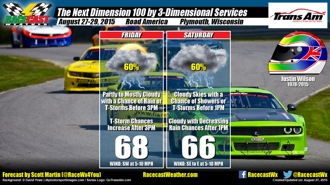
A strong mid-level shortwave trough will move across the area ahead of a low pressure center, with strong upper divergence moving across at the same time. Looking at the latest run of the NAM 4k model, it is actually keeping any organized rain away until after 3-5PM timeframe. There is a chance of some shower or thunderstorm development before that time. I’m going with partly to mostly cloudy skies with a chance of showers and thunderstorms before 3PM, with rain chances increasing afterwords. Highs will reach the upper 60 to close to 70. Winds will be out of the southwest at 5-10 MPH. Chance of rain is 60%. Expect rainfall amounts up to 1/4 inch, even more possible in thunderstorms. SATURDAY The shortwave trough will linger around the area and will get reinforced by a vort max from Canada on Friday night. A low level jet will join in the action and allow warm air advection to move in. Hopefully by Saturday morning, most of the energy from all of this will have moved out of the area. Unfortunately it looks like cloudy skies and a chance of rain will persist thought the day. Some thunder could be possible before 1PM. Highs will reach the middle to upper 60s. Winds will be out of the southeast at 5-10 MPH, becoming out of the east in the afternoon. Chance of rain is 60%. Expect rainfall amounts up to 1/4 inch, even more possible in thunderstorms. Radar is up and running on our website at www.RacecastWeather.com. I’ll have updates on my Twitter feed @RaceWx4You. Let’s hope I am way wrong with this forecast. I’d rather bust and it be dry, than to be correct and be wet. By Doug Schneider Today will be the warmest day of the race weekend at Sonoma Raceway as team load into the track. Highs are expected to reach into the upper 80s under sunny skies.
A few more clouds will be around the area on Friday as an upper level low pressure trough and surface cold front approach from the west. The rainfall associated with this system is expected to stay north of the track. although I can't entirely rule out some light sprinkles Friday night. If there is any rain, I don't think it will even be enough to measure (less than a hundredth of an inch), so I'm not including a chance of measurable rain in my forecast graphic. Saturday is expected to have mostly cloudy skies as the cold front and upper trough pass through, and temperatures will be cooler, with highs in the upper 70s. Dry weather and pleasant temperatures will continue for Sunday and the IndyCar championship festivities on Monday, with highs both days in the upper 70s. By Scott Martin THURSDAY
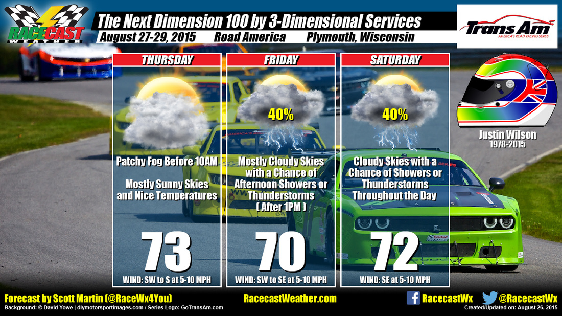
The day will start off with some patchy fog, but should dissipate by 10AM. Some clouds will be in the sky as a shortwave will be exiting the area. Skies are expected to be mostly sunny throughout the day. Highs will reach the lower 70s. Winds will start off light out of the southwest, but will increase to 5-10 MPH by late morning. Chance of rain is 0%. FRIDAY With the approach of a low pressure center from the west, a few shortwaves are expected to move through the area. The shortwaves are expected to move across during the afternoon and evening hours. Morning will probably start off partly cloudy, with clouds building throughout the day. A chance of showers and thunderstorms are possible after 1PM. Highs will reach the lower 70s. Winds will start off out of the southwest at 5-10 MPH, shifting out of the southeast at 5-10 MPH during the afternoon. Chance of rain is 40% SATURDAY As the low pressure moves across the area during the late afternoon hours, rain chances will decrease. Unfortunately, the race will be ran in the morning. Expect cloudy skies with a chance of showers and thunderstorms. Highs will reach the lower 70s. Winds will be out of the southeast at 5-10 MPH. Chance of rain is 40% I will have radar up and running on Thursday and will be up throughout the weekend on our website. I will also have updates on my Twitter feed @RaceWx4You. By Doug Schneider It is difficult to think about the next IndyCar race today after the horrible news of last night. With heavy hearts and prayers for the Wilson family, the series moves on to Sonoma.
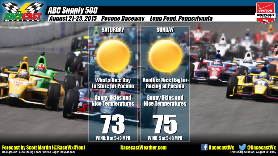
The weather pattern for the second half of this week along the Pacific coastline will feature a high pressure ridge over the desert southwest and Rocky Mountains, with a low pressure trough moving east across the eastern Pacific Ocean. Temperatures will be warm Thursday and Friday ahead of the approaching trough, then cool down a little beginning Saturday as the trough moves through. Any rain associated with the trough is expected to stay well north of the Bay area at this time, and it should only bring some more clouds to Sonoma on Friday and Saturday. Mostly sunny skies return for Sunday, with temperatures remaining pleasantly comfortable in the upper 70s. Nice weather continues into Monday for the IndyCar championship celebrations. For forecast updates, follow our Twitter feeds on the right (@Race4caster and @RacecastWx) and the Racecast Weather Facebook page. By Scott Martin High pressure that is located over the Great Lakes will keep the conditions dry throughout the weekend at Pocono for the Verizon Indycar Series. Considering what my forecast looked like just two days ago, I just don't think it could be any better.
SATURDAY Sunny skies and nice temperatures will dominate the day at Pocono. Highs will reach the lower 70s. Winds will be out of the north at 5-10 MPH. Chance of rain is 0%. SUNDAY Once again, sunny skies and nice temperatures will dominate the day at Pocono. Highs will be a little warmer, as they will reach the middle 70s. Winds will be out of the south at 5-10 MPH. Chance of rain is 0%. By Scott Martin Not much change at all to the forecast, just a slight change to the winds and a small bump up in temperature for Saturday.
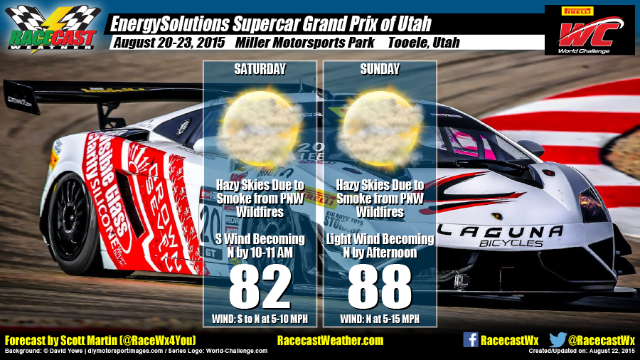
SATURDAY Sunny skies are expected, but haze caused by smoke from the Pacific Northwest wildfires will still be a problem. Temperatures will be cooler, as highs are only expected to reach the lower 80s. Winds will start off from the south, but will shift out of the north at 5-10 MPH by late morning. Chance of rain is 0%. SUNDAY Sunny skies and warmer. Once again, haze from the PNW fires will still be an issue. Highs are expected to reach the upper 80s. Winds will be light to calm in the morning, but will be out of the north at 5-15 MPH. Chance of rain is 0%. |
Social Feeds
Authors
Doug Schneider Partners
Categories
All
Archives
December 2023
|

