|
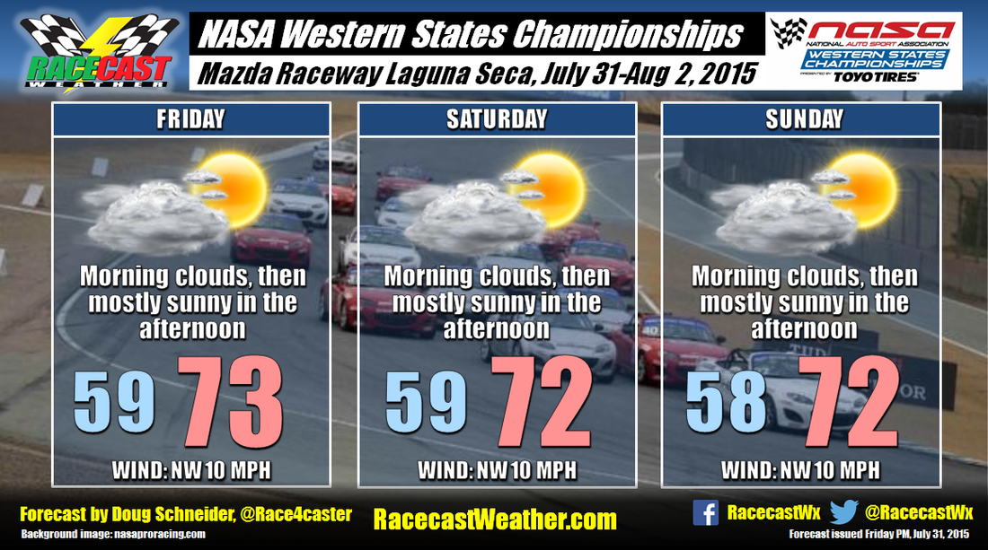
By Doug Schneider There will be very little change to the weather pattern through the weekend across the central California coastal area, so each day of the NASA Western States Championships at Mazda Raceway Laguna Seca should see similar weather to the day before. A west-northwest flow off the ocean will result in low clouds to the area each morning - the combination of the low level moisture from the ocean and cooling temperatures at night cause water vapor to condense into clouds. But as the summer sun rises and causes mixing of the lower levels of the atmosphere, the clouds will dissipate, leaving mostly sunny skies in the afternoon. No rain is expected as the moisture off the ocean will be confined to a very shallow layer. Temperatures will be really nice throughout the event, with highs each day in the lower 70s.
By Scott Martin You almost couldn't ask for a better forecast for this weekend's racing action at Mid-Ohio. Thursday and Friday are going to be absolutely brilliant. Sunny skies and warm with a little breeze to make it even more comfortable. Highs will top out in the lower 80s with winds out of the west at 5-15 MPH. Chance of rain is 0% for both days.
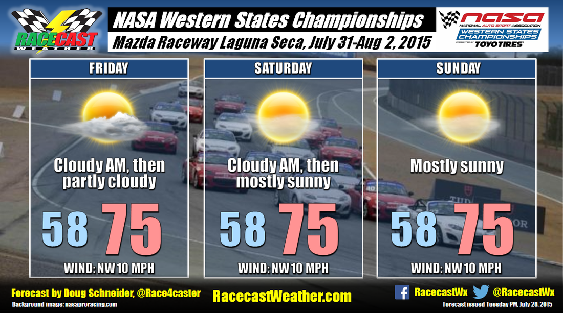
Rain may creep into the forecast for later in the evening on Friday and last throughout the early afternoon on Saturday, as a weak surface trough and a small shortwave cross the area. Saturday's forecast will be partly cloudy with a slight chance of an isolated shower or thunderstorm until 1PM, then mostly sunny afterwords. Highs will reach the lower 80s with winds out of the west at 10-15 MPH. Chance of rain is 20%. Sunday will be a repeat of Thursday and Friday. Mostly sunny skies and warm with a gentle breeze. Highs will top out in the lower 80s with winds out of the west at 5-10 MPH. Chance of rain is 20%. By Doug Schneider There's not too much change to the forecast with today's update for the NASA Western States Championships. It does look like there will be some moisture that will spread northward toward the Monterey Peninsula, and this will bring some clouds on Friday and early Saturday morning. Some models are hinting at some light rain on Friday with this moisture, but I really doubt that it will be enough to squeeze out any measurable precipitation. I'm sticking with a dry forecast. Clouds may linger into Saturday morning, but most of the day should be sunny. Sunday will see plenty of sunshine as well, and temperatures each day will top out the mid 70s.
By Scott Martin Not a very difficult forecast for this weekend's events at the Mid-Ohio Sports Car Course featuring the Indycar Series, Pirelli World Challenge, Indy Lights, Pro Mazda, USF2000 series. Mostly sunny to sunny skies will rule the weekend, with only a small chance of an isolated shower or thunderstorm on Sunday. Highs throughout the time frame will be in the lower to middle 80s. Heat index will not be a factor as humidity levels will remain low for this time of the year, as the numbers will closely match the temperatures. Only thing you may have to worry about is sunscreen. With almost maximum sunshine each day, please sunscreen up. Have fun this weekend at Mid-Ohio.
I'm in the middle of moving this week, so my forecast may be short and to the point. I'll have radar up later this week as well. By Doug Schneider I have to make a confession - I really dislike forecasting for California. Part of the enjoyment of meteorology is to analyze the weather pattern and try to figure out the most likely scenario that will occur. In California, that scenario is almost always dry and sunny. I should probably be grateful that I have a high probability of making an accurate forecast, but honestly, it's boring. But at least it's great weather for racing!
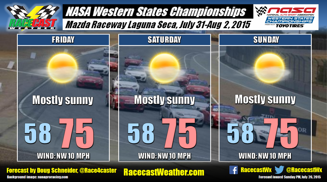
A big ol' high pressure ridge will be over the western United States next weekend, which will provide nice weather for the NASA Western States Championships. The pattern remains the same for several days in a row, so I don't see much change happening from one day to the next. Every day will be mostly sunny with highs in the mid 70s. At Laguna Seca, there's always some potential for morning fog. It's too early to make a call on that, but I'll keep an eye on it as we approach the weekend, and update the forecast as needed. By Doug Schneider With this morning's forecast update, I had to add a mention of isolated showers for this afternoon. The chance of rain in the area is creeping up a little higher based on the latest data I'm seeing. That does not mean that it's going to be a wet day by any means - the chance of one of these showers hitting the track is only about 20%, which means that there's an 80% chance that there won't be any showers. If there is a shower, it will be light, with only a trace to a few hundredths of an inch expected, and it won't last for long, maybe 10 to 20 minutes. The timing window for the showers looks to be between 4 pm and 7 pm.
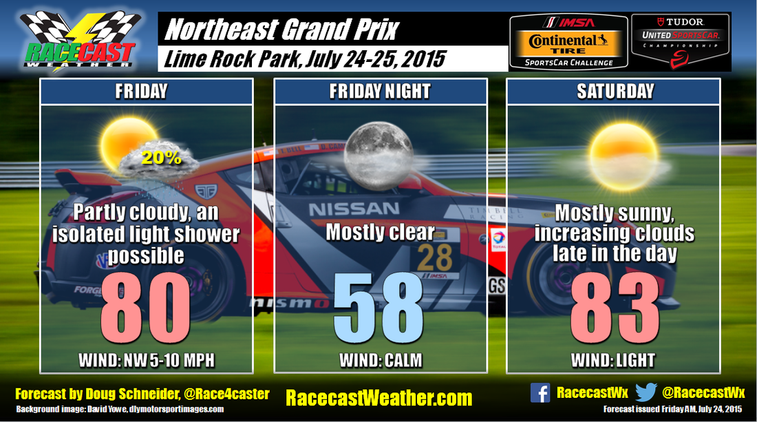
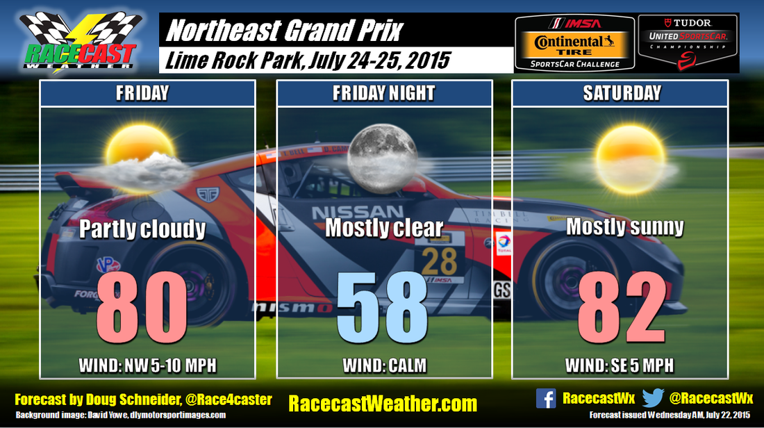
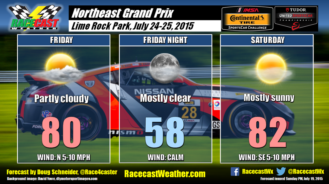
Saturday still looks like a nice day, but clouds will be increasing through the afternoon. The approaching system is trending a little faster, but it still looks like any rain with it will hold off until Saturday night and Sunday. By Doug Schneider No changes were needed to the forecast today as the weather still looks good for the Northeast Grand Prix at Lime Rock Park.
I do have to mention one caveat to Friday's forecast - there are some indications that there could be a few showers around the area in the afternoon. In my last post, I mentioned an upper level low pressure system that will be northeast of New England, near Nova Scotia and the Gulf of St. Lawrence, that would bring a mix of sun and clouds on Friday. Some models develop enough instability under this low to squeeze out some light rain across Connecticut. However, I'm not biting on this in my forecast as I think the showers will stay to the east, and the chances of rain at the track are too small to make it worth a mention. From what I see, the indications are stronger that the day will be dry, so I'm sticking with my original dry forecast. But I'd put the chance of seeing a shower on Friday around 10%. Saturday still looks great as high pressure builds in, with mostly sunny skies and highs in the lower 80s. A chance of showers and thunderstorms is expected to hold off until Sunday when a cold front will approach the area. By Doug Schneider The initial weather prognosis for the Northeast Grand Prix at Lime Rock Park looks good. A low pressure system will be located near the Gulf of St. Lawrence on Friday, and the counter-clockwise flow around the low will bring a northerly flow to New England, and keep any rainfall well to the south and east. This should result in comfortable temperatures and a few afternoon clouds at Lime Rock on Friday. This low pressure area continues to track east on Saturday, and high pressure will extend over New England through the day. Temperatures will be a little warmer as a southeast flow develops and fewer clouds are expected. There is some potential for light rain on Sunday. I'll keep an eye on the trends over the next few days to see if this system speeds up, but I'm confident right now that this won't be an issue for the racing on Saturday.
|
Social Feeds
Authors
Doug Schneider Partners
Categories
All
Archives
December 2023
|

