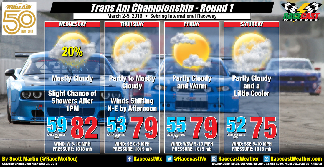
Models, as of now, are only showing a very slight risk for a passing shower on Wednesday. There will be a frontal boundary passing through the area, but the main areas of moisture seem to be contained north of the track. A jog to the south of a few miles in the coming days could mean showers for the track, so that is why I am putting a slight risk for a passing shower on Wednesday. This frontal boundary will allow for humidity levels to back off some and actually allow the high temperatures to be cooler for Thursday and Friday. Another boundary will make its way through the area sometime on Friday bringing in a reinforcement of dry air and cooler temperatures for Saturday.
I'll have updates on the website and the usual social network feeds (links located on the right of this page). I will also have radar up and running if needed. I'm so excited for this season to start. Have a great day and lets get racing!


