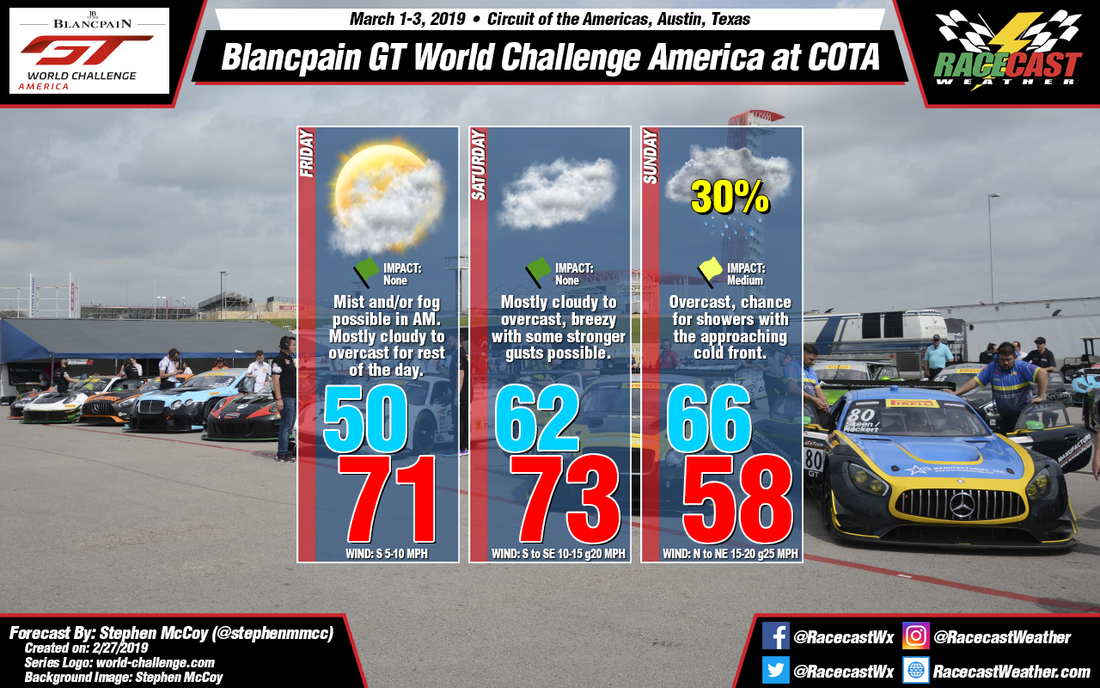
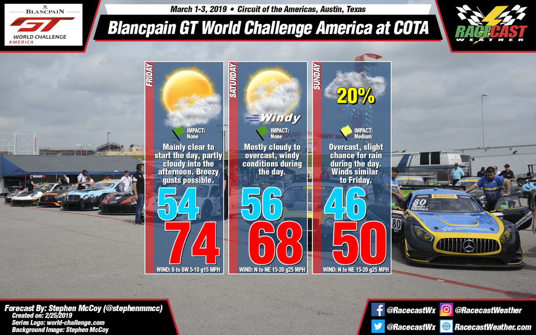
Saturday's conditions will be similar to Friday's as winds continue from the south to southeast, though they are expected to increase as the cold front approaches the region; a chance of fog is possible again for Saturday morning.
The timing of the cold front passage is still being disputed among the models, though the model average points more towards overnight Saturday or Sunday morning; a chance for scattered showers exists ahead of the front. Once the front passes, precipitation chances will decrease but temperatures will also decrease due to strong northerly winds transporting cooler air to the region, which is why the afternoon temperature is colder than the morning temperature. However, timing is again important as a later frontal passage will allow temperatures to increase during the day before dropping behind the front. The models are showing both scenarios, with a 30+ °F spread for the high temperature on Sunday. Regardless of timing, conditions will likely be overcast ahead of the front before clearing as it passes through the region.


