|
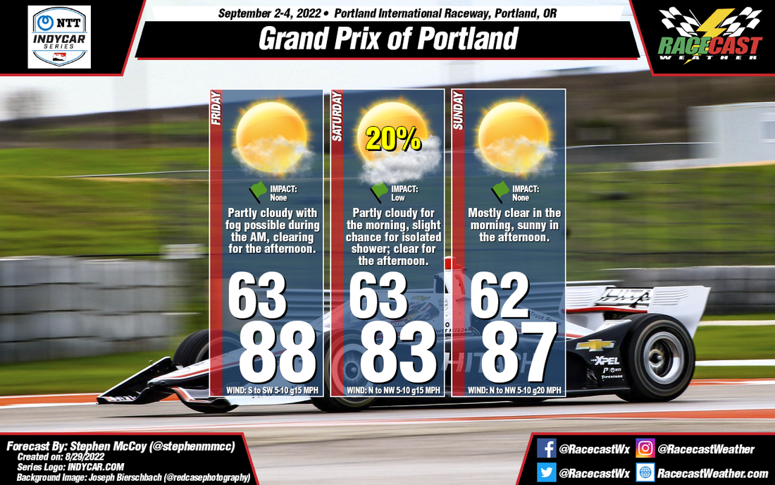
By: Stephen McCoy The weather pattern for this week over Portland is expected to be fairly stable, but with the possibility of a cold front approaching the region on Saturday. Dry conditions and minimal cloud cover will be present as a result. Some light fog may be possible during the early mornings, but will quickly clear as temperatures increase from morning lows in the 60's to highs in the 80s; temperatures may be slightly cooler on Saturday depending on the location of the front. The front may also bring a slight chance for isolated showers to the region Saturday morning, but will cause little to no impact to the track. Relatively light winds are expected throughout the weekend, shifting from the South/Southwest on Friday to the North/Northwest for Saturday and Sunday.
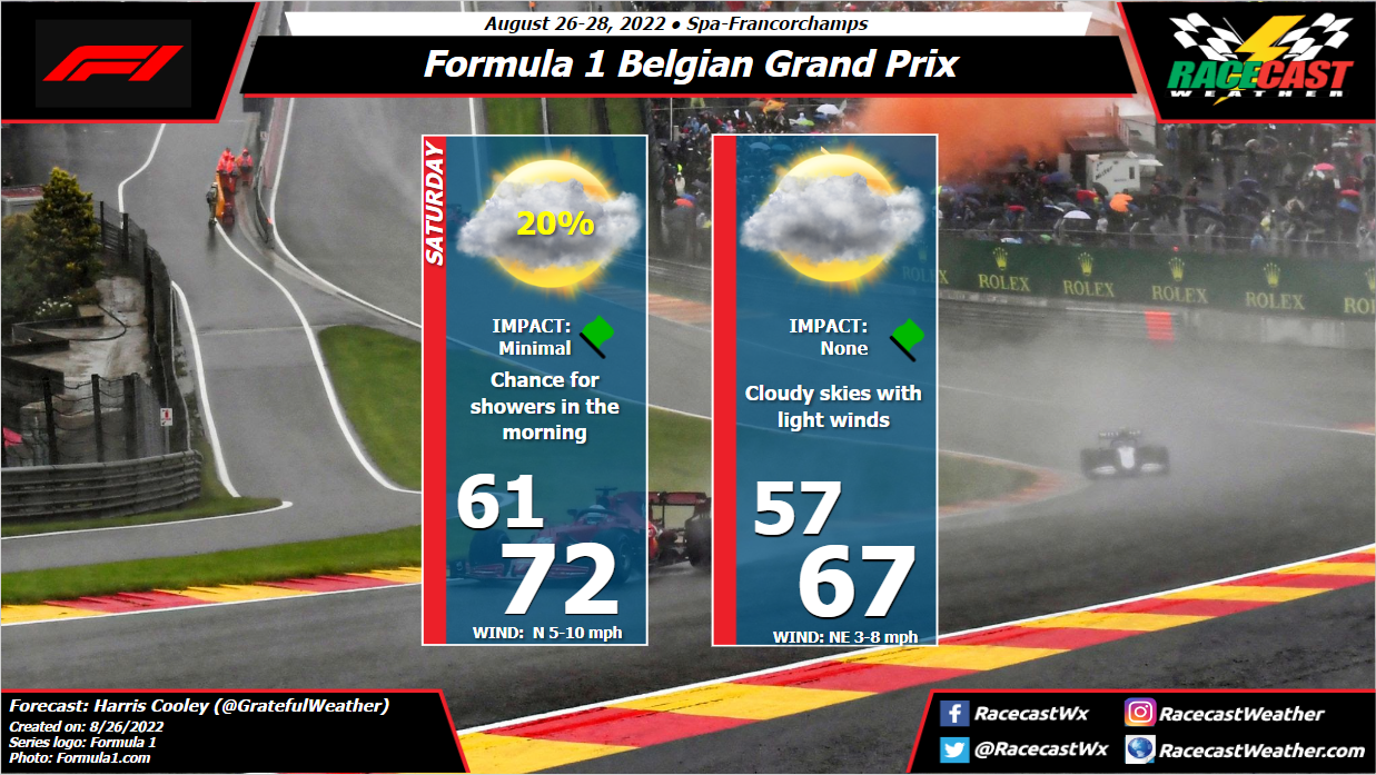
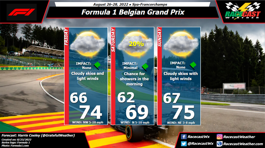
By: Harris Cooley Not much has changed for this forecast update. Cloudy skies will likely be the trend for this weekend as lower pressures lay over the area keeping wind speed low as well. Chances for light showers in the area still remains present, however the rain will be scattered and sporadic so radar surveillance will be imperative.
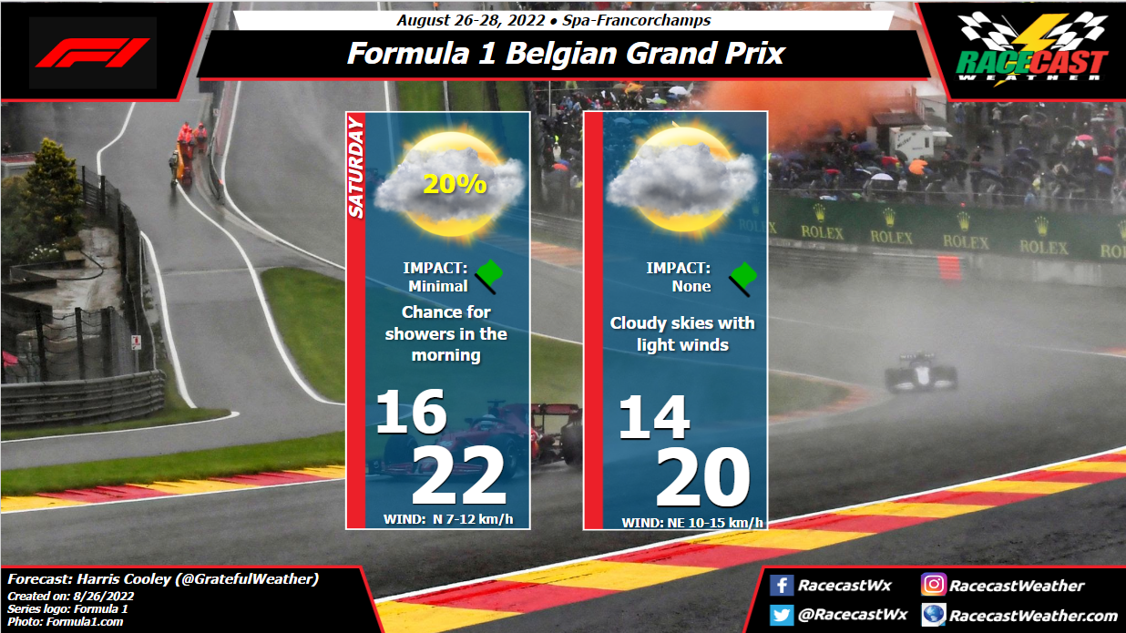
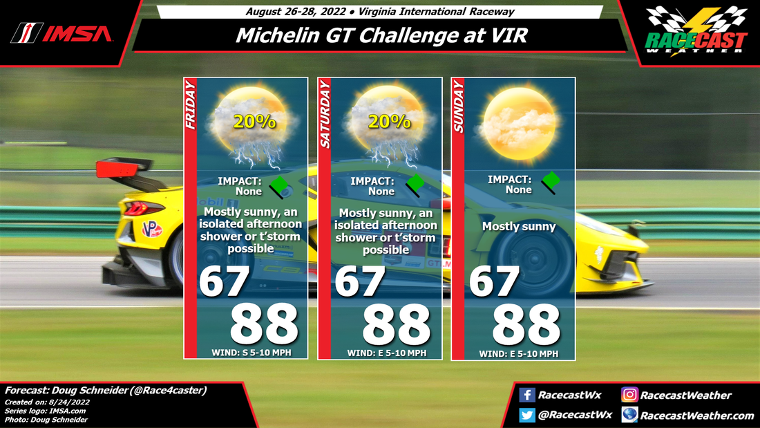
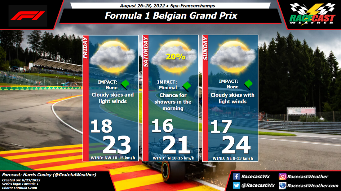
It will be a usual day at Spa in terms of weather which will be sure to provide an exciting race. Strategy and poise from both the drivers and teams is going to make the difference in this one. A metric graphic is posted below... By Doug Schneider Since my initial forecast I posted on Monday for IMSA weekend at VIR, the chance of rain has trended downward. I'm more confident today that there will be only a small chance of seeing rain Friday and Saturday afternoons. The vast majority of the event will be dry and mostly sunny, good news for those of us who will be in attendance.
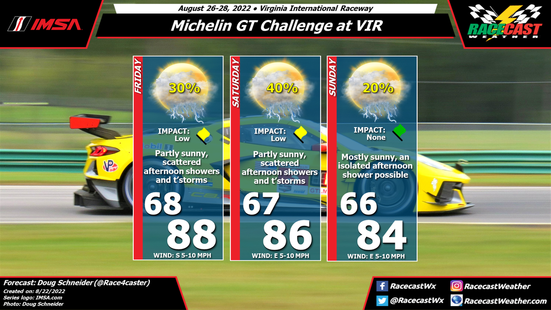
A weak cold front will be approaching the Appalachians from the west on Friday, and most of the shower activity on Friday should be near the mountains and foothills. The movement of these showers will be from west to east, so there is a small chance that one could reach VIR late in the day, if it can hold together long enough as it moves east off the mountains. The weak front will be east of the mountains on Saturday, but it appears to be so weak that there will be very little impact from it on the weather. The shower activity on Saturday afternoon will be across the Piedmont, but it may be mainly to the east of VIR. With the front being positioned somewhere in the Piedmont region, I think a shower or thunderstorm will be possible on Saturday, but it's just a small chance, and most of the day will be dry. On Sunday, a high pressure ridge over the Atlantic starts to build over the Carolinas, which should suppress afternoon shower development. I've taken out the mention of showers and storms from Sunday's forecast, because I think the chance of one is too low to warrant a mention. Temperatures will be near normal throughout the weekend, with light winds. I'm looking forward to spending the weekend at my favorite track. By: Harris Cooley It will likely be a cloudy and dreary weekend at Spa for the return from Summer Break. Lower pressures with a relaxed gradient will bring cloudy weather and calm winds to the area for the weekend. The highest chances for rain come early Saturday morning, though the chances are low. There will be light rain showers in the area through the weekend, so showers Friday or Sunday are not out of the picture.
This will likely cause some strategy head aches for the teams' first race back as these storms will be sporadic and short-lived. The other conditions appear to be cooperating, so these rain chances are the main focal point of preparation. I will update you all with any changing conditions. A metric graphic is posted below... By Doug Schneider Overall, the forecast for IMSA weekend at VIR is a pretty typical summer-time pattern for the area, with high temperatures in the mid tp upper 80s and a chance of afternoon showers and thunderstorms each day. But there are some finer details that may raise or lower rain chances each day, depending on how the pattern plays out.
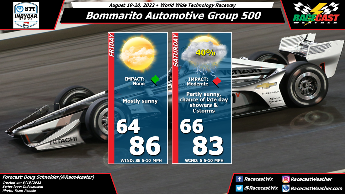
On Friday, a warm southerly flow will set up across North Carolina and southern Virginia, while a cold front located to the northwest will be approaching. With afternoon hearting, scattered showers and thunderstorms are possible in the area around VIR. The chance of showers and thunderstorms appears to rise a little on Saturday as the cold front gets closer to VIR. Exactly where the front will be located will affect the chance of rain, which adds to the uncertainty of the forecast. But it does look like Saturday has the best chance of seeing wet conditions at some time in the afternoon. Sunday will depend on whether the front can push through the area, or stalls nearby. If it stalls, the chance of rain will be higher. If it pushes through, it will likely be a dry and cooler day. With this uncertainty, I have to have at least a small chance of afternoon showers and thunderstorms for now, but this could change as we get closer to the weekend. By Doug Schneider Confidence is increasing that there will be some showers and thunderstorms to contend with for Saturday evening's Bommarito 500 at World Wide Technology Raceway.
Friday looks nice - not much else to say about that. But during the day on Friday, a low pressure system will be dropping into the upper Midwest region. As that system tracks south and east through Saturday, it will bring showers and thunderstorms to the St. Louis area late in the day and the evening. As of today, I expect that the most likely time for these showers to arrive at WWTR is between 6 pm and 9 pm local time - during the race. An earlier or later arrival time, give or take a couple hours, is certainly possible, and keep in mind that a lot can change between now and Saturday. But that is my best estimate based on today's data. Hopefully the chance of rain will hold off long enough until the race is over. I'll have another update posted before the race to give a more exact timing estimate, and I'll be watching the radar and posting live updates on Twitter (@RacecastWx) during the race on Saturday. By Doug Schneider A high pressure system will be over the Great Lakes region on Thursday and Friday, which should provide nice weather those days. However, an upper level trough will move into the northern Great Plains on Saturday. A southerly flow on the west side of the high pressure system will supply increasing moisture into the St. Louis area ahead of this trough. Showers and thunderstorms are expected to develop over Iowa and northern Missouri on Saturday afternoon, and track toward the southeast. There is a chance that they could arrive at WWTR during the race. Exact timing is still uncertain this far out, but I would put the chance of a shower or storm during the race at 40%. Check back for updates later in the week as the timing becomes more clear.
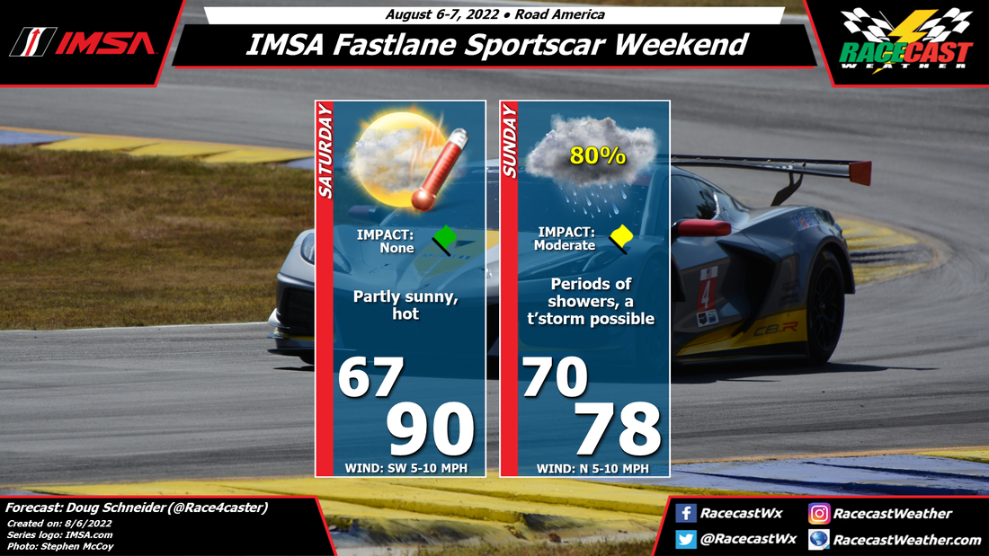
By Doug Schneider Today at Road America, temperatures will be rather hot, with an afternoon high expected to reach near 90 degrees. It will fell humid as well, which will put the heat index around 95.
My confidence is increasing that rain will occur on Sunday, but the impacts on the racing will depend on the timing, which is less certain. I expect two main rounds of showers - one will move through this evening, between 8 pm and midnight, then another round on Sunday morning. This will likely impact the Porsche Carrera Cup and the WeatherTech Championship warm-up sessions. If the showers persist long enough, it could affect the start of the WeatherTech race, which begins at 10:40 AM local time. This round of rain is expected to produce about a quarter of an inch of rain, and it may come down heavy enough to cause some delays or stoppages. Additional showers will continue to be a threat through the rest of the day. But these showers may be more on/off and scattered in coverage, so I expect the potential impacts during the second half of the WeatherTech Championship race and the Lamborghini Super Trofeo race will be lower than in the morning. |
Social Feeds
Authors
Doug Schneider Partners
Categories
All
Archives
December 2023
|

