
By Doug Schneider
The Rolex 24 is just two weeks away, which is within range of the extended weather models. A lot can change in the forecast over two weeks, so I'm not going to make a detailed forecast this far out. But I'm getting excited about the start of the racing season, so I thought I'd share what I'm seeing in the weather pattern for the race weekend (I did a Twitter thread on this topic this morning on our @RacecastWx account).
Here are a couple images that summarize the pattern for the Rolex 24 weekend. These images are taken from the GFS model, valid Friday 1/26. They are temperature and moisture (precipitable water) anomalies, which means how much the model is expecting temperatures and moisture content to depart from normal. Normal temperatures at Daytona for Rolex 24 weekend are a high of 69 and a low of 48.
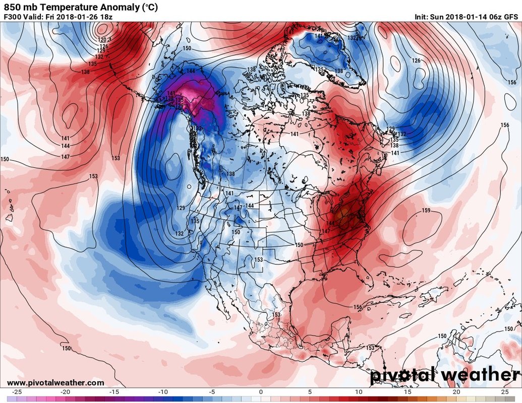
Image: 850 mb temperature anomaly of the GFS model for 1/26. Contours: 850 mb heights.
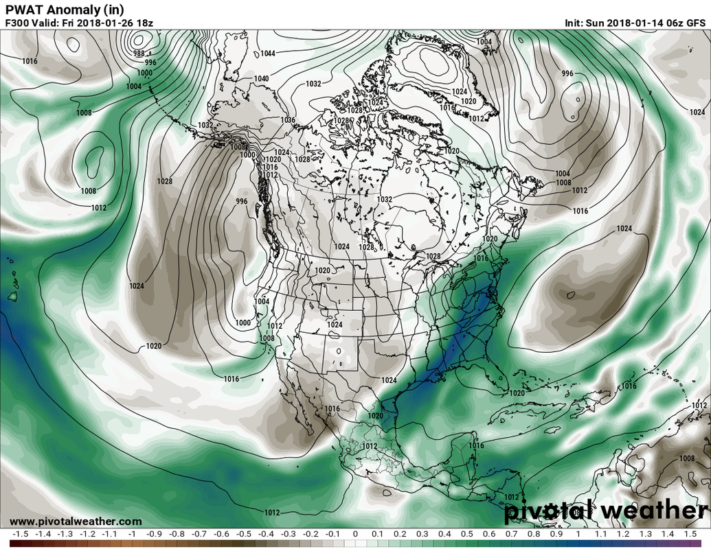
Image: precipitable water anomaly from the GFS model for 1/26. Contours: surface pressure
There is a high pressure ridge located off the east coast that provides a southerly flow across the eastern portions of the U.S., with a low pressure system tracking across the Ohio Valley region and a trailing front down to the Gulf Coast. Because of that pattern, this model is predicting above normal temperatures across Florida (in the range of 3-6 degrees above normal), and slightly above normal moisture content.
If this general pattern holds true, I am pretty confident that temperatures will be warmer than normal for the Rolex 24. I am less confident about the chances of rain. Just because the moisture is above normal does not necessarily equal rain, as there are other factors in play that are too uncertain this far out.
Check back here the week before the race for the detailed forecast, and be sure to follow @RacecastWx on Twitter, as it will be our main social media feed for all of our posts (and more) this year.


