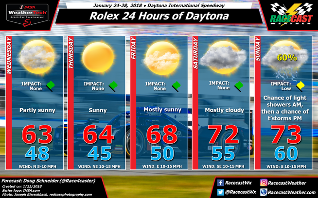
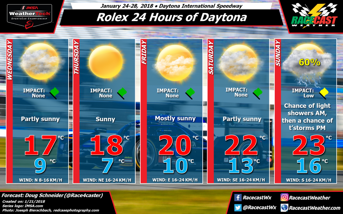
A cold front will be passing through Daytona on Tuesday, which will bring a chance of showers as teams start to load into the track and setup in the paddock area. By the time on-track activity begins on Wednesday, this rain will be gone but temperatures will be cooler as high pressure builds in, with highs in the 60s and lows in the 40s.
The high pressure system will be moving across the Southeast states through Thursday, then move off the coast on Friday. As this happens, winds will shift from a northerly direction to an easterly direction on Friday, then southeasterly on Saturday. The result of this will be a warming trend each day, but also increasing clouds each day as moisture starts to increase.
On Saturday, a low pressure system will be moving across the central United States, with a trailing cold front moving across the Gulf Coast region. The front will move across the Florida Panhandle on Saturday night, then into the Florida Peninsula on Sunday. There is good agreement between the models that showers and some thunderstorms will occur ahead of the cold front, but there are some differences in their timing. And for the race, timing is everything. On the bright side, and nice southerly wind will provide comfortable temperatures in the 70s on Saturday and Sunday, so there won't be a cold rain like last year.
We are still too far away from Sunday to pin down the timing with any certainty, but I think the most likely scenario right now is that there may be some light rain showers Saturday night and Sunday morning, with an increasing chance of rain through the day. In the afternoon, there may be some heavier showers with some thunderstorms possible. The end of the race is at 2:40 pm EST, and I cannot say with any confidence whether the heavier rain will come before or after the end of the race. We'll just have to wait and see how things develop through the week before I can give more detail on the timing.
Stay tuned to our social media feeds on the right to keep up with the latest forecast updates.


