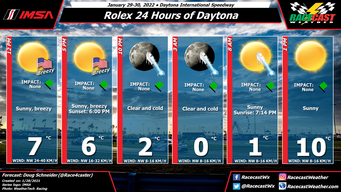
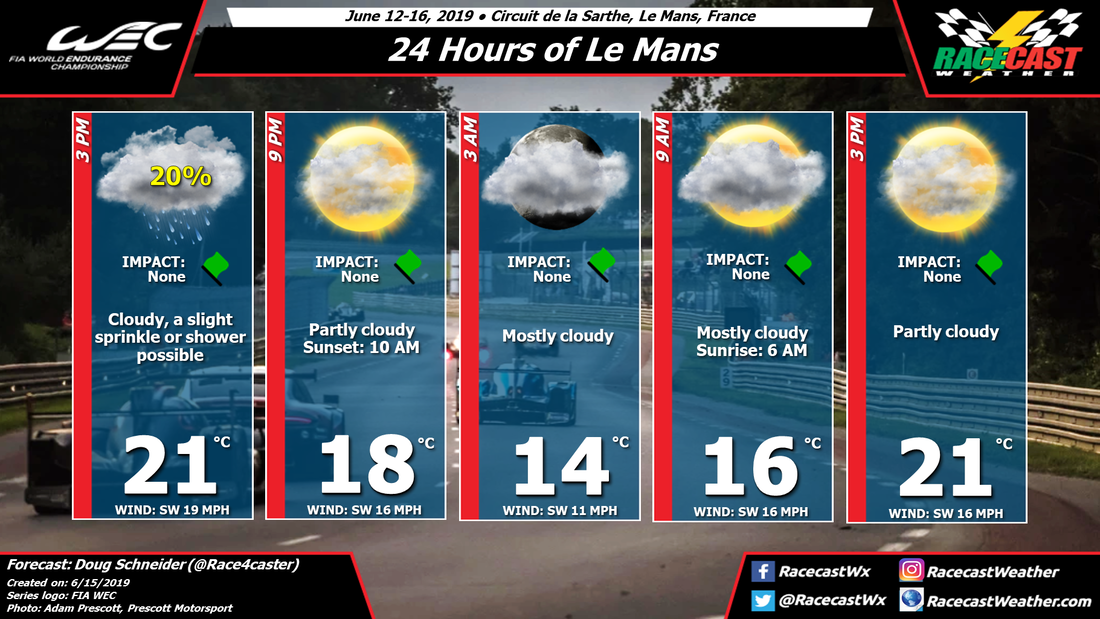
By Doug Schneider
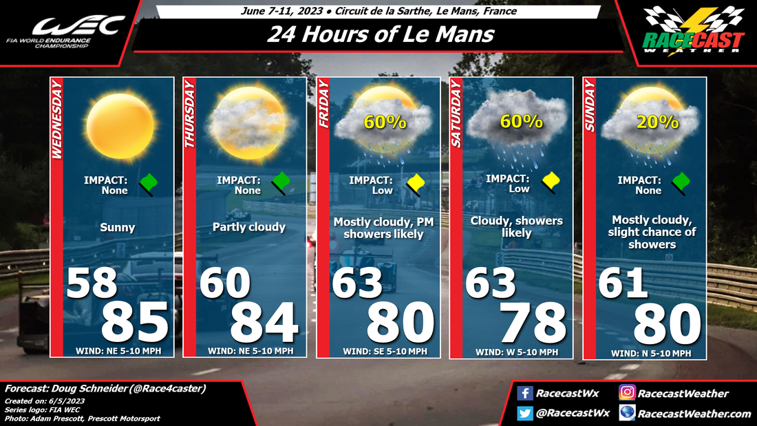
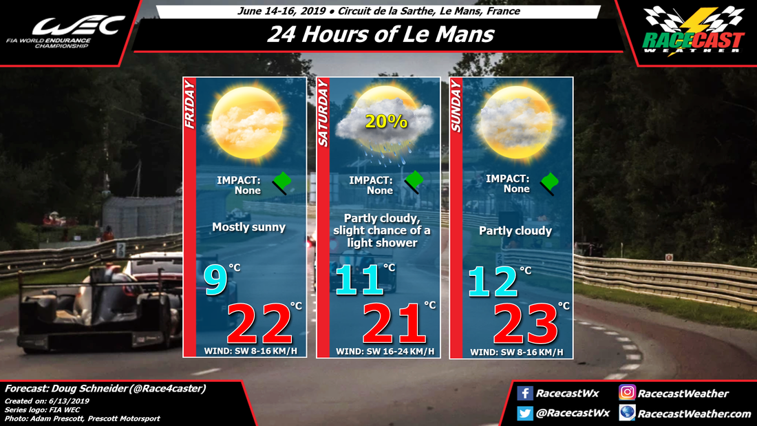
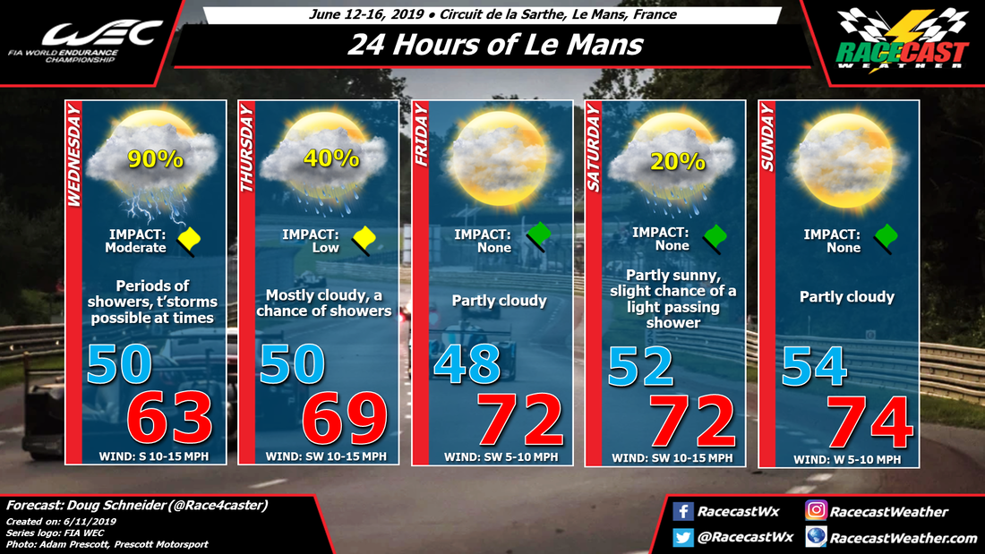
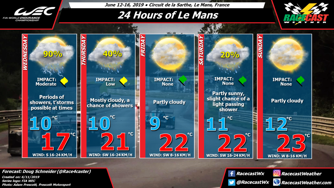
Warm temperatures and mostly sunny skies are expected at Le Mans through most of this week, but as we approach the weekend, the chance of rain still start to increase, and there's a good chance of seeing rain at some point during the race.
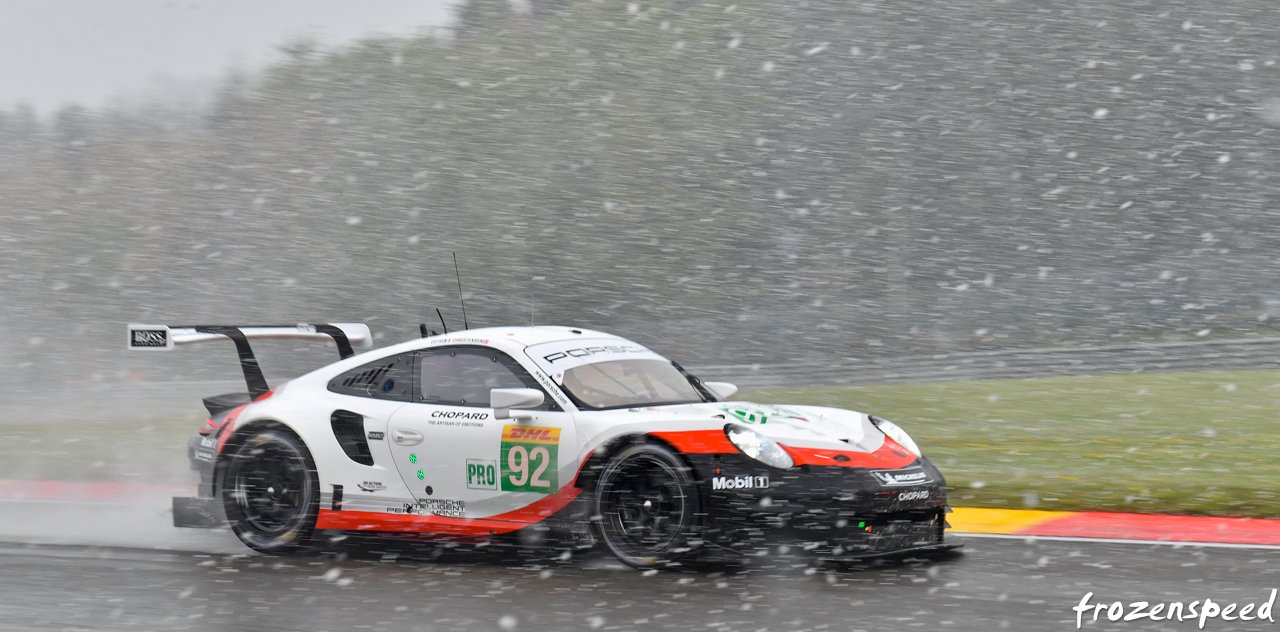
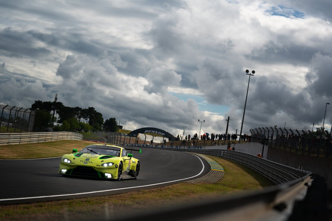
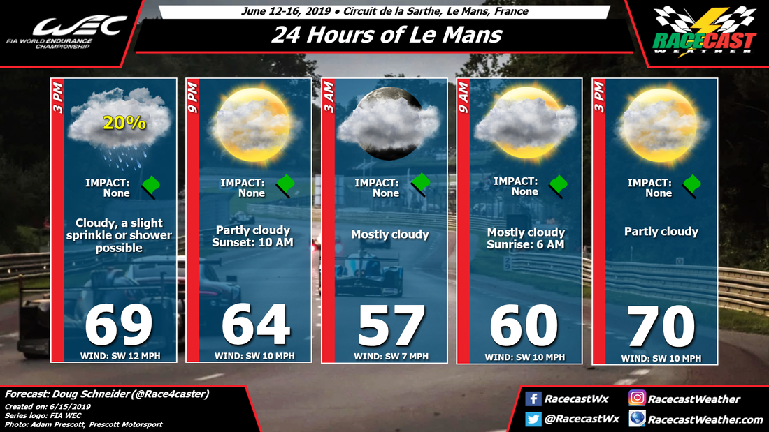
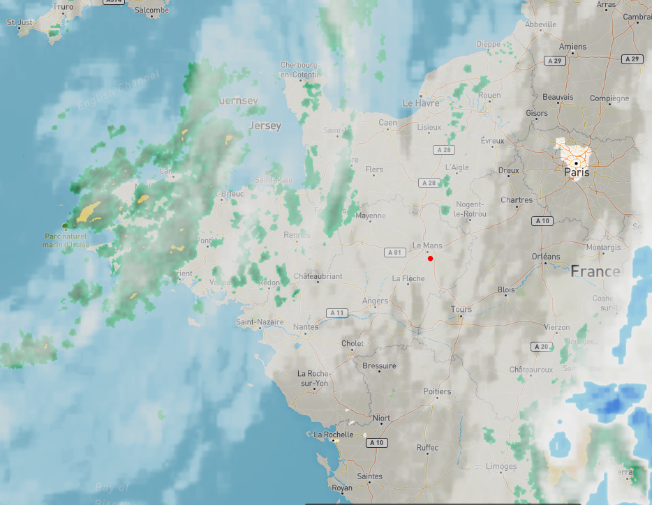
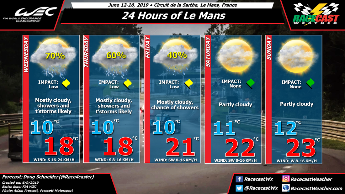
A large high pressure system will be drifting east from England to Scandinavia from Wednesday through Friday, providing dry weather and warm temperatures across northern France. A low pressure system will be tracking east across the Atlantic, and be located somewhere near the Bay of Biscay by the end of the week. This low pressure system will spread increasing moisture into France over the weekend. The chance of rain is a bit uncertain this far out, and it will depend on the exact position of this low, which isn't yet clear. If it tracks farther south as some models suggest, there will be a lower chance of rain. A more northerly position of the low will increase the rain chances. In this forecast, I have taken a middle ground, with rain chances in the 40-50% range. This may go up or down with later forecast updates, so check back through the week.
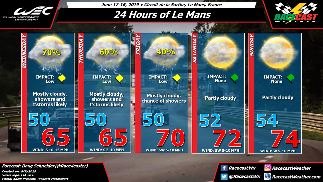
A large high pressure system will be drifting east from England to Scandinavia from Wednesday through Friday, providing dry weather and warm temperatures across northern France. A low pressure system will be tracking east across the Atlantic, and be located somewhere near the Bay of Biscay by the end of the week. This low pressure system will spread increasing moisture into France over the weekend. The chance of rain is a bit uncertain this far out, and it will depend on the exact position of this low, which isn't yet clear. If it tracks farther south as some models suggest, there will be a lower chance of rain. A more northerly position of the low will increase the rain chances. In this forecast, I have taken a middle ground, with rain chances in the 40-50% range. This may go up or down with later forecast updates, so check back through the week.