By Scott Martin

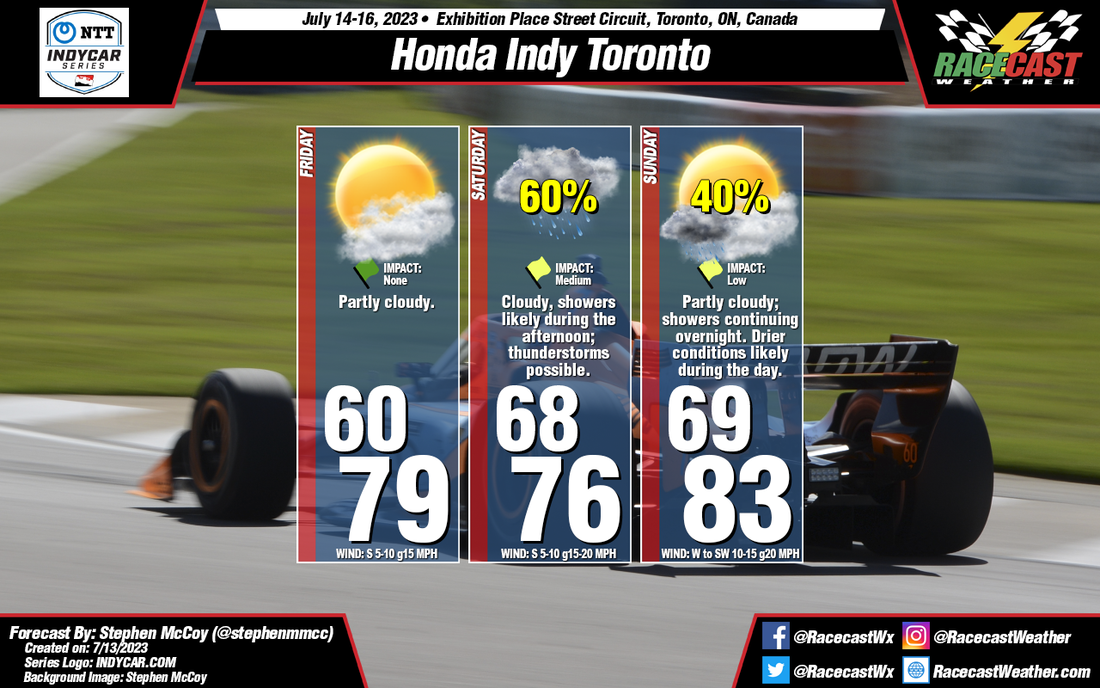
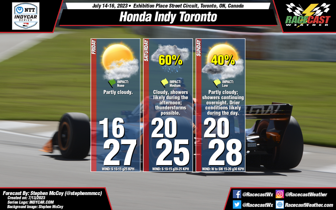
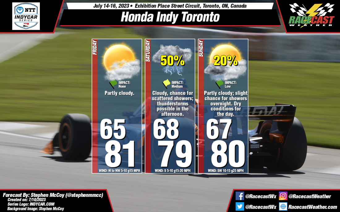
Looking at the latest model runs for this weekend, we may have to put up with a passing storm on Saturday as a cold front will be working through the area, but will make it feel much nicer and less humid on Sunday. The good news is that the models are not too bullish on the rain activity on Saturday, but convective storms are usually not handled well by the models sometimes. I'll keep a chance of storms in the forecast on Saturday afternoon and early evening.
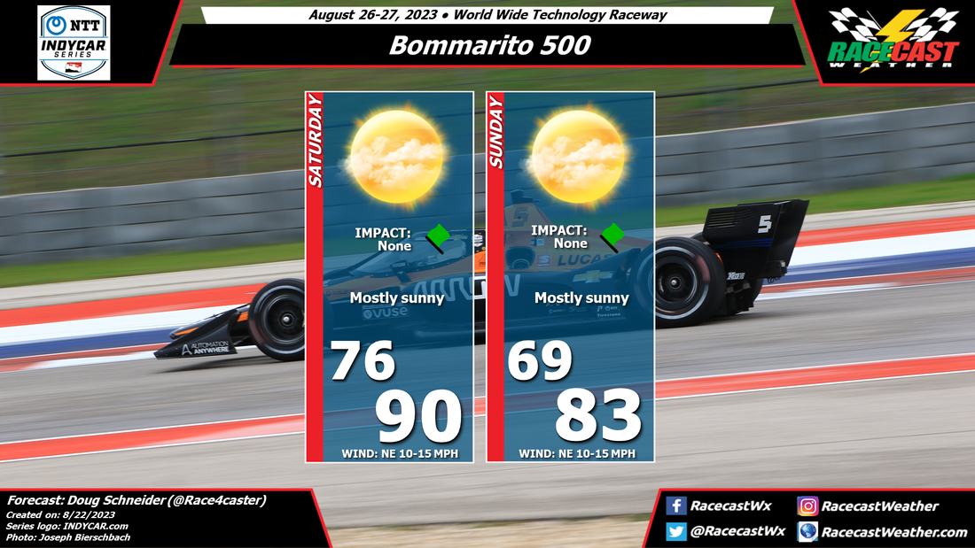
Sunday will be a very nice day with temperatures in the lower 80s and low humidity. There will be a mix of sun and clouds, and I just can't rule out an isolated shower during the afternoon to early evening, but with the amount of dry air in place, chances will be very, very low.
Sunday will be a very nice day with temperatures in the lower 80s and low humidity. There will be a mix of sun and clouds, and I just can't rule out an isolated shower during the afternoon to early evening, but with the amount of dry air in place, chances will be very, very low.