
By: Stephen McCoy
 | 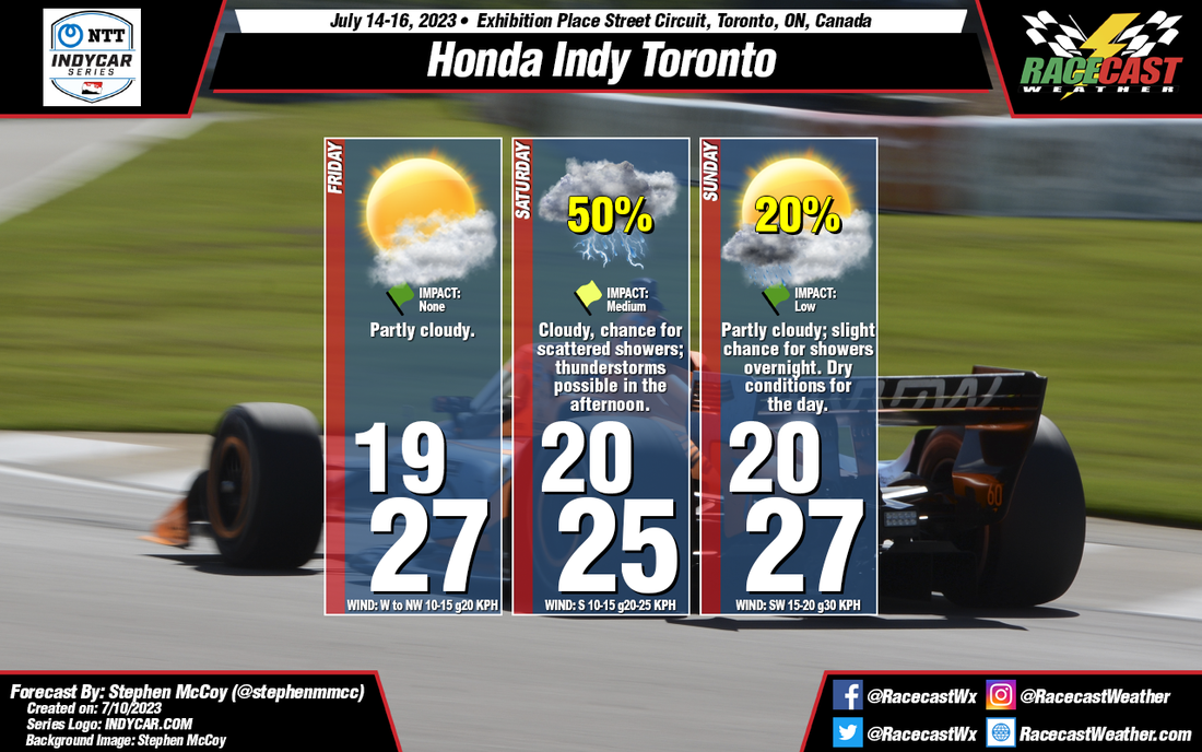 |
Before the weekend, there will be a cold front moving through the region on Thursday, associated with a low pressure system located over Northern Canada. Conditions behind the front will be as-expected for this type of synoptic setup: winds will shift to the West/Northwest, flowing around the center of the surface low. This will cause a slight dip in temperatures overnight Thursday into Friday, but afternoon temperatures should return to near 80°F (mid/upper 20's °C). With cooler, drier conditions aloft moving in from Northern Canada, expect clear to partly cloudy skies for much of Friday.
Saturday will provide differing conditions to Friday as another front is expected to make its way through the region in the evening to overnight. Surface winds will shift to the South ahead of the front, with Southwest winds aloft providing enough moisture to keep conditions mostly cloudy to overcast through the day. As fronts are generally weaker this time of year, temperatures will stay mostly constant between Friday and Saturday. There will most likely be some development along the front, creating a chance for scattered showers, especially during the afternoon, with some stronger thunderstorms possible in the region.
Much like Friday, conditions for Sunday are fairly typical for this type of synoptic setup. While there is a slight chance for showers continuing overnight into Sunday morning, daytime conditions are expected to be dry. Surface winds may pick up after the front moves through as an area of high pressure begins to move in.


