
By: Stephen McCoy
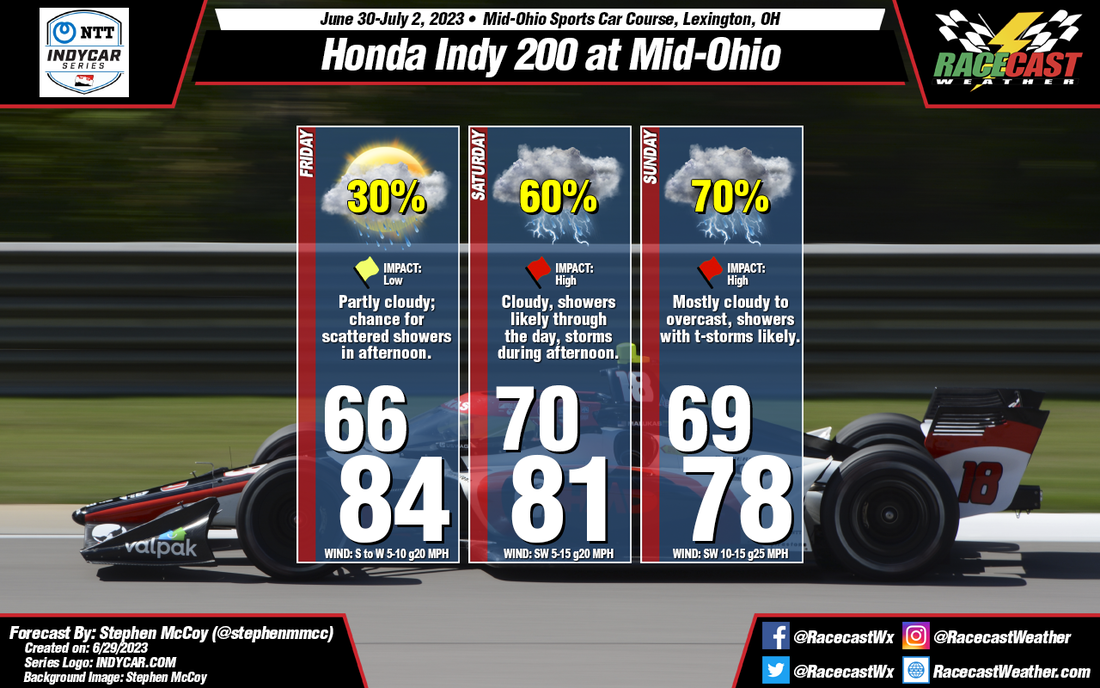
Expected conditions are far from improved for Mid-Ohio this weekend. Temperatures, winds, and cloud cover remain mostly consistent with the initial forecast, however rainfall chances and impacts have increased significantly for the latter portion of the weekend.
Friday's synoptic pattern is still likely to occur as was suggested in the initial forecast from Tuesday. A low pressure system will be centered over Ontario to the north of the region, with a surface high located over the southeastern US. The anticyclonic motion around the high will bring moisture from the Gulf of Mexico north through the Great Plains and into the Midwest. The additional moisture will result in dew point temperatures hovering in the low 70's. Air temperatures in the mid 80's with mean heat index values will approach the low 90's for a high. Moisture in the low levels will bring cloudier conditions to the region, especially for the afternoon and may result in a few scattered showers in the area.
Temperatures will cool slightly for the remainder of the weekend as cloudier conditions move in. Saturday and Sunday will see medium to high impacts for on-track sessions as showers and thunderstorms are likely during the afternoons. Each day could see upwards of 1/2" of rainfall, but the main safety concern will be lightning within the storms.


