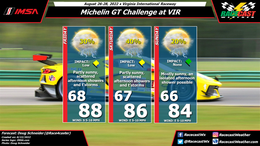
On Friday, a warm southerly flow will set up across North Carolina and southern Virginia, while a cold front located to the northwest will be approaching. With afternoon hearting, scattered showers and thunderstorms are possible in the area around VIR.
The chance of showers and thunderstorms appears to rise a little on Saturday as the cold front gets closer to VIR. Exactly where the front will be located will affect the chance of rain, which adds to the uncertainty of the forecast. But it does look like Saturday has the best chance of seeing wet conditions at some time in the afternoon.
Sunday will depend on whether the front can push through the area, or stalls nearby. If it stalls, the chance of rain will be higher. If it pushes through, it will likely be a dry and cooler day. With this uncertainty, I have to have at least a small chance of afternoon showers and thunderstorms for now, but this could change as we get closer to the weekend.


