
By: Stephen McCoy
No major changes to the forecast from Monday; continue to expect cooler than normal temperatures with chances for showers both days.
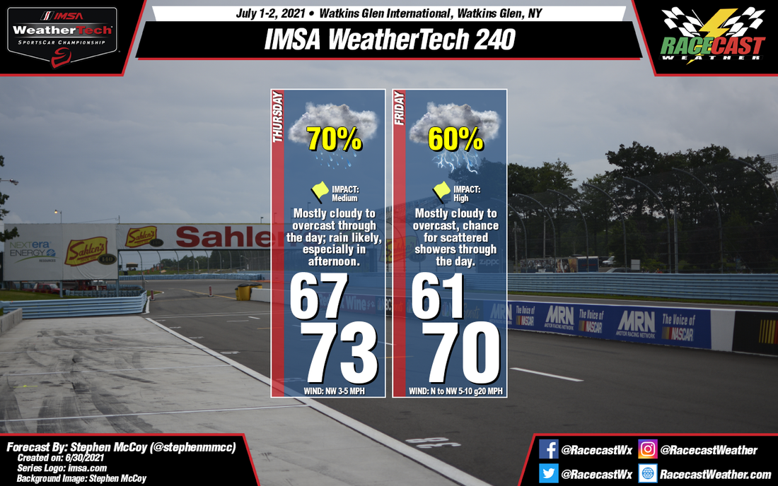
A cold front will pass through the region on Thursday as it heads eastwards to the Atlantic. Cooler air behind the front will result in lows in the low-to-mid 60's and highs in the low 70's. Winds aren't looking as strong for Thursday as they once did, however winds will pick up on Friday around the central low. The cooler low level air undercutting the present warm air will result in a fair amount of instability, causing widespread showers on Thursday along with scattered to widespread showers and/or thunderstorms on Friday. Fog may be possible Thursday morning as the result of saturated air at the surface trapped under a weak inversion, but should wane as the morning progresses.
A cold front will pass through the region on Thursday as it heads eastwards to the Atlantic. Cooler air behind the front will result in lows in the low-to-mid 60's and highs in the low 70's. Winds aren't looking as strong for Thursday as they once did, however winds will pick up on Friday around the central low. The cooler low level air undercutting the present warm air will result in a fair amount of instability, causing widespread showers on Thursday along with scattered to widespread showers and/or thunderstorms on Friday. Fog may be possible Thursday morning as the result of saturated air at the surface trapped under a weak inversion, but should wane as the morning progresses.


