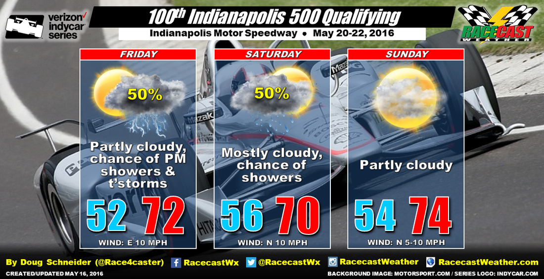
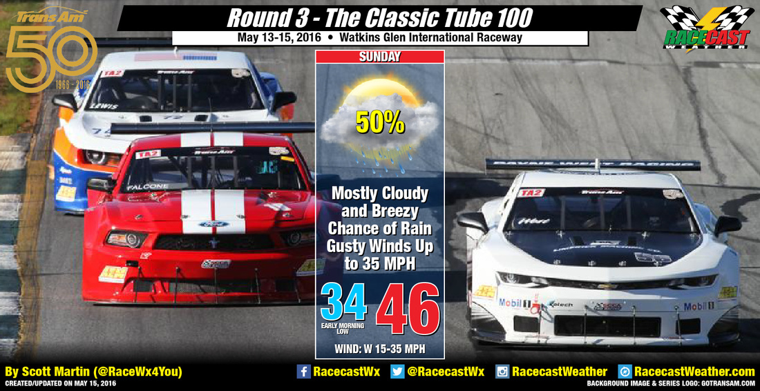
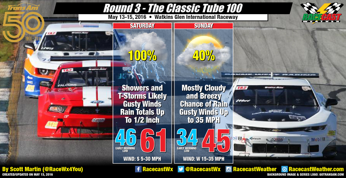
By Scott Martin
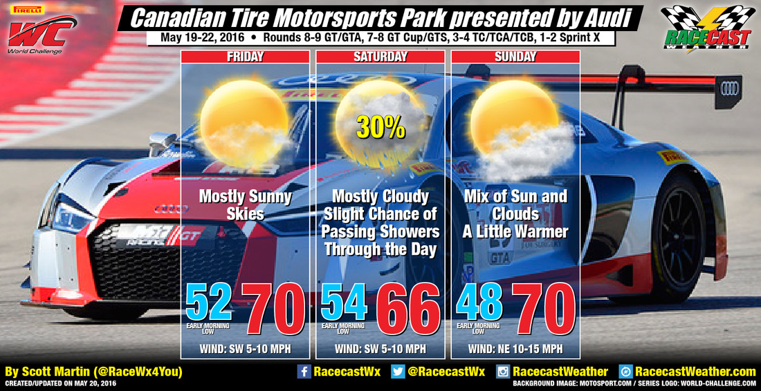
I'm still going with what I forecasted yesterday, but I'm adding a slight chance of rain for Sunday as well. A disturbance will be moving through the northeastern United States throughout the day Today. Clouds will start to build in during the late morning hours, and rain chances should increase after 12PM. The track is going to be right on the northern edge of this disturbance, so that is why I'm only going with a slight chance. As this disturbance passes by to the south, it will pull some moisture down from Northern Ontario during the early morning hours on Sunday, and they may persist through 11AM (if they hold together). After they pass through, skies will become partly cloudy and should be great for racing.
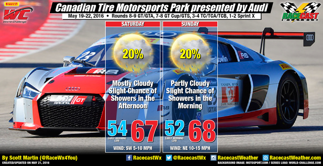
Radar is up and running on the Pirelli World Challenge website. Just click the link posted beneath the Racecast Weather logo. I'll also have updates on our Twitter feed.
Radar is up and running on the Pirelli World Challenge website. Just click the link posted beneath the Racecast Weather logo. I'll also have updates on our Twitter feed.