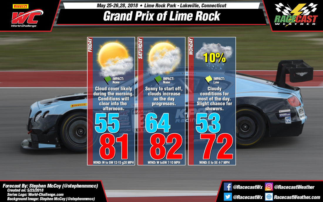
The low pressure system mentioned in the previous discussion is expected to now move out into the Atlantic Ocean during the day on Friday. However, a second low pressure system is expected to move into the Midwest region on Saturday. A warm front is expected to extend eastward out of the system into New England. There is a slight chance of showers associated with this front, but should hold off until after track activities have ended.
For Monday, the current long-range models are in some disagreement for the likelihood of precipitation and the high temperature. The current runs of the GFS model indicate that for Monday, a moist atmosphere in the lower levels and cooler temperatures are likely to result in rain during the morning and early afternoon. However, the Euro model suggests warmer temperatures with little precipitation occurring at the end of the second GT SprintX race. Because of this disagreement, I’ve decided to indicate a slight chance for showers, though I don’t have very high confidence in the likelihood for precipitation. I’ll have a better understanding of what to expect for Monday in the next update.


