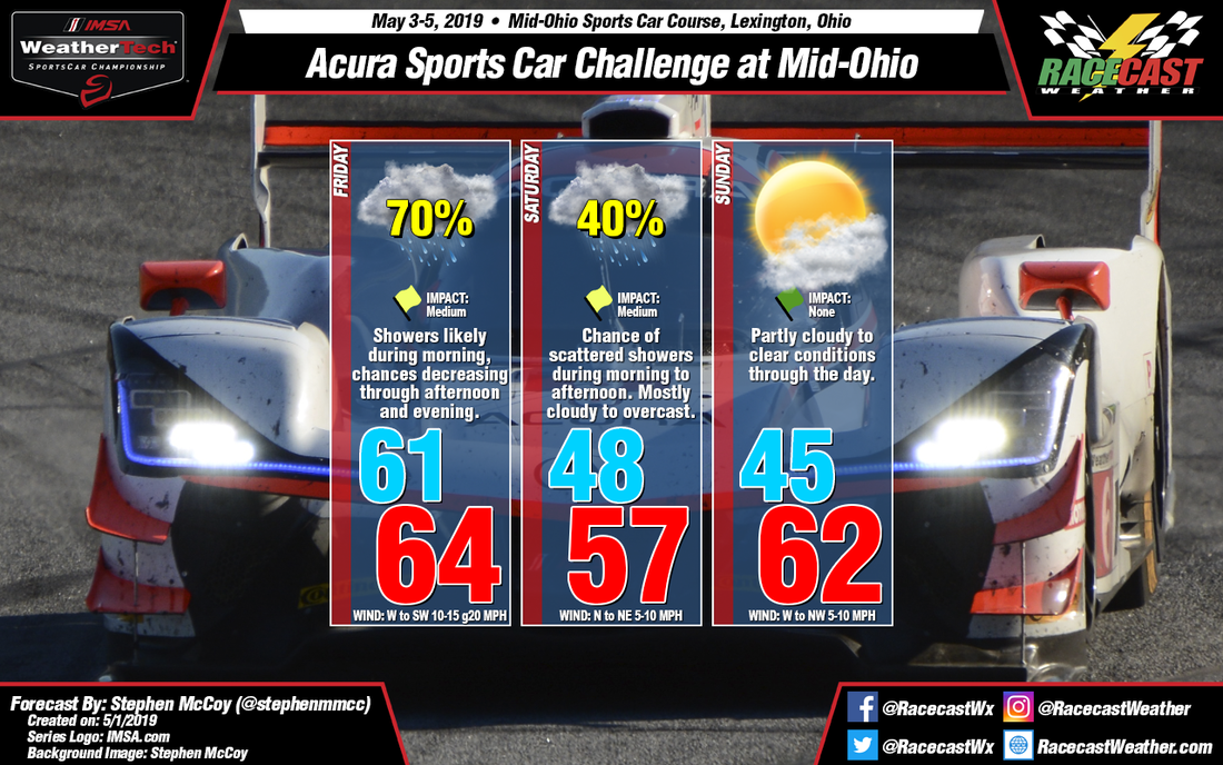
An upper level longwave trough, currently centered over the western U.S. is expected to continue tracking eastward through the weekend; multiple shortwave troughs are likely to form within this trough. A surface low pressure system will form over the southern Plains Thursday ahead of one of these shortwave troughs and track northeastward through Friday. The system will bring precipitation to central Ohio overnight Thursday into Friday; largest chances occur during the morning, with chances of scattered showers still possible in the afternoon. Ahead of the cold. front, surface winds will be from the southwest, shifting north to northwest after the frontal passage during the early to mid afternoon. Overcast conditions expected throughout the day.
A second shortwave trough is expected to move through the Great Plains late Friday into Saturday, with another low pressure system forming ahead of it, tracking northeastward. Like I mentioned above, Saturday is still proving somewhat difficult among the models, especially in regards to the timing and/or placement of the warm front from this low pressure system. For the moment, the warm front is expected to set up to the south of the region, bringing cooler temperatures, overcast skies, and stratiform precipitation; timing appears to be from the mid-morning to afternoon.
For Sunday, winds through most of the atmosphere will shift to the west/northwest, bringing cooler, drier air to the region resulting in clear to partly cloudy conditions. The increased amount of sun will allow temperatures to warm slightly to the low to mid 60's.


