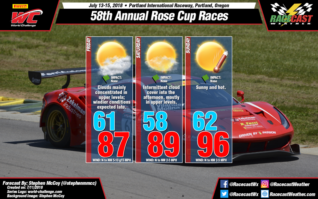
For Friday, the main concentration of clouds over the region will be focused in the upper levels of the atmosphere from moisture moving through from the south. With a temperature inversion and a dry atmosphere expected in the mid and lower levels, expect a high temperature in the upper 80's with heat index values in the low to mid 80's. Later into the evening, winds could pick up as the low level winds and surface winds are both expected from the northwest, possibly creating some moderate gusts; downslope flow from mountains to the west could contribute to stronger winds.
For Saturday, expect similar conditions to those on Friday apart from large amounts of cloud cover as drier air moves into the upper atmosphere. The moisture moving into the area mentioned in the previous forecast appears to hold off, resulting in more intermittent cloud cover, mainly concentrated in the afternoon.
For Sunday, temperatures are expected to reach into the 90's, which is consistent with the previous forecast. However, much like the previous forecast, the models are in disagreement for the high temperature, with the GFS continuing to bring temperatures closer to 100, while the ECMWF and German Global models are in the low 90's. The latter two models are slowly trending warmer, though and with the addition of the NAM and other high resolution models, the next forecast should provide a better consensus for the high temperature; heat index values will remain in the low 90's regardless. Sunny conditions are expected during the day as dry air moves in throughout the atmosphere.


