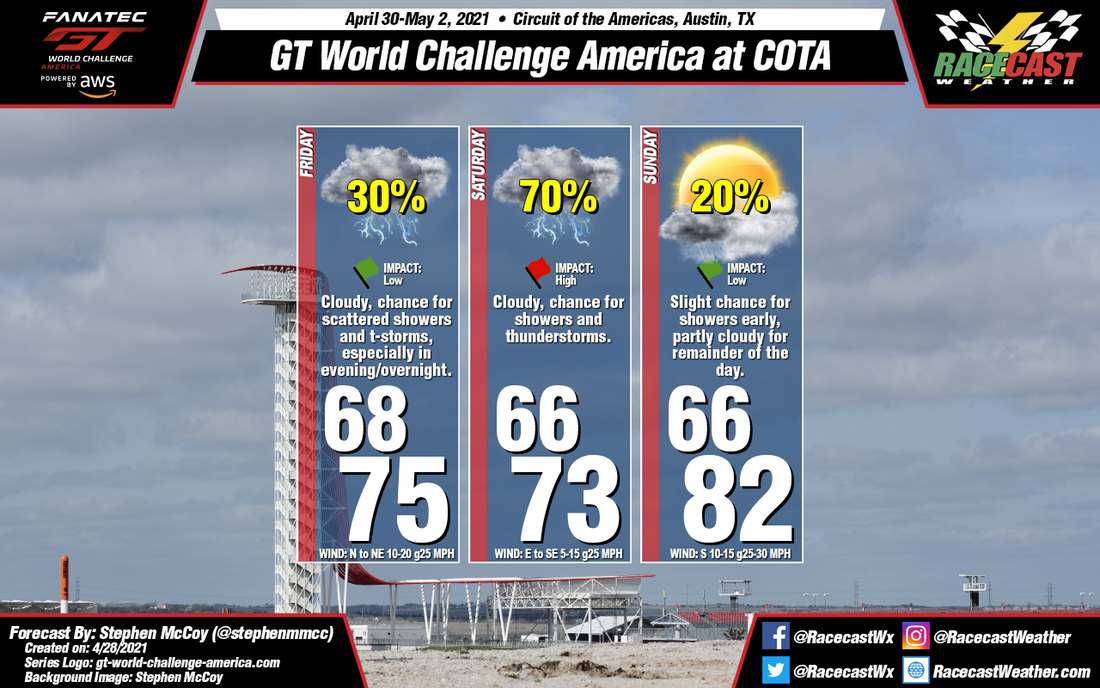
Friday and Saturday will see cooler temperatures through the day after a cold front passes through the region on Thursday. Surface winds behind the front will largely be from the north on Friday, but will begin shifting to the east/northeast as an area of high pressure moves in over the Arklatex region. Low level winds from the east/southeast will bring in moisture off the Gulf, causing mostly cloudy to overcast skies through the day. These conditions are expected to persist into Saturday, along with an increased chance for precipitation.
A slight chance for lingering showers is possible Sunday morning, but as the upper level trough begins moving eastward, drier conditions will move in. Partly cloudy skies will be present for much of the day after sunrise with temperatures at their highest of the weekend due to surface winds largely from the south.


