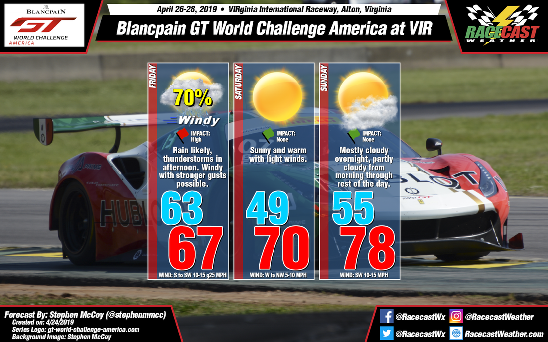
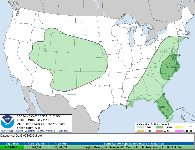
An upper level shortwave trough is still expected to develop over the northern plains region of the U.S., deepening as it tracks eastwards across the country. At the surface, a low pressure system will form in the eastern side of the Rockies, over the Wyoming/Nebraska border and will move towards the Northeast through Saturday. A cold front from the system will affect southern Virginia on Friday as the low approaches New England. Model output suggests precipitation may begin overnight Thursday ahead of the front, with rain persisting for much of the day. An upward trend in the models has shown an increase in CAPE (atmospheric instability) and, as a result, thunderstorm potential for Friday afternoon, with values reaching above 1000 J/kg. Periods of heavy rain and/or lightning could halt track activities during the afternoon sessions. As referenced in the picture below, the National Weather Service's Storm Prediction Center currently has much of Southeast Virginia in a Marginal risk for severe weather on Friday. Look for updates on the Racecast Weather Twitter if the categorical outlook increases in the next day or two. The front will bring strong winds from the southwest; some gusts could reach upwards of 25 mph.
Another shortwave trough is expected to track through the Midwest overnight Saturday, which will shift upper level winds to the west/southwest, bringing some moisture back to the region. The increased moisture will cause some heavy upper level cloud cover overnight, and may persist into the morning, though the cloud cover should decrease into the afternoon. Ahead of the trough, another surface low pressure system is likely to develop in the lee-side of the Rockies, tracking in a similar direction to the system on Friday. A cold front is expected to approach southern Virginia on Sunday from the north, however no precipitation is expected with this system.


