
By Scott Martin
 NOAA/NWS SPC Severe Outlook(valid Thursday 6AM-Friday 6AM) | 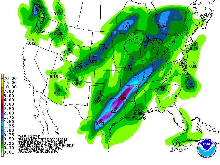 NOAA/NWS Day 1-2 QPF Chart(valid Wednesday 6PM-Friday 6PM) |
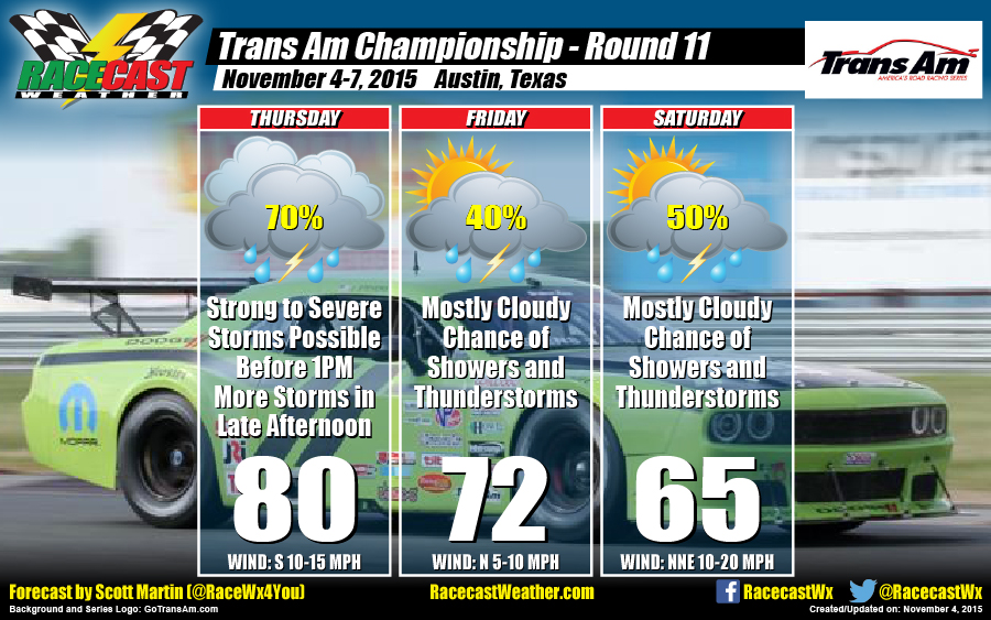
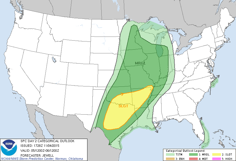
Looking over the latest data that is pouring in from the models and the NWS, I do not believe in much change from yesterday's forecast update. The Storm Prediction Center has placed much of Texas (including COTA) under a SLIGHT RISK for severe weather for Thursday. A shortwave impulse will be moving through the area during the morning hours with enough instability for strong to severe storms to develop. These storms could produce heavy rainfall amounts, some strong winds at 40-60 MPH, and a brief spin-up tornado can't be ruled out. Models are suggesting rainfall totals with the morning storms at 2 inches or more possible. There should be a break in the action at some point during the mid to late afternoon hours before the cold front moves through the area. That will bring with it more strong thunderstorms, with gusty winds and more heavy rainfall.
Please have a reliable source of weather information on hand during the day, and stay weather aware. Expect heavy rainfall with possible flash flooding, dangerous lightning, strong winds at 40-60 MPH, and a possibility of a brief spin-up tornado. We'll have our radar up and running for you to see at our website (www.racecastweather.com) that features live warning data. I'll also have updates on my Twitter feed (@RaceWx4You) if dangerous weather is heading in that direction.
On Friday and Saturday, the cold front slows down just to the south of the area and an upper-level disturbance behind the front should keep showers and thunderstorms in the forecast throughout the race weekend. Fortunately, these storms will be elevated, so no severe weather is expected with these storms.


