
By Doug Schneider
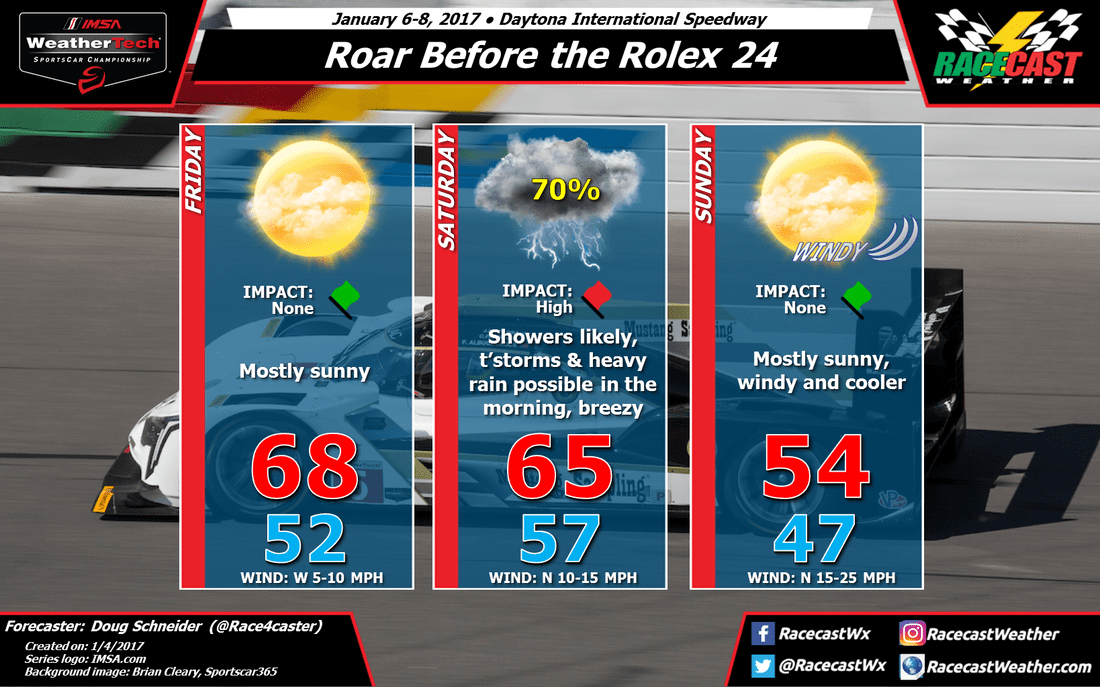
The forecast is coming into better focus today as the models are in much better agreement on the timing of rain. My confidence in the forecast is much higher than it was on Monday. The most likely period of rain will be Friday night into Saturday morning, and there could be some thunderstorms and heavy rainfall at times Saturday morning. There will likely be a reduced amount of testing on Saturday. There may be an opportunity to run in the late afternoon and evening.
Friday looks great as high pressure will be over the Bahamas. Low pressure will be developing over the Gulf of Mexico, and strengthening as it move east. Rain is expect to move in on Friday night, as early as midnight. The overnight rain should be mainly light, with heavier rain expected to arrive Saturday morning. Here's the rainfall forecast for Saturday from the National Weather Service:
 | 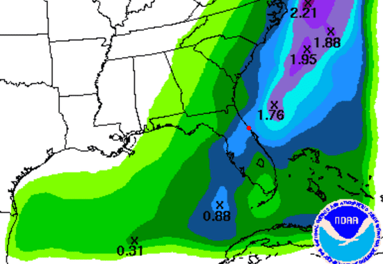 |
That is between 0.75 and 1 inch of rain, just on Saturday. Additional rain from Friday night could bring amounts closer to 1 to 1.25 inches.
The center of the low pressure is expected to track across central Florida, just south of Daytona, which will result in a northerly wind and colder temperatures than I had in my previous forecast. Winds will be picking up in the afternoon as the low moves east and the cold front moves through Daytona. I expedct the rain to taper off in the afternoon, so there may be an opportunity for testing late in the day and the evening.
As the low pressure continued to strengthen off the Florida coast, north winds will really be blowing on Sunday. Winds of 15 to 25 mph with gusts near 30 mph are expected. It will be sunny but cooler behind the front, with highs only in the 50s.


