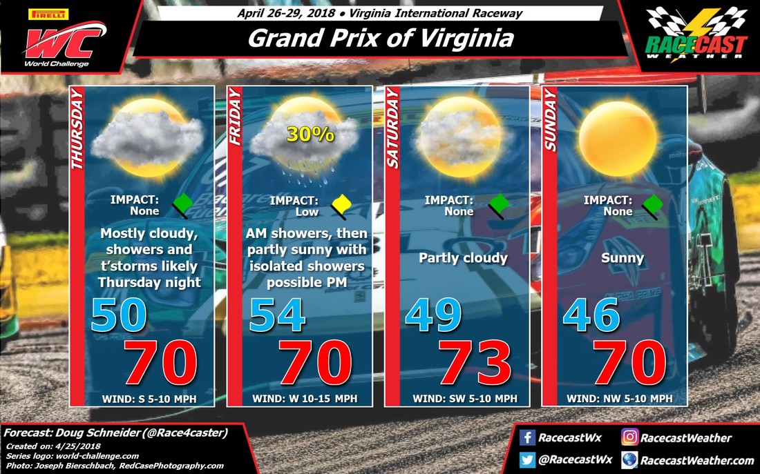
On Thursday, VIR will be between an exiting storm system that is delivering some rain to the area today, and another system that will be arriving Thursday night. All indications are that the test sessions on Thursday will be run in rain-free but mostly cloudy conditions.
A low pressure system will be tracking across the Tennessee Valley region through the day, then across the Carolinas Thursday night. This system could bring quite a bit of rain to VIR Thursday night, probably around a half inch but with the potential to produce up to one inch. There may also be some thunderstorms moving through overnight. The good news is that the models are in good agreement that this system will be exiting early Friday morning, and most of the practice sessions that day should not be impacted. I have a low chance of rain and a low impact mentioned on Friday mainly due to the possibility that some of the first practice sessions of the day could be delayed a bit, and the track will likely be wet to start the day. Through the rest of the day, I can't completely rule out an isolated shower in the afternoon, but any afternoon showers will be light and brief, with no lightning expected.
The rest of the weekend looks to be about as good as you could hope for this time of year in Virginia. Saturday will be partly cloudy with highs in the lower 70s. A cold front is expected to move across the area Saturday evening, but it will not have enough moisture with it to produce any rain. Behind the front on Sunday, a northwest wind will bring slightly cooler temperatures, with morning lows in the mid 40s and afternoon highs close to 70.


