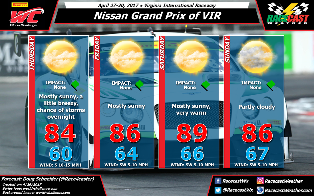
On Thursday, a cold front and an upper level trough will be approaching from the west. The good news is that storms along the front will be weakening after they cross the mountains. There is still a chance of a few storms making it to VIR Thursday evening, but the timing of any rain chance appears to be after the end of the day's on-track activities. I think the earliest chance of showers to begin will be between 7 and 9 pm, and the F1600 practice session is scheduled to end at 6 pm. I'd put the chance of showers and storms on Thursday night at 30%.
On Friday, high pressure will be located off the NC Outer Banks, and it will be strengthening and building westward through Saturday. This will provide mostly sunny skies, dry weather, and a warm southwest flow that will help temperatures rise into the upper 80s on Saturday. Humidity levels will be rising through the weekend as well, but it won't be oppressively humid. You'll want to be prepared with sunscreen and plenty of water if you're going to the track.
The high pressure ridge will begin to give way a little on Sunday as a low pressure system tracks across the Midwest states. Based on the current timing of the models, most of the rain with this system should remain well west of VIR on Sunday, and hold off until Monday. However, some models are indicating that with the high pressure ridge weakening, there may be enough instability for some afternoon storms to pop up around the Piedmont. I am keeping the forecast dry for Sunday because I think the chances of storms at the track is still too low to mention. But I'm not feeling very confident about this, and this will bear watching over the next few days. There will be a little more cloud cover spreading over the track, which will take a few degrees off the high temperatures compared to Saturday.


