
By Doug Schneider - @Race4caster
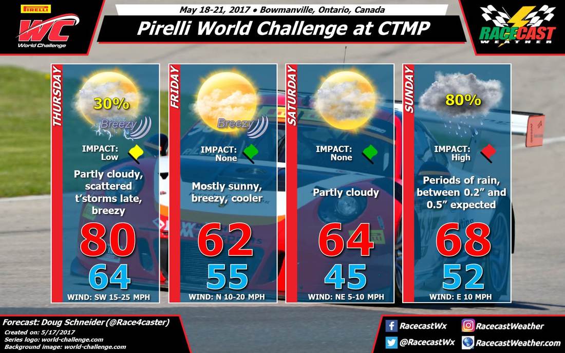 | 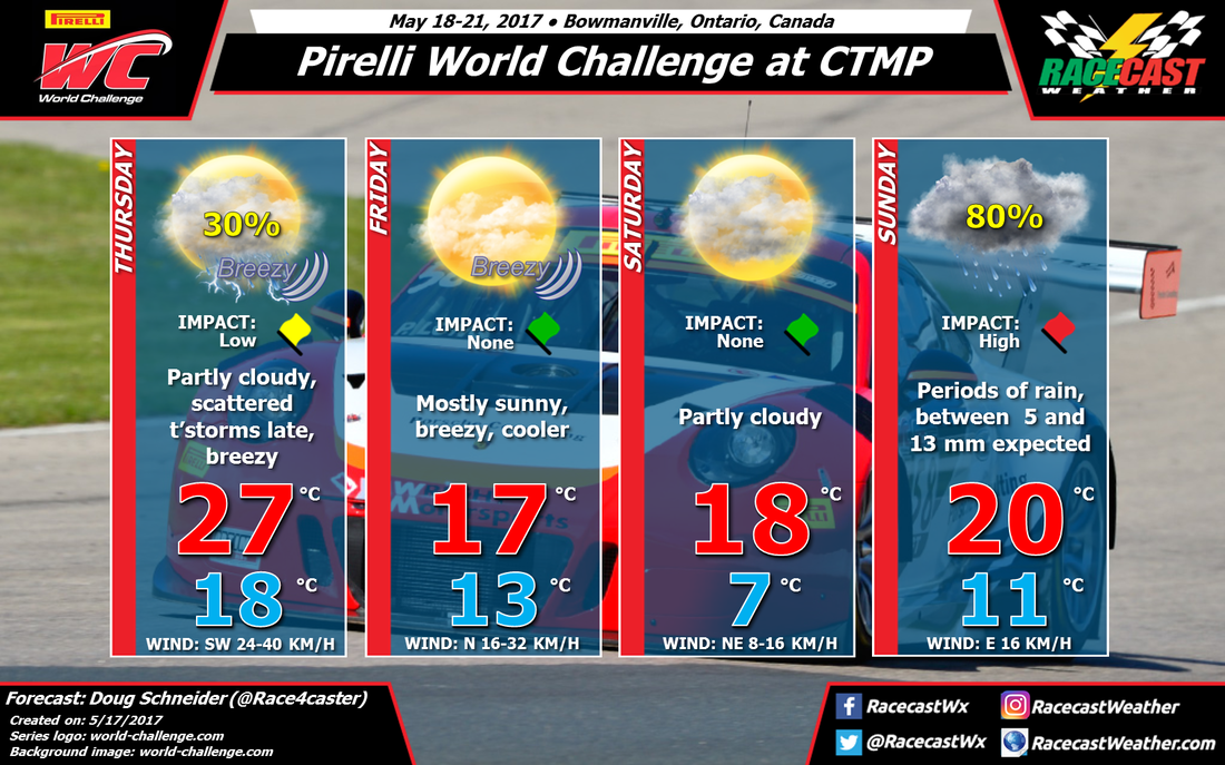 |
Overall, there hasn't been too much change in my thinking for the weather forecast at CTMP this weekend. There's going to be beautiful weather on Friday and Saturday, but Sunday continues to look pretty wet.
A low pressure system will pull a cold front across southern Ontario on Thursday night, and there could be some scattered showers and thunderstorms ahead of it. The most likely timing for any chance of rain appears to be in the late afternoon and evening hours, so a vast majority of the day will stay dry with warm temperatures. I only have a 30% chance of rain before track activities end at 6:20 pm. There will be a higher chance of rain after that time when the front moves through.
Friday will be breezy and cooler as high pressure builds into the area behind the cold front. It will be mostly sunny, but temperatures will only reach the lower 60s (upper teens Celsius). Saturday will also be quite nice, with less wind and slightly warmer temperatures. Clouds will be increasing through the day ahead of the next low pressure system.
The cold front that moved through on Thursday night will lift back to the north to near Lake Ontario on Saturday night, and as the center of the low pressure system moves across Michigan, a moist southerly flow up and over this warm front will result in a wet day on Sunday. I have high confidence that there will be rain on Sunday, so I have raised the chance of rain to 80%. The most likely amount of rain at the track on Sunday appears to be between 0.2 and 0.5 inches, or between 5 and 13 mm. Periods of rain are possible at any time of the day, so I think that all action on the track will be affected. This could result in some delays or possibly cancellations of events, depending on how heavy the rain will be.
I plan on having another forecast update posted on Friday, unless there is a major change before then.


