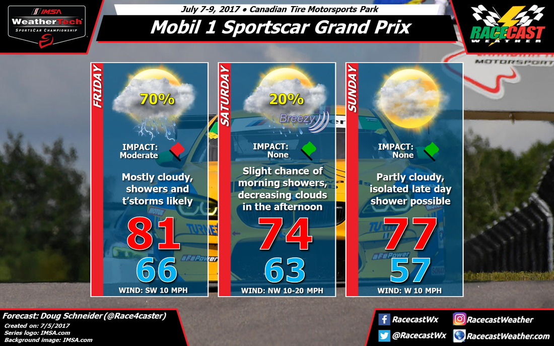
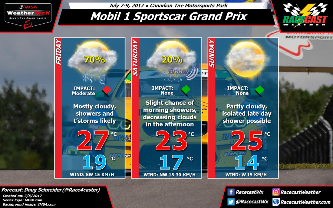
The models continue to point toward Friday for the best chances of rain as a cold front will be approaching the area. Numerous showers and thunderstorms will move through southern Ontario with the front during the day, and rain amounts are expected to be between a quarter and a half inch. This could cause some of the sessions to be canceled, so I've ranked the impact at Moderate. But that will depend on the finer details of timing of storms, which is still uncertain.
The cold front will move east of the area Friday night, but a trough in the midlevels of the atmosphere will lag behind. There will still be a chance of showers until that trough moves away, which will happen on Saturday. I think it will just be a slight chance of rain, mainly Saturday morning, and any rain will be light. By the afternoon, clouds will be decreasing and sunshine will be increasing, although it will be breezy with a northwest wind between 10 and 20 mph. The northwest wind will usher cooler temperatures into the area, and highs will be in the mid 70s.
Sunday is becoming more of a question mark, as the models have changed their tune a bit about the pattern. One model (ECMWF) brings a second cold front and upper level trough into Ontario on Sunday, and it shows rain in the area Sunday afternoon. Another model (GFS) shows a much weaker trough and a front that stays north of the track. I've added a mention of an isolated late day shower to Sunday to account for the possibility, but I'd only put the chance of rain at 10% right now. I don't have enough confidence make a big change to Sunday's forecast at this point, since a dry day seems most likely. Hopefully that won't change as we get closer to the weekend, but stay tuned.


