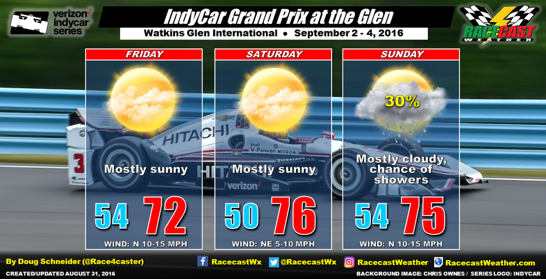
So we are dealing with a highly uncertain situation here. For now, I'm going with the Hurricane Center's current forecast track along the black line, which could result in a few showers on the outer fringes of Hermine getting close to Watkins Glen on Sunday. In this scenario, it does not look like a washout at all - just a few passing light to moderate showers, with the vast majority of the day being dry. This is why I have just a 30% chance of rain for Sunday, and I've increased the wind speed forecast for Sunday to 10-15 mph. However, I am concerned that the models will continue to trend Hermine's track to the west. I'll be watching this possibility closely over the next few days. Stay tuned for updates.
|
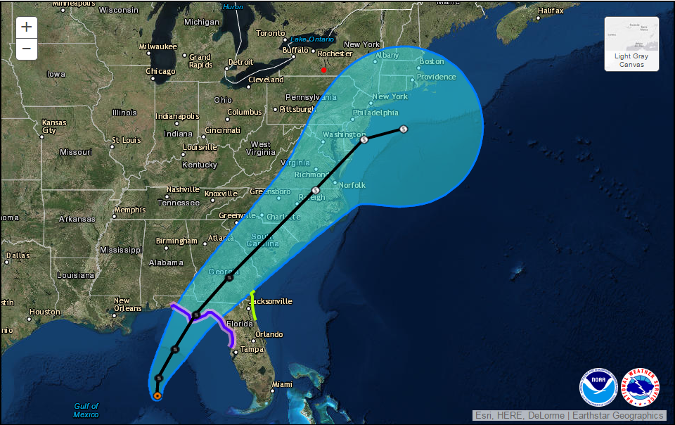
By Doug Schneider The forecast for Watkins Glen this weekend has taken a turn for the worse today due to Tropical Storm Hermine becoming a player in the weather. Hermine is currently over the Gulf of Mexico, and will track northeast across the Florida Panhandle Thursday night. What track it takes after that is highly uncertain. Over the past few days, the models have all kept Hermine well out in the Atlantic, but the latest model runs today have show a track that is much farther west, inland across the Carolinas to southern New Jersey. Here's the forecast track from the National Hurricane Center as of Wednesday afternoon: Watkins Glen is near the red dot. The black line is the most likely track expected by the Hurricane Center forecasters, while the shaded blue area is the cone of uncertainty that the track may take - it represents the range of possible tracks. The white dot at the southern tip of New Jersey is Hermine's forecast position on Sunday afternoon. If Hermine sticks to a track to the right of the black line, then I think the weekend will be dry. If it tracks to the left of the black line, then there will be a chance of rain. The farther left the track is, the more likely rain will be, and the greater the quantity of rain that can be expected. The wind will also be stronger with a more westward track.
So we are dealing with a highly uncertain situation here. For now, I'm going with the Hurricane Center's current forecast track along the black line, which could result in a few showers on the outer fringes of Hermine getting close to Watkins Glen on Sunday. In this scenario, it does not look like a washout at all - just a few passing light to moderate showers, with the vast majority of the day being dry. This is why I have just a 30% chance of rain for Sunday, and I've increased the wind speed forecast for Sunday to 10-15 mph. However, I am concerned that the models will continue to trend Hermine's track to the west. I'll be watching this possibility closely over the next few days. Stay tuned for updates. |
Social Feeds
Authors
Doug Schneider Partners
Categories
All
Archives
December 2023
|


