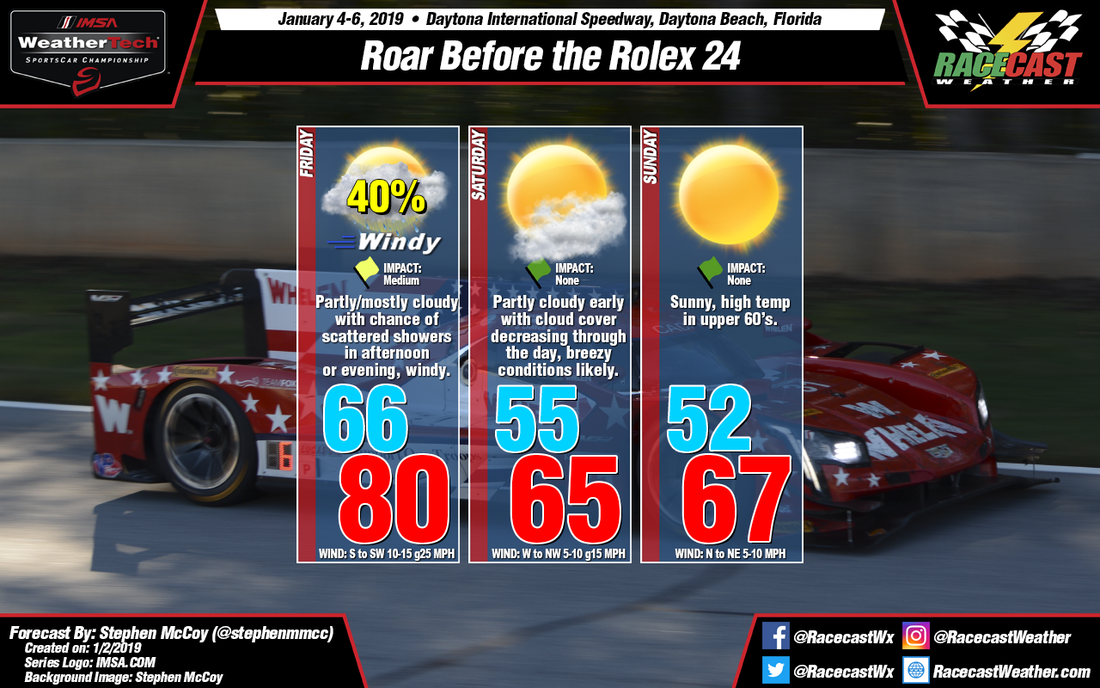
Conditions are expected to be similar to those indicated in the previous forecast, though the models are somewhat split on the timing of precipitation on Friday. Model confidence is increasing towards a frontal passage in the afternoon or evening on Friday, which would certainly cause impacts to the afternoon sessions. However, the most recent GFS runs are showing the front passing in the early afternoon, while the latest ECMWF and NAM runs show the passage in the late afternoon or evening. One thing to note is that the recent NAM 3km runs indicate precipitation will be mostly scattered ahead of the front as opposed to a squall line, which lowers chances as showers could be hit-or-miss.
Winds on Friday will reach 10-15 mph with stronger gusts likely as both surface winds and low level winds will be from the southwest; gusts will reach their maximum speed as the front approaches the track. Cooler temperatures will move in behind the front for Saturday and Sunday. Some partly cloudy conditions are expected in the morning as moisture will linger behind the front in the upper levels, but will clear out into the afternoon and conditions will remain clear through the rest of the weekend.


