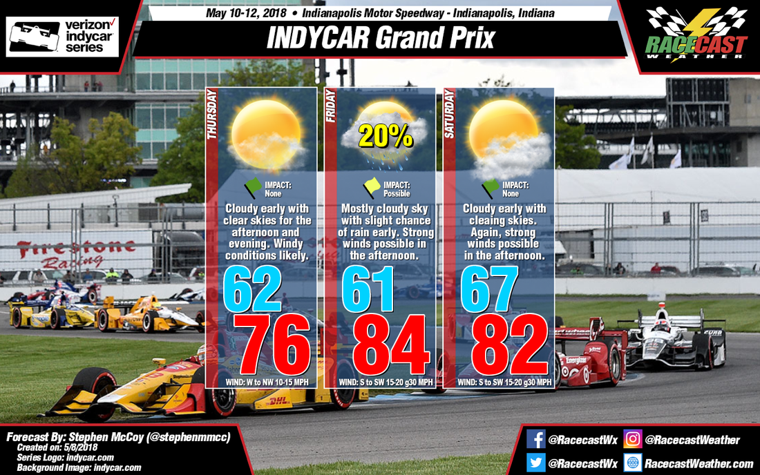
The timing of an upper-level trough and cold front remains consistent with previous model runs, with the front moving through central Indiana Wednesday night into early Thursday. This will bring rain ahead of the front around mid-day into the evening before the front tracks further eastward. On Thursday, conditions will start out cloudy before clearing out into the afternoon and evening for the first practice sessions of the weekend. Winds will propagate out of the west and northwest at around 10-15 mph.
On Friday, a slow-moving warm front associated with a low pressure system located over the Great Plains will bring an isolated threat of rain in the morning that could affect some of the early on-track activities. This appears to be the largest threat for rain at the moment and conditions should clear further into the day. A shortwave upper-air trough will align with the surface front, causing winds around 15-20 mph during the afternoon with some stronger gusts approaching 30-35 mph out of the south and southwest.
The warm front mentioned for Friday is expected to move slowly northwards, causing any threat of rain to be located in northern Indiana. With the front’s position, expect warmer temperatures in the morning during Indy Lights qualifying and the USF2000 and Pro Mazda races. Conditions on Saturday are expected to be similar to Friday, with clouds in the morning clearing into the afternoon, with winds out of the south and southwest around 15-20 mph with gusts around 30-35 mph.


