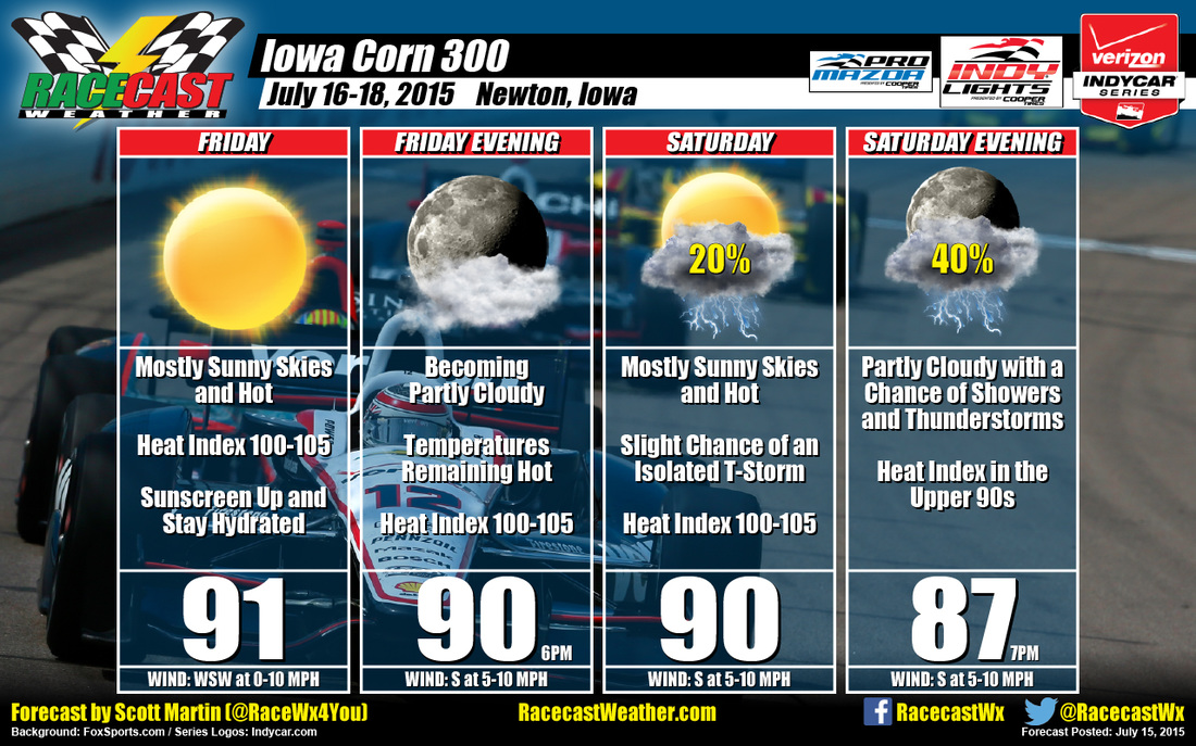
Here is where the forecast has changed, and I hate to say it, but not for the better. Skies will once again be mostly sunny, but with a developing frontal boundary to the northwest of the area and with instability from daytime heating, there is a slight chance of an isolated thunderstorms. If it does rain, I do not believe it will last long and the track should dry relatively quickly. Highs should reach 90. Winds will be from the south at 5-10 MPH. Chance of rain is only 20%. Sunday evening, the skies will be partly cloudy and chances of rain will increase. Instability levels will climb as the area will be in the warm sector ahead of the frontal boundary. Temperatures at 7PM should be in the upper 80s. Winds will be out of the south at 5-10 MPH. Chance of rain is 40%.
Another week where we'll have to wait and see what we have closer to race time. Right now, I'm not too confident on when and where rain will fall, if it even falls at all. Radar will be up and running and I will have updates on my Twitter feed (@RaceWx4You).


