
By Scott Martin.
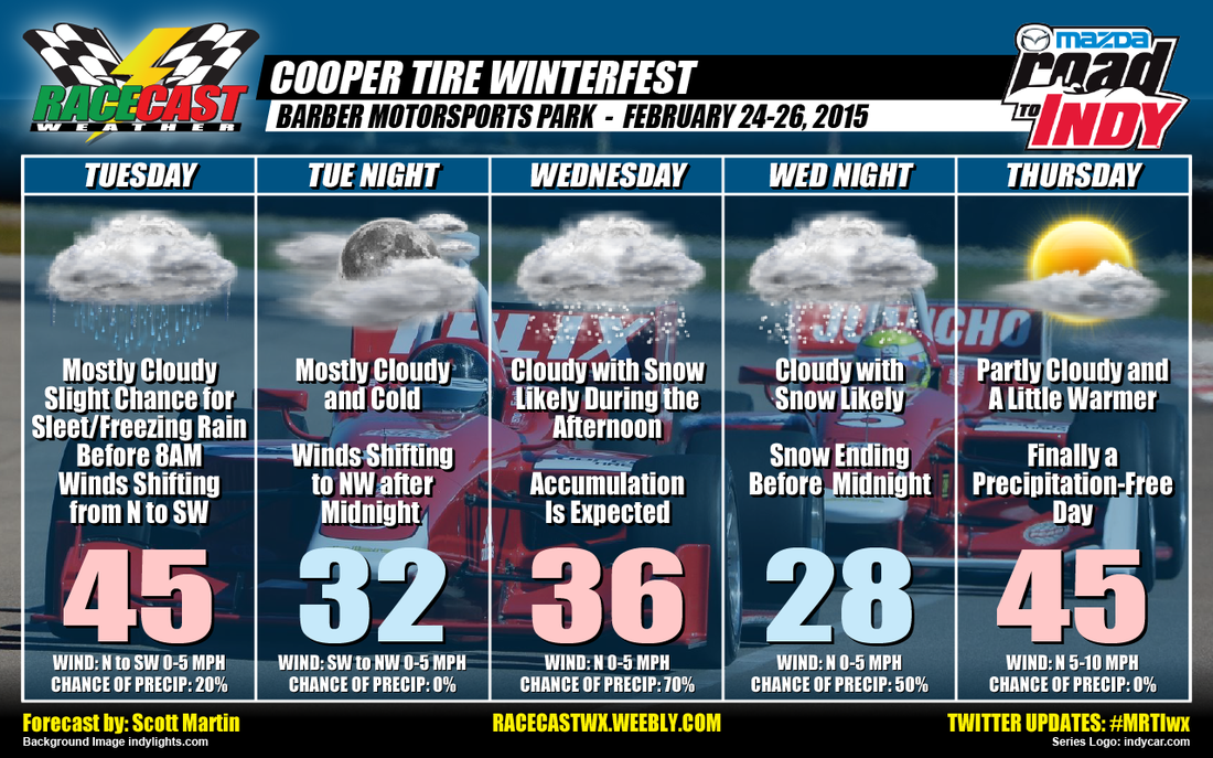
Can you hear Anna from Frozen singing, "Do You Want To Build A Snowman?" For people in central Alabama, we are ready for the Spring to get here. If only the weather timeline was a week faster, we would experience temperatures in the mid to upper 60s with partly cloudy skies. Unfortunately, "Old Man Winter" still has one more trick up his sleeve before he departs Alabama for now. So here is the update that I have for you at this moment.
Tuesday:
The day will start off mostly cloudy with a slight chance of either sleet or freezing rain before the 8 o'clock hour. There may be some slick spots on the roads and bridges, but I do not believe that major travel problems will happen for this time. If conditions change, I will update on Twitter (@RaceWx4You) as soon as possible. After that, the day will stay mostly cloudy. You may see the sun peek through on some occasions, but not for long. Highs will reach the mid 40s by the mid afternoon. Winds will be light out of the N at first, but will be shifting out of the SW during the afternoon.
Wednesday:
Here is the day with the big questions... Will it snow?... and... How much will we get?
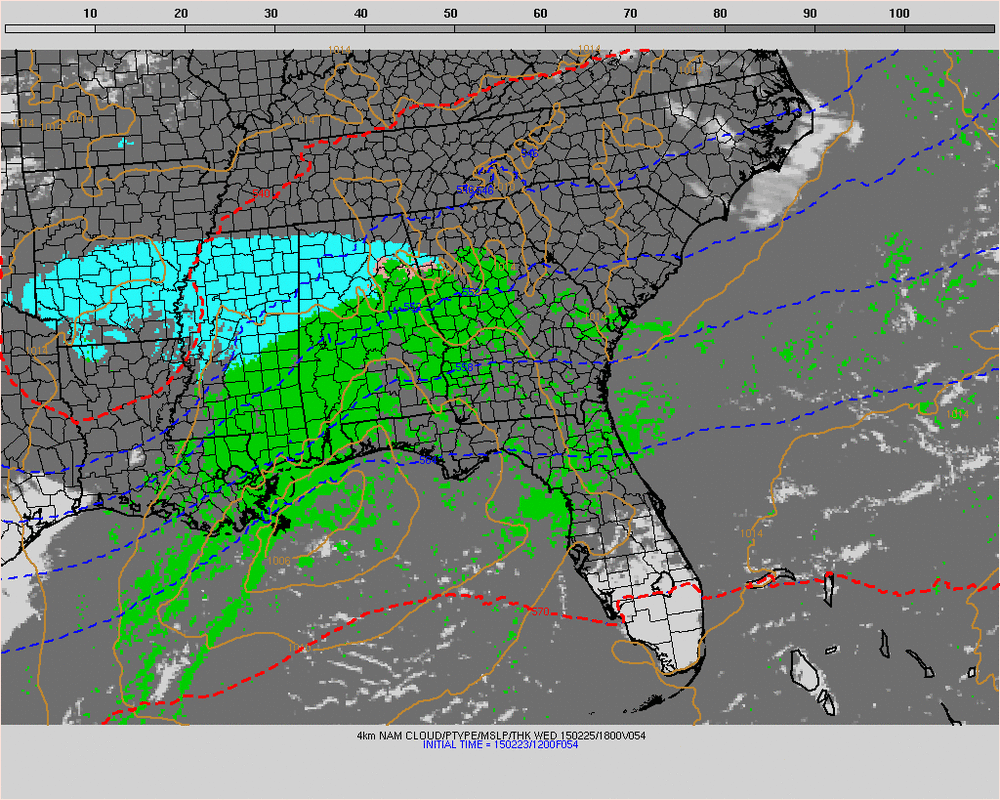
This is the image from the latest run of the NAM 4km model valid at Wednesday at 12pm. Snowfall will have started falling in the Birmingham area at that time. It should take a while for the temperature to cool down enough for accumulations to happen unless the snowfall starts off heavy. If that happens, accumulations could amount quickly for this area. Now I am not calling for blizzard conditions, but there could be well more than enough to build some decent snowmen.
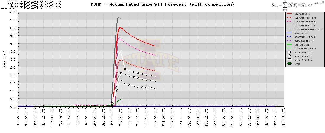
This image of the meteogram for Birmingham may look confusing to you, but I'll explain. Lines on this graph represent model output for snow accumulation amounts for the Birmingham area. You see that one model is predicting about 5.75 inches while another is only predicting 0.5 inches. Right now it is too early to put an estimate on exactly how much snowfall we will receive. Sometimes you will not know until the event is finished and you go out and measure what you have in front of you to know.
This could possibly turn out to be a high-impact weather event for the Birmingham area. I will have a better understanding this evening and Tuesday morning about what will happen. If I were to make a guess on this right now, I would say 3 to 5 inches of snow, but that is only a guesstimate right now... not a forecast.
Bottom line: Wednesday will be partly to mostly cloudy during the AM, with a decent chance of rain (at first) changing over to snow by lunch time, and snowing through the rest of the afternoon and evening hours. Highs will top out in the mid 30s by noon. Once the snow starts to fall, evaporative cooling will start and the temperature will probably drop to the low 30s to even the upper 20s by nightfall. If there is decent snow coverage on the ground, I'll have to adjust temperatures for Thursday.
Thursday:
By the time you wake up on Thursday morning, the snow will be gone and you may see the sun break through the clouds at times. I'm calling for partly cloudy skies and highs reaching the mid 40s (may be a little lower if there is decent snow coverage on the ground). Finally there is no rain or snow chance and hopefully all track activities will go on uninterrupted.
I wish this could be a better forecast. Snow events in the "Deep South" are just so hard to forecast, even for the professionals who have been at this for many years. If this event travels 25 miles farther North, we may just get rain and snow flurries. If it travels 25 miles further to the South, we may get 8 to 10 inches of snow. I'll have updates to this developing snow situation as more information comes in and models come into better agreement.


