
By: Stephen McCoy
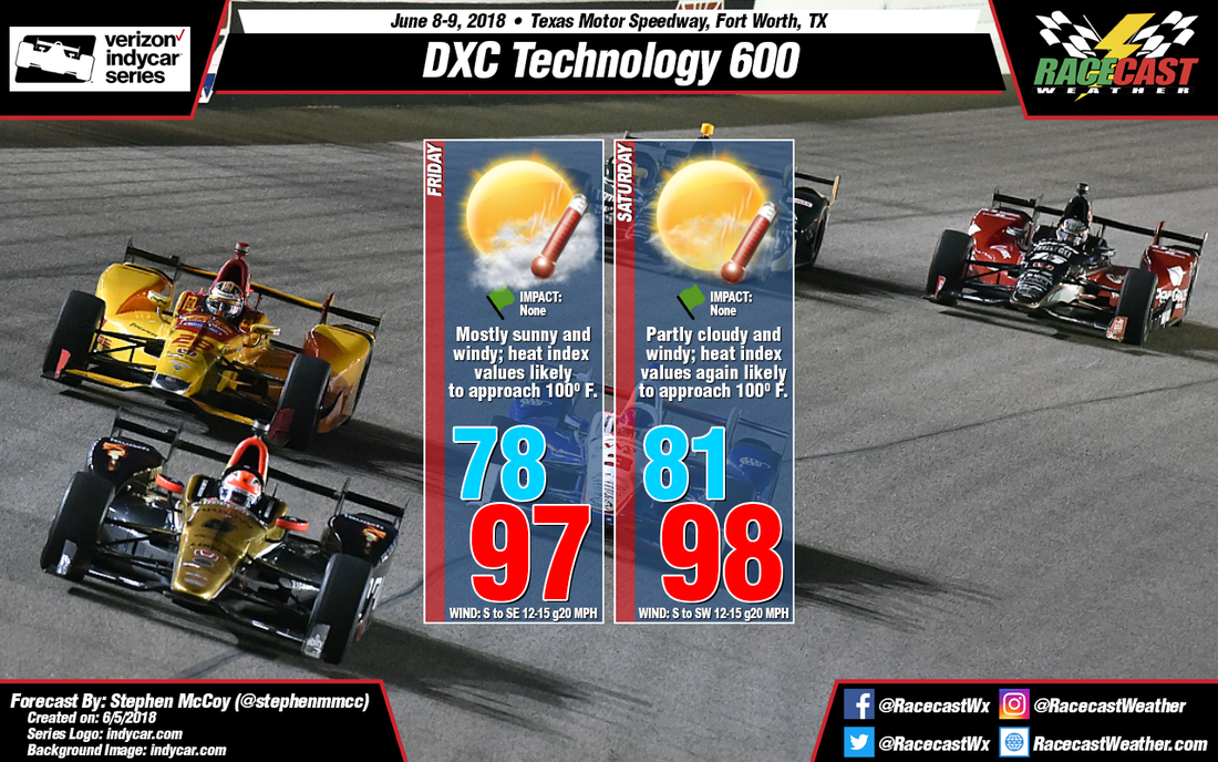

The forecast for the DXC Technology 600 still looks hot and windy for both days of on-track action. If you are planning on being at the track at any time this weekend, be sure to stay hydrated as conditions are expected to be very hot.
In the upper levels, a high pressure ridge has set-up over the southern Great Plains and will likely remain stationary through the end of the week. In the lower levels and at the surface, southerly winds will bring in moisture to the area from the Gulf of Mexico. Surface winds will be around 12-15 mph due to a surface low pressure system moving into northern Oklahoma; winds are likely to gust over 20 mph due to low level and surface winds both coming from the south. Conditions are expected to start partly cloudy on Friday as the tops of some strong thunderstorms in western Texas will reach the Dallas-Fort Worth are overnight. Once daytime heating and the low and mid-level winds begin to erode the cloud cover, conditions will clear and allow for lots of sunshine to heat things up. Temperatures will reach the mid to upper 90’s with heat index values approaching 100. Similar conditions are expected on Saturday, albeit a little warmer than Friday.
With this forecast, I’ve also included a chart from iWeatherNet showing heat index values when looking at the air temperature. The temperatures in the highlighted box are values that are likely be seen on Friday and Saturday. If you want more information on heat index, be sure to follow the link below.
http://www.iweathernet.com/educational/heat-index-calculator-and-conversion-table


