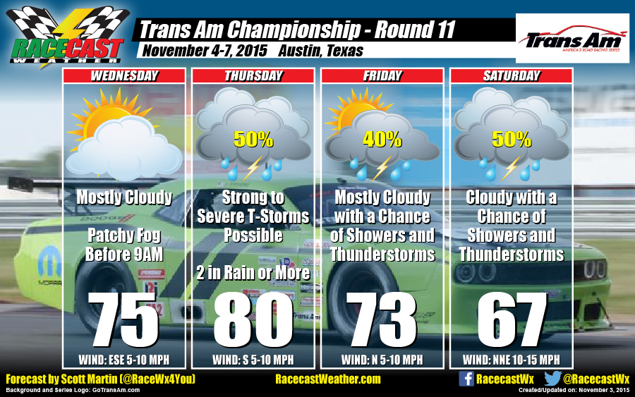
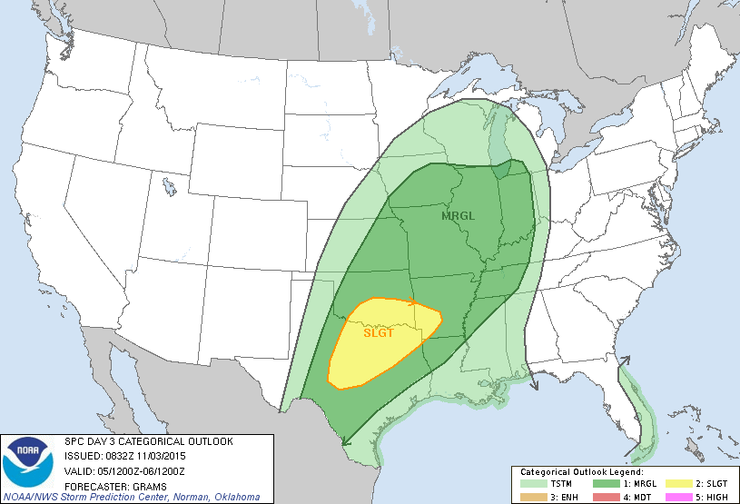
It looks like the front will make it south of the area by Friday, but an upper level trough will hang back to the west of the area. This will keep rain and thunderstorm chances in the forecast on Friday evening through the day on Saturday. Good news is that there is no threat of severe weather.
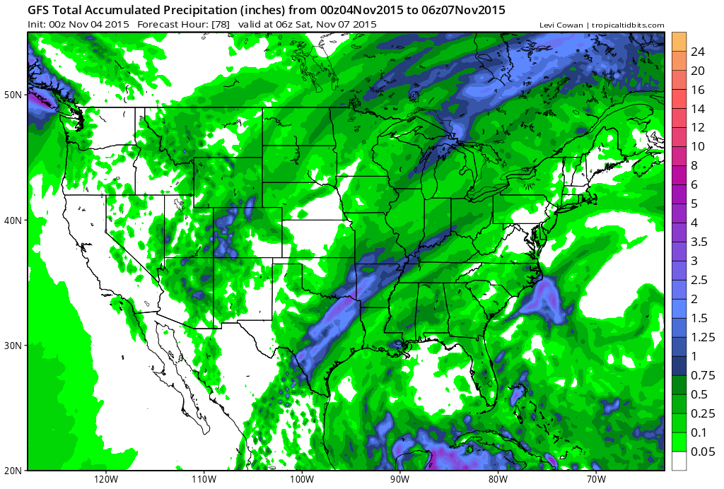
Unfortunately, models are lining up in decent agreement that the COTA area will be receiving plenty of rainfall from this system. Since the ground has been saturated lately due to previous lows and the remnants of Patricia, flash flooding could be a possibility. As shown in the graphics above, the GFS total accumulated precipitation model run (valid at midnight on Saturday) is projecting 2 inches of rain for the area. I wouldn't be surprised if totals are higher underneath a heavy thunderstorm.
Bottom line for this situation... stay weather aware. Have a reliable source of weather information on hand. I will have updates on my Twitter feed (@RaceWx4You) throughout the week and will have radar images posted. If anything changes with this forecast, check back on our website (www.racecastweather.com) or on my Twitter feed. I hope this forecast is totally wrong and the week turns out dry. Let's cross our fingers.


