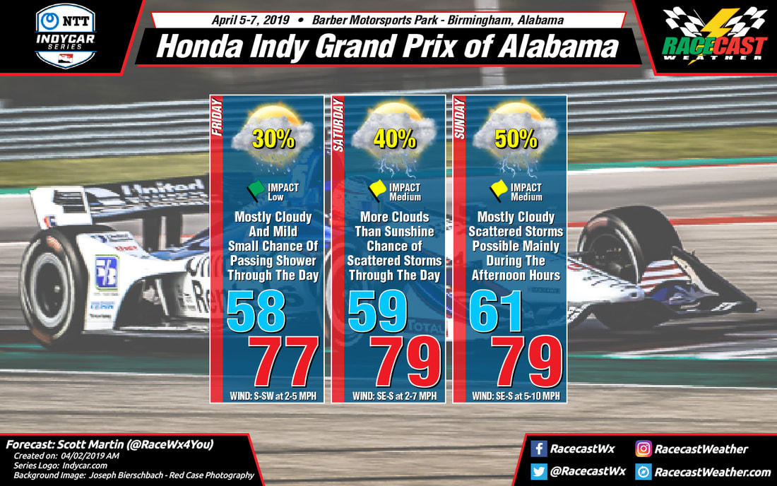
Saturday will be a day that features more clouds than sun and with the heating of the day, we could see a scattered shower or thunderstorm or two. At this point, the models are disagreeing in the timing of the better coverage in shower activity, with the GFS more robust in the morning hours and the European more likely in the afternoon. So, we'll go with a scattered shower or thunderstorm possible at any time throughout the day, but the chance of rain at the track is only 40%. Morning temperatures start off in the upper 50s and top out in the upper 70s near 80 degrees for the high. Wind will be out of the southeast to south at 2-7 MPH. The good news is that rainfall amounts look to be less than 0.05 inches for the day. We'll have to stay weather aware for any lightning that may occur.
On Sunday, the models are in better agreement as they are keeping the morning hours dry with showers and thunderstorms becoming possible during the mid-afternoon hours. The only problem is that we are seeing some higher instability values during the afternoon hours topping out around 1800 J/kg at the 1:00 pm hour according to the GFS. That means there is a potential for some stronger thunderstorms during the afternoon and evening hours in the area, but it is too early to be specific on any severe threats. We'll have to keep our eyes on the developing situation for Sunday, as it could affect the running of the Honda Indy Grand Prix of Alabama. Not a reason to cancel your trip out to the track, but just to stay weather aware while you are there. Morning temperatures will start off in the lower 60s and top out in the upper 70s to near 80 degrees. Winds will be out of the southeast to south at 5-10 MPH, and the chance of rain at this point is at 50%.
Since there is a threat of lightning occurring on Saturday and Sunday, please remember these safety tips from my Lightning post from Severe Weather Awareness Week on the AlabamaWx Weather Blog (my real job).


