
By Doug Schneider
There's good news with today's forecast update - the chance of rain is looking lower, especially on Sunday.
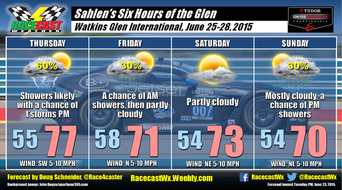
A low pressure system will be tracking across the Great Lakes on Thursday, and this will begin to spread some showers into western New York Thursday afternoon. A few thunderstorms could be possible, but they should be few and far between. Rain is expected to continue through the evening, but most of it should be ending early Friday morning before sunrise. I'm keeping a 30% chance of rain on Friday after sunrise just in case it lingers a little longer, but I expect that the majority of Friday will be dry with decreasing clouds.
Saturday should be a really nice day as high pressure builds over the region, with partly cloudy skies and highs in the lower 70s.
The good news with this forecast is that the potential for rain on Sunday is looking lower than before. The latest model runs are showing that the low pressure system which had been shown moving directly over New York will stay farther to the south. There are still some differences in how much moisture spreads northward on Sunday, so I am keeping a chance of rain mentioned that day. One model keeps Sunday completely dry, but I'm not ready to bite on that one yet. If there is any rain on Sunday, it does look like it will be light and mainly in the afternoon and evening.
Our live radar link for Watkins Glen is up and running at the top of the website.


