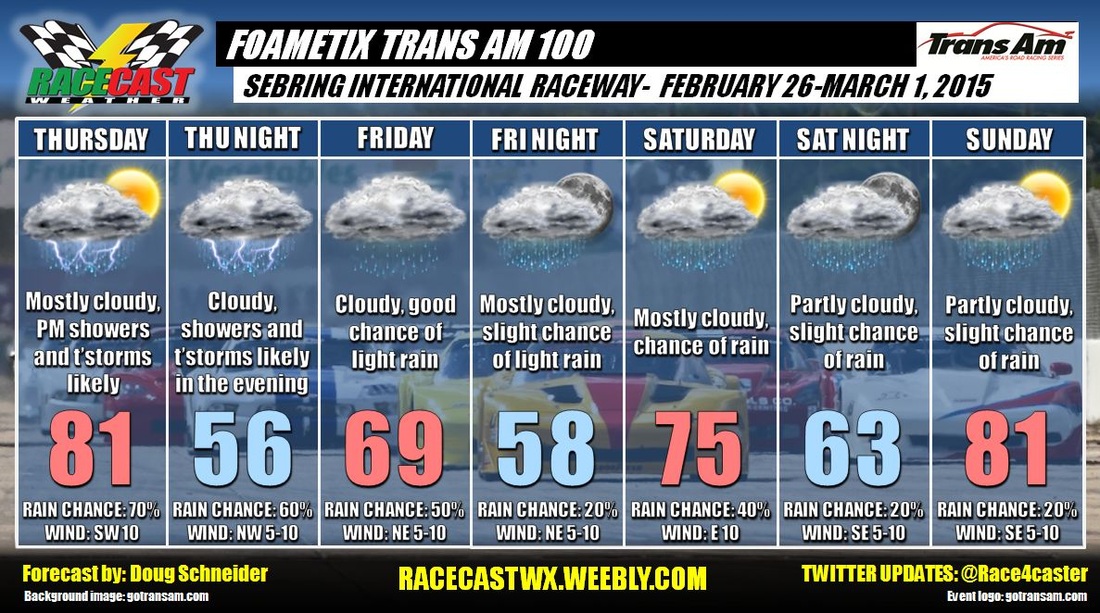
A cold front pushes through on Thursday night, and stalls across south Florida. I've lowered temperatures on Friday as a northeast wind brings in cooler air behind the front, and plenty of clouds are expected to linger all day. Moist air aloft may continue to run up and over the front, which could produce some light rain Friday through Saturday. I expect that if there is rain these days, it will only be a few hundredths of an inch.
My forecast confidence lowers for the weekend. The front that stalled to the south is expected to lift back to the north on Saturday, with high pressure to the east bringing warmer temperatures for Sunday. How quickly this occurs will affect the timing of rain and temperatures on Saturday. I have raised the chance of rain Saturday because it looks like the front is slower to lift northward than previously indicated by the models. Sunday looks like the best day, with temperatures reaching into the lower 80s, and just a slight chance of rain showers as the front is expected to be well north of the area by then..


