
By Doug Schneider
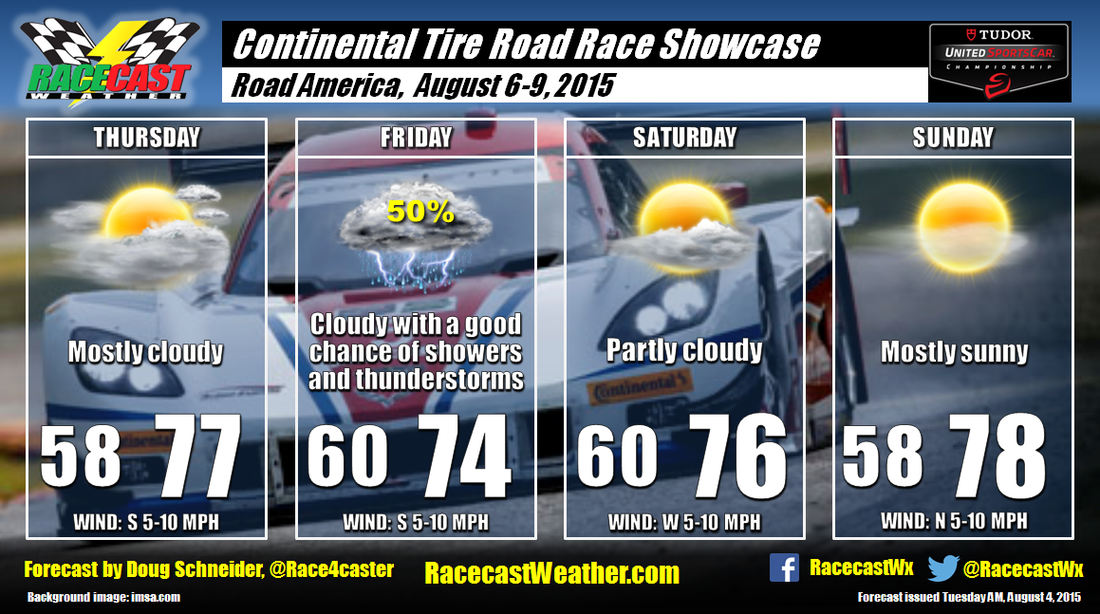
I had to make some changes to the forecast today as the models are changing their tune on the rain chances for Thursday and Friday. I mentioned in my last post that most of the rain on Thursday could pass south of the area, and it looks like the models are all pointing in this direction. Therefore, I took out the mention of rain on Thursday. However, the models are now coming into agreement on another system that will approach Wisconsin from the northwest on Friday. As it stands now, the best rain chances are Friday afternoon through Friday night, but the models have not been very consistent lately, so this timing could (and probably will) change.
There is uncertainty regarding Saturday and Sunday. Some models are indicating a chance of rain both days, bringing some weak upper level disturbances across the area. This is not a pattern that is typically handled well by the models, and they differ on the location and strength of these disturbances. My forecast confidence is low, but until I see better consistency from the models, I'm sticking to my original dry forecast. Stay tuned for more updates through the week.
There is uncertainty regarding Saturday and Sunday. Some models are indicating a chance of rain both days, bringing some weak upper level disturbances across the area. This is not a pattern that is typically handled well by the models, and they differ on the location and strength of these disturbances. My forecast confidence is low, but until I see better consistency from the models, I'm sticking to my original dry forecast. Stay tuned for more updates through the week.


