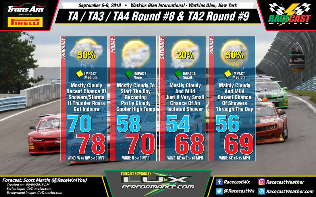
Friday will be a little cooler with mostly cloudy skies and surface winds out of the north at 5-10 MPH. Saturday looks to be mainly dry, but there is a very small risk of an isolated shower during the late afternoon and early evening hours.
Sunday looks to be the wettest day of the weekend at this point, as moisture associated with the remnants of Gordon moves into and over the area. The 06z GFS showing as much as 1-inch of rain falling over the area during the morning and into the early afternoon hours, if this model pans out. Rainfall will be less in coverage after that, but still a decent chance of rain for the area.


